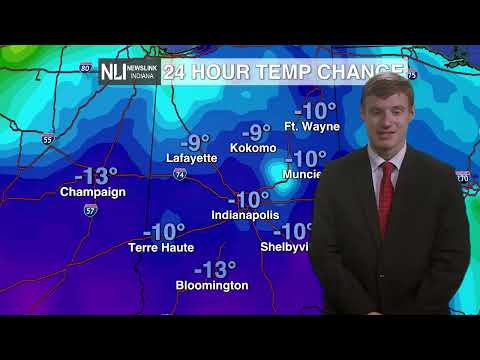

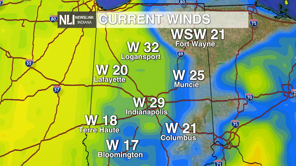
Tonight: A windy shock to the system as gusts to 40-45 mph couple with chilly conditions around 38° to deliver feels-like temps in the 20s. Bundle up out there for your late-night plans!

Tomorrow: Feeling more like February with an increased threat of that S-word, SNOW, in the form of showers that should be more intense overnight for your Wednesday. Plan on slick conditions and continue dressing in layers!

7-day Forecast: We will slowly see a warm-up into the weekend with a chance of showers as a warm front crosses the region. Before that though, we will see some frost/freeze possibilities especially Friday and Saturday morning. Protect those plants, but get ready to break out the shorts and short-sleeved shirts by this time next week!

-- Weather Forecaster Ryan Hill
Follow us on Twitter @NLIWeather for breaking weather updates.
NewsLink Indiana is a proud Ambassador for the NOAA Weather-Ready Nation program.
For more information about the Weather-Ready Nation program please click HERE .
