

A fairly cool weekend is on the way, with temperatures 10-15° below average for this time of the year. On the bright side there will be plenty of sunshine for the last weekend of April.
Friday Night: A very mild evening is in store for us here in east central Indiana. Temperatures will hang in the low 60s through about the seven o'clock hour.

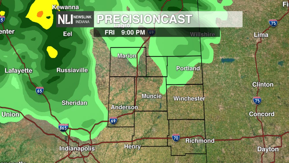
You'll want the umbrella out the door this evening as a passing cold front will bring the chance for rain showers into the region tonight. It looks like the prime window for rain showers will be 9 p.m. Friday through 2 a.m. Saturday.


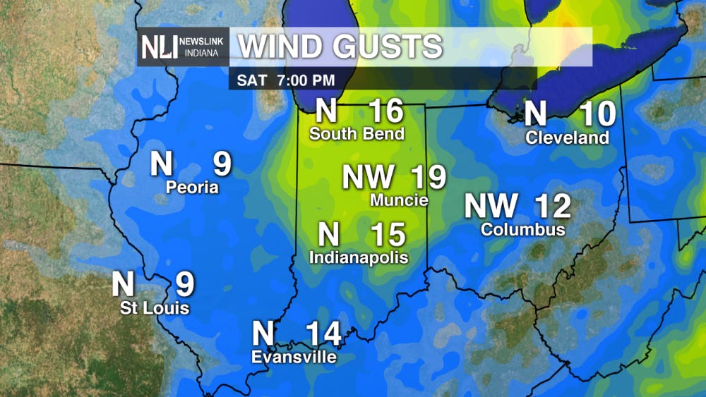
Saturday: Saturday morning, the advancing cold front that brought us the rain showers will have moves off to the East. In its wake will be a cool air mass overhead and breezy conditions for much of the day.
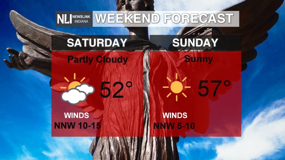
While Saturday will be mainly dry, we will have cloud cover overhead. I think we'll still have a pretty good shot of salvaging a fair amount of sunshine, especially as we progress into the afternoon hours. Breezy northerly winds will be responsible for driving the cold air into the region. This trend will persist through Saturday evening and into Sunday.
Sunday: Improved weather conditions are expected for Sunday, as temperatures will warm into the upper 50s and there will be an abundance of sunshine overhead. Winds will shift from northerly to westerly Sunday evening. Eventually move southwesterly early on Monday. This will be the driving force for warmer air to move into the region to start next week. We should expect temperatures to climb into the mid-to-upper 70s by the middle part of finals week.

Read More
Late Night Legacy: Ball State’s Letterman Reacts to Colbert Curtain Call
By Ball State Daily / 12 hours agoBall State alumni and late-night icon David Letterman has finally weighed in on the cancellation of "The Late Show with Stephen Colbert", sort of, and by doing it in a way only Letterman would.
Blink and You’ll Miss it: Here is Your CommCenter Catch-Up
By Ball State Daily / 14 hours agoFall is quickly approaching, and with it comes new opportunities to grow, learn, and connect at Ball State! This week’s highlights include a professional networking session, a faculty workshop on Canvas course templates, and changes coming to student Adobe access. Don’t miss out on what’s happening across campus!

Fire Up DWNTWN set to return with high energy, new attractions
By Trinity Rea / YesterdayFire Up DWNTWN is back in Muncie Aug 2, with a strong showing of community excitement, new attractions, and expanded vendor offerings.
