
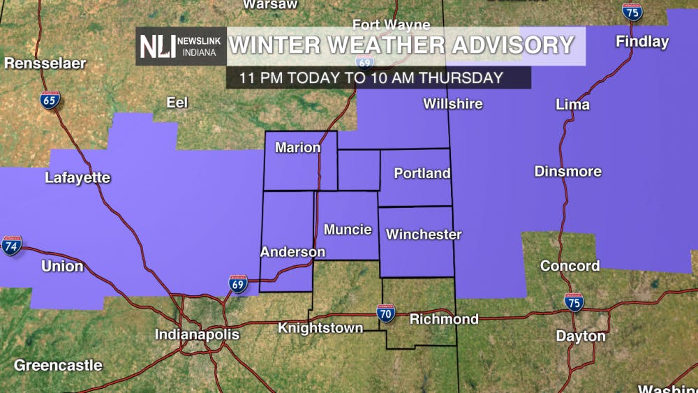
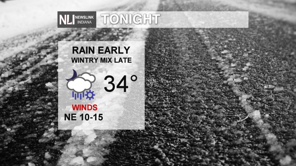
Tonight: Rain showers enter the picture late this evening, becoming widespread overnight. By daybreak, freezing rain, sleet, or snow may mix in with the rain. As a result, the National Weather Service has issued a Winter Weather Advisory for Grant, Blackford, Jay, Madison, Delaware, and Randolph counties in our area until 10 AM Thursday. Watch out for slick spots heading out in the morning.
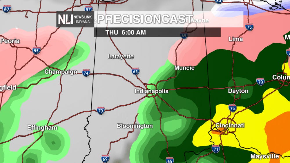
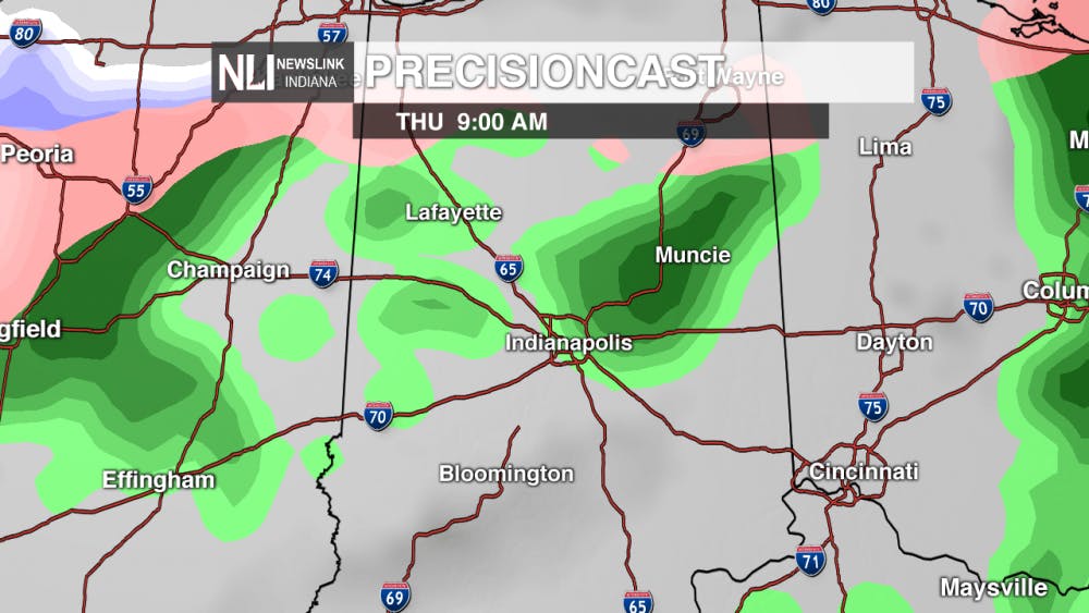
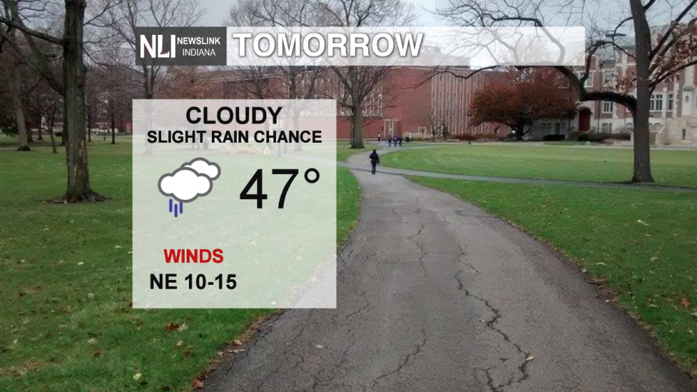
Tomorrow: Any wintry precipitation will transition to all rain by the late morning hours. Rain showers will exit the region by the early afternoon, leaving cloudy skies and temperatures in the mid-to-upper 40s.
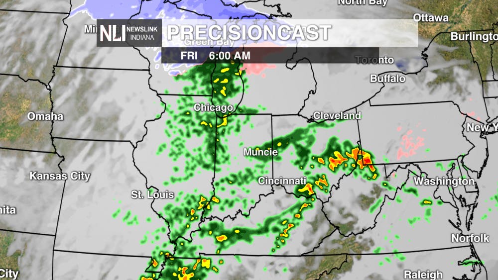
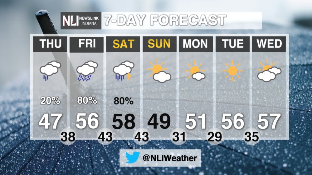
Late Week: Widespread rainfall returns to Central Indiana Friday through Saturday. A few thunderstorms are also possible on Saturday. A soggy, but warm start to the weekend is expected, before sunshine finally returns on Sunday.
7-Day Forecast: Once we make it past a soggy Friday and Saturday, next week looks much better. Temperatures will be cooler, but sunshine will prevail. Highs will gradually work their way back up toward the upper 50s by midweek.
For more updates be sure to follow us on Twitter @NLIWeather.
---Weather Forecaster Nathan Gidley
NewsLink Indiana is a proud Ambassador for the NOAA Weather-Ready Nation program.
Read More

Beyond the Nest: SJSC students study abroad
15 hours agoThroughout the trip, students will read and analyze travel writing while learning the skills to produce evocative storytelling that contains concrete observations, strong action, thoughtful research and appropriate pacing. Journalism students will focus on narrative nonfiction while strategic communications students will produce public relations and advertising content for travel companies, cities and historic sites.

Indiana Capital Chronicles: Even as interest in women’s college sports rises, report finds big gap in participation
By Indiana Capital Chronicle / 17 hours agoA congressional watchdog in a new report called on the U.S. Department of Education’s Office for Civil Rights to improve its enforcement of Title IX compliance in college athletics.

Delta baseball defeats Yorktown in extra innings to become Delaware County champions
By Zach Carter / 2 days agoThe Eagles defeated the Tigers 5-2 in extra innings to win the Delaware County baseball tournament. It's the first time Delta has won the event since 2017.
