
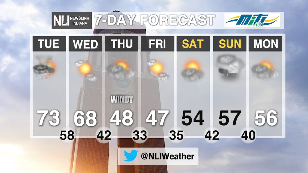
What a beautiful start to the week! The warm weather is here to stay for at least a couple of days, but unfortunately we have to deal with some rain chances.
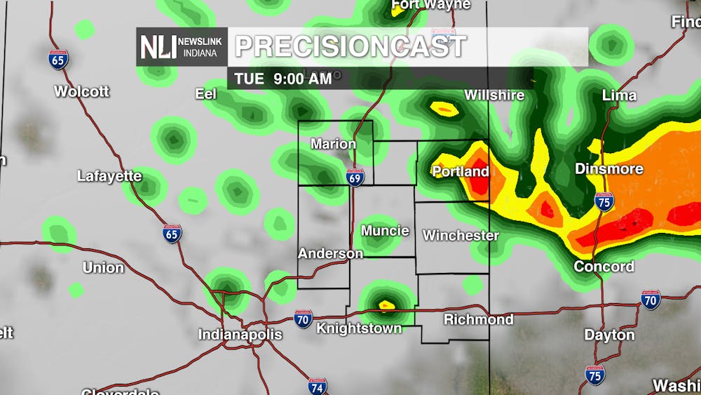
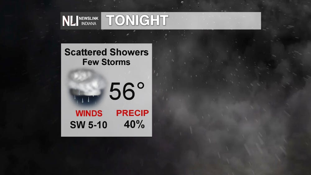
Tonight: Mild conditions continue through this evening, but clouds increase and rain chances enter the picture. Scattered showers and thunderstorms persist through the overnight hours and into Tuesday morning. A few storms could be strong, but widespread severe weather is not expected. Thus, the Storm Prediction Center has issued a Level 1 (on a scale of 5) or Marginal Risk for severe weather this evening.
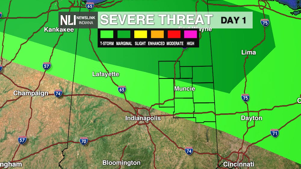
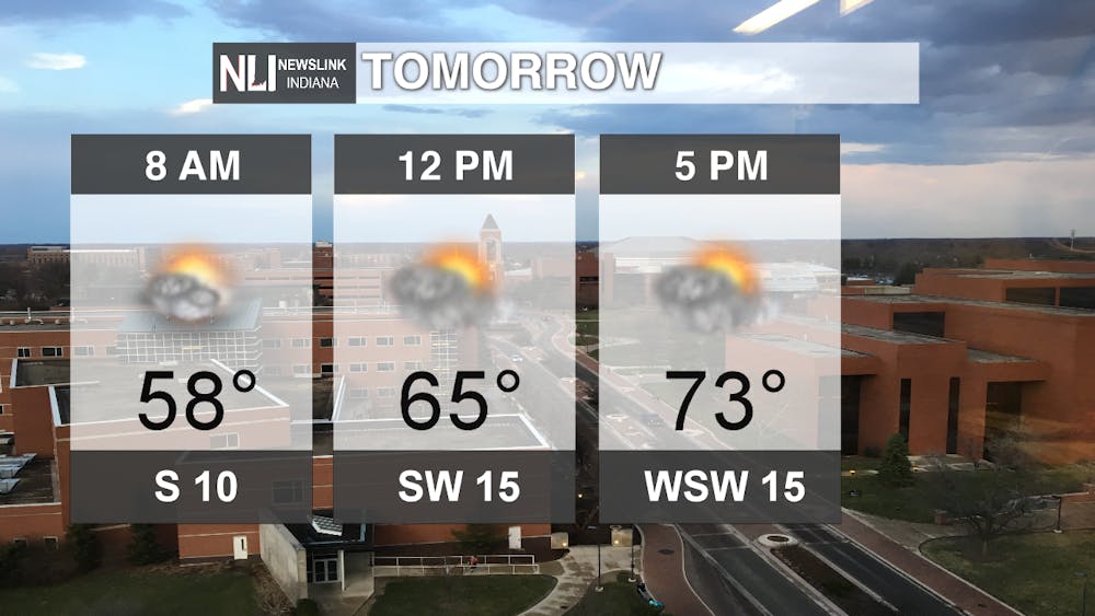
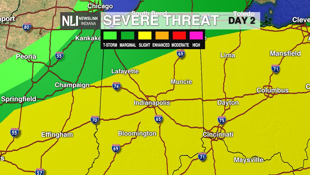
Tomorrow: A few showers and storms may still be around Tuesday morning. However, we get a chance to dry out later in the morning and into most of the afternoon. Temperatures soar into the upper 60's and lower 70's! As the warm and humid air builds in, we will have another chance for thunderstorms tomorrow evening, resulting in a Level 2 or "slight" risk for severe weather in place. Damaging winds and large hail look to be the main threats.
7-Day Forecast: Warm weather stick around for Wednesday, which looks to be a beautiful day. Unfortunately, a cold front moves through Wednesday night, bringing rain and much cooler temperatures for the second half of the week. Highs fall into the 40's as we head into the weekend, but temperatures return closer to average by the start of next week.
Follow us on Twitter @NLIWeather for breaking weather updates.
NewsLink Indiana is a proud Ambassador for the NOAA Weather-Ready Nation program.
For more information about the Weather-Ready Nation program please click HERE
Read More

Ball State adjusts 51 degree programs amid statewide enrollment mandate
By Trinity Rea / 10 hours agoIn a statement to The Ball State Daily News, the university says its academic changes reflect long-standing internal planning, not just compliance with new state requirements.
IPR: Trump administration withholds over $100 million in education funding from Indiana schools
By Indiana Public Radio / 11 hours agoThe Trump administration told states this week that it won’t be dispersing over $6 billion in federal education grants, according to reporting from NPR.

What You Might've Missed: CommCenter Catch-Up
By Ball State Daily / 11 hours agoBetween the busy schedule of spending time with loved ones, summer jobs, and the latest trends on social media, it’s easy to miss important updates from Ball State’s Communication Center! This week’s catch-up highlights include parking permit sales information for this school year, yoga in the planetarium, and a hot volunteer opportunity!
