
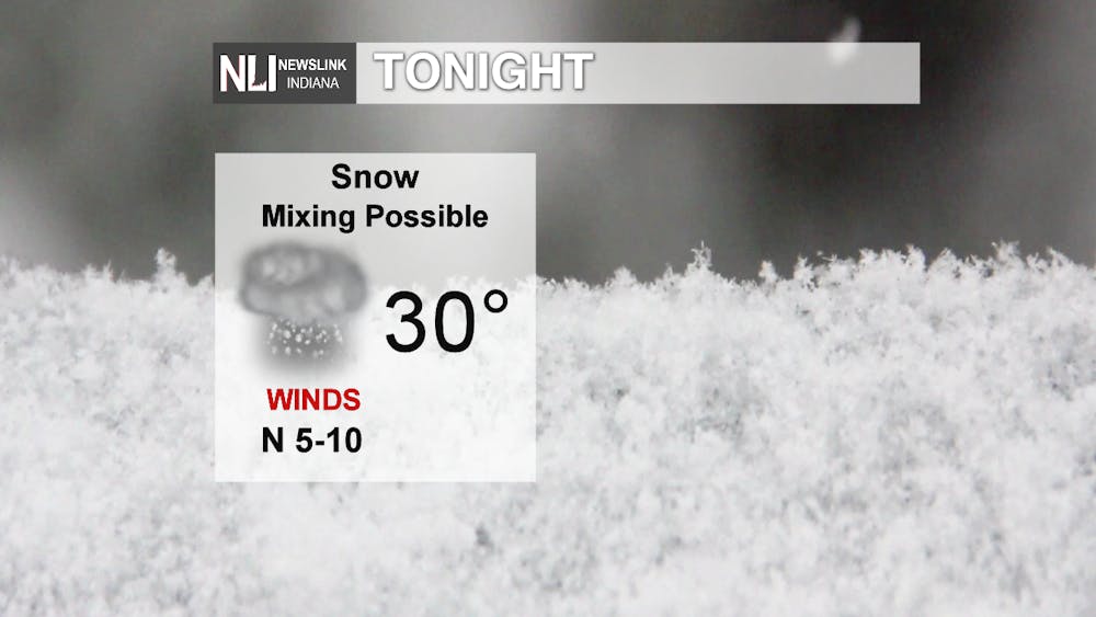
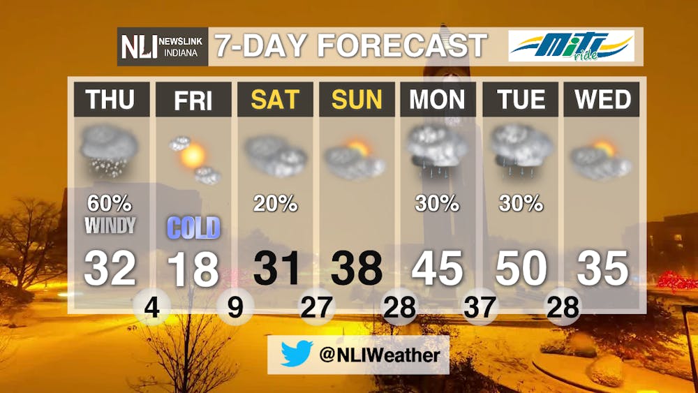
Tonight: Dangerous travel conditions continue through the overnight hours as snow continues to add up across the region. Some mixed precipitation may also occur in our southeast counties. Be very careful if traveling tonight and through the Thursday morning commute. A Winter Weather Advisory remains in effect until 1:00 PM Thursday.

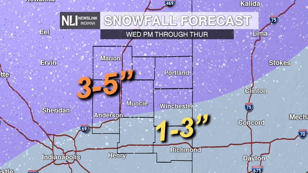
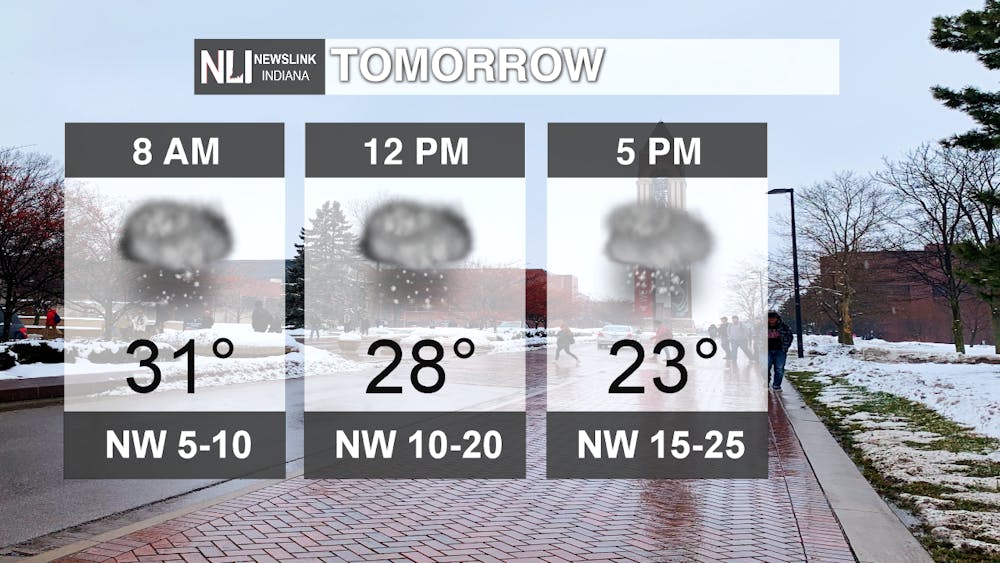
Tomorrow: Snow will continue tomorrow morning. When all is said and done, Muncie and areas off to the north and west are expecting 3-5 inches and areas off to the southeast of Muncie are expecting 1-3 inches, with some additional sleet and freezing rain in these locations. The snow will gradually taper off in the afternoon, with falling temperatures, strong northwest winds, and bitterly cold wind chills. Bundle up and be careful outdoors tomorrow.
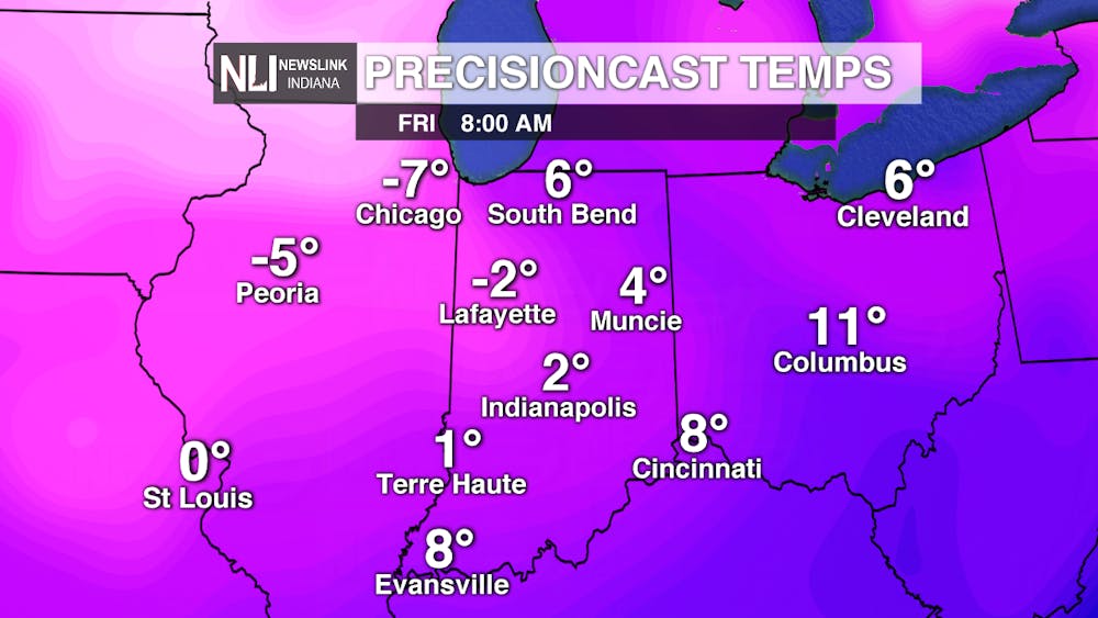
7-Day Forecast: Valentine's Day will be very cold, with morning wind chills likely well below zero. We slowly start to warm up heading into next week, however, with well above normal temperatures arriving by Monday and Tuesday. Some rain showers are also possible during this time before temperatures return to more seasonable levels by midweek. Be safe from the snow and cold the next two days!
---Assistant Chief Weather Forecaster Nathan Gidley
Follow us on Twitter @NLIWeather for breaking weather updates.
NewsLink Indiana is a proud Ambassador for the NOAA Weather-Ready Nation program.
For more information about the Weather-Ready Nation program please click HERE
Read More

New owners of Mark III Taproom announce purchase of new location
By Trinity Rea / 10 hours agoThe new owners of Mark III Taproom have announced they’ve purchased a new location for the oldest gay bar in the state.

Ball State celebrates 2025 summer graduates at commencement ceremony
By Trinity Rea / YesterdayBall State's summer commencement honored graduates with speakers delivering messages of creativity, courage, and the power of vulnerability.

ICC: Defense letter confirms Indiana’s Camp Atterbury to be used for immigrant detention
By Indiana Capital Chronicle / YesterdayIndiana’s Camp Atterbury will be used to detain immigrant detainees under a new federal plan revealed this week by Defense Secretary Pete Hegseth.
