
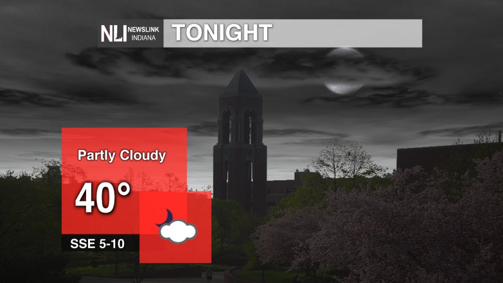
Tonight: Temperatures will stay stead once we drop down into the lower 40's. Cloud cover moves in overnight stopping us from dropping any lower. It is possible that we see some rain overnight but the atmosphere is dry at the lower levels and any rain that falls may evaporate before hitting the ground.
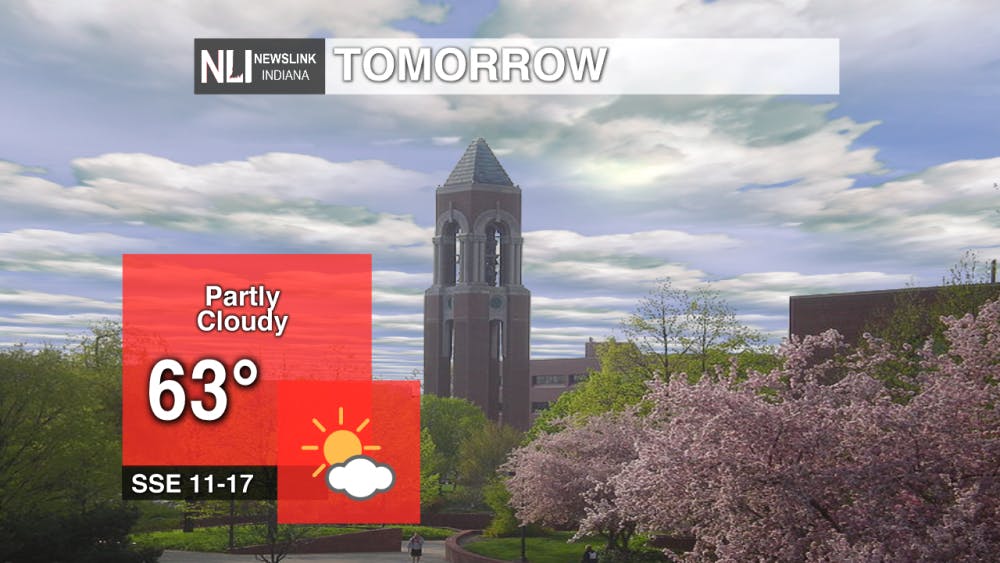
Tomorrow: Temperatures rebound nicely and push our highs into the lower 60's. It has been a while since we have had 60 degree weather much less sunny and 60 degree. Winds will pick up throughout the day which is the reason why we will see temperatures jump into the lower 60's. Our highest chance of rain tomorrow will be in the late morning hours as our atmosphere has had time to moisten up.

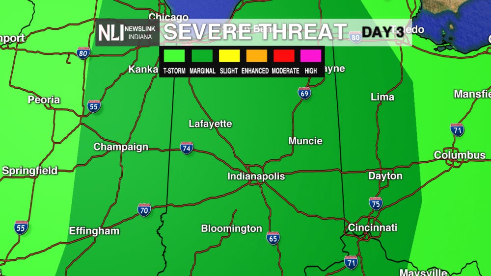
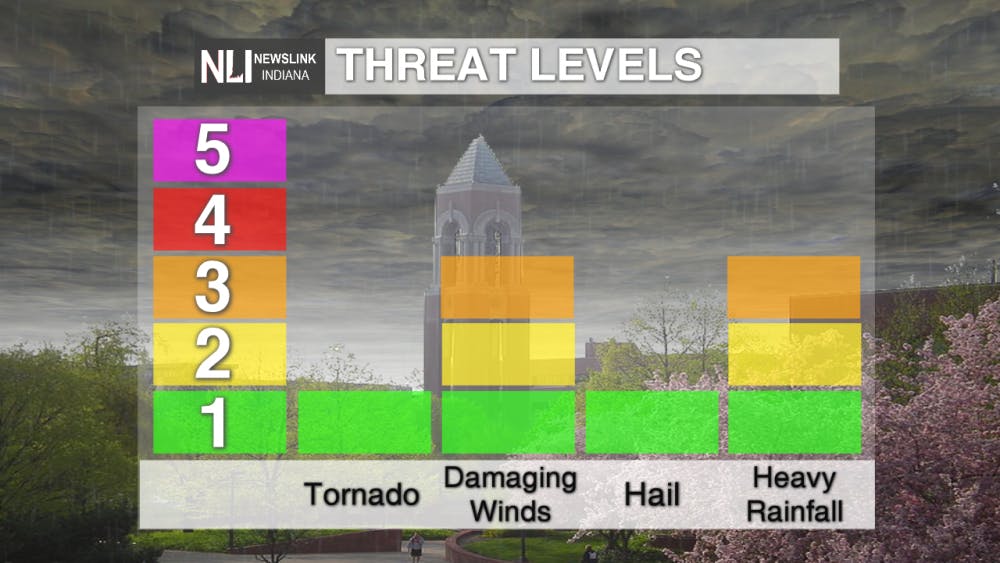
7-Day Forecast: Buckle in as the next several days will see gusty winds and a drastic temperature change yet again. Winds can gust upwards of 50-60 mph during the day on Thursday. Also since we may hit 70 in March a chance of severe weather will be possible Thursday afternoon as a strong line of thunderstorms will race on through area bringing in some more gusty winds. After this large system moves out expect temperatures to stay almost constant and little to no rain.

--NewsLink Indiana Weather Forecaster Jordan Nienaber
Follow us on Twitter @NLIWeather for breaking weather updates.
NewsLink Indiana is a proud Ambassador for the NOAA Weather-Ready Nation program.
For more information about the Weather-Ready Nation program please click HERE
Read More

IPR: Muncie Community Schools launches ‘freshman academy’ to ease transition into high school
By Indiana Public Radio / 10 hours agoMuncie Central High School is beginning a “freshman academy” to ease the transition for middle school students.

Ball State breaks Into top spot for Sports Media in 2025 National Rankings
By Ball State Daily / 14 hours agoBall State's programs earned multiple honors in this year's BEA festival, including top placements for video features, live production, and on-air talent. In total, Ball State students won nine individual awards in sports categories, contributing to the university’s rise from last year’s No. 2 position and securing the top spot for the first time.

Capital Chronicle: Strategic legislative revisions aid renewed Indiana drive for tolling
By Indiana Capital Chronicle / 19 hours agoIndiana Gov. Mike Braun’s administration is getting serious about tolling to make up for falling fuel tax revenue and upgrade aging highways nearly eight years after former Gov. Eric Holcomb’s administration backed away from the prospect.
