


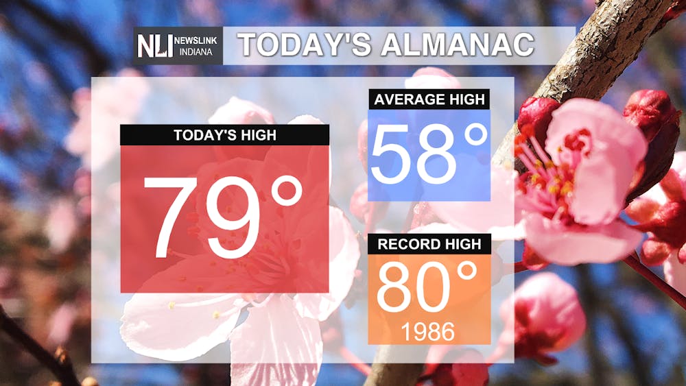
Tonight: Clear, sunny skies allowed for temperatures to warm in the upper 70s during the day, and SSW winds at 5-10 mph will allow the lows to fall into the low 50s. A few more clouds will drift into the area overnight giving us partly cloudy skies, and some moisture in the atmosphere could allow for a few sprinkles to fall in some places. Most of us will only be seeing clouds.

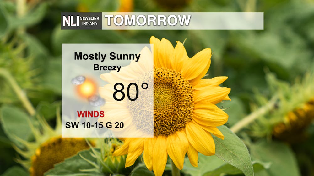
Tomorrow: Once again mostly sunny skies will brighten the region allowing temperatures to warm up again to 80. Our last 80 degree day was seen in November. The breeze will be back tomorrow from the SW at 10-15 mph with some gusts up to 20 mph. As we get closer to the evening, more clouds will once again bring partly cloudy skies by the time the sun goes down.

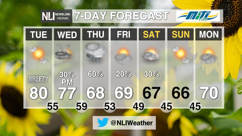
7-Day: After Tuesday, there will be better chances for some rain that will help with the dry conditions we have seen over the past week. A system moves in Wednesday night giving us a slight chance of seeing some thunderstorms by the evening and cooling our daily highs into the 60s. Then Thursday will give us the best chance of seeing rain, though exact amounts are hard to pinpoint at this time. Some scattered showers could pop into the area for the beginning of the weekend, and sunshine will be back with us by Sunday.
-Weather Forecaster Natasha Leland
Follow us on Twitter @NLIWeather for breaking weather updates.
NewsLink Indiana is a proud Ambassador for the NOAA Weather-Ready Nation program.
For more information about the Weather-Ready Nation program please click HERE


