


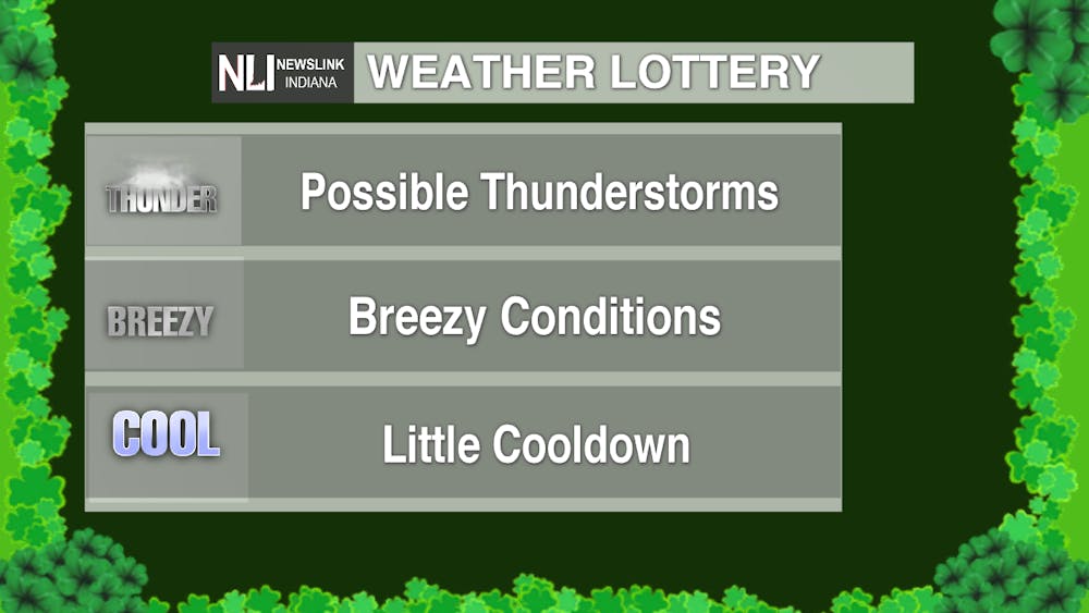
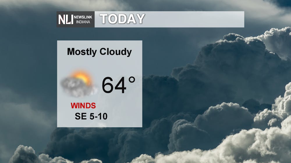
Today: After some morning fog, clouds will be increasing this afternoon leaving us with mostly cloudy skies on this St. Patrick's Day. Temperatures will rise into the mid-60s with SSE winds at 5-10 mph. the temperatures, wind and bits of sunshine will make today feel like a pleasant spring day. A few isolated sprinkles could fall before dusk, but most of the rain will hold off until after sundown.
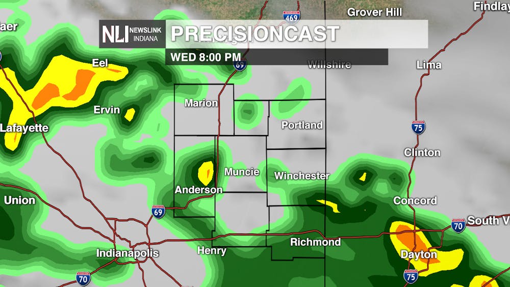
Tonight: It will feel even more like spring with rain entering the area. More organized rain will begin to fall around midnight then become widespread throughout the night. There could be a few isolated thunderstorms embedded within the rain, but they would not be anything significant. The window of seeing those storms will be from 3 am - noon. The low will fall around 43. Wind will begin shifting to the east and picking up at 10-15 mph.


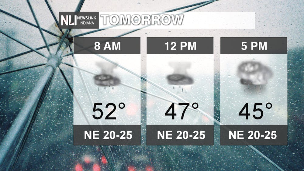
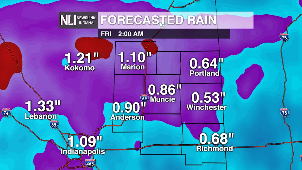
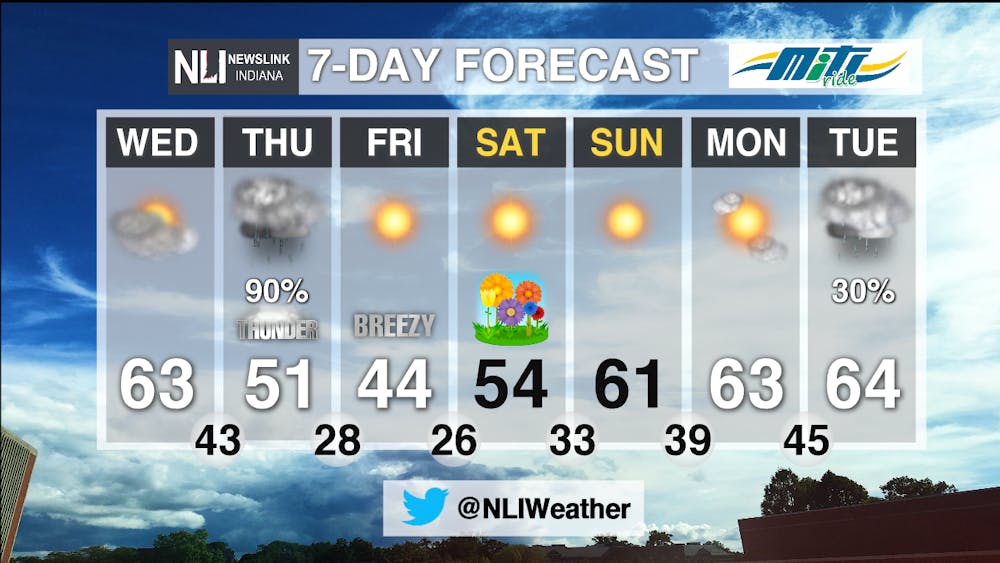
Tomorrow: Rain will be widespread for most of the day with isolated thunderstorms possible. The biggest threats with this system include heavy downpours, localized flooding, and gusty winds. By Friday, we could have seen around 1" of rain. Winds will shift to the NE at 20-25 mph with gusts up to 40 mph. Temperatures will be falling throughout the day as the system passes with the high only reaching 52 early in the morning. By Thursday night, temperatures will be in the 30s.

7-Day: After the rain ends Thursday, the weekend will be full of sunshine as high pressure dominates pushing out moisture. Temperatures will gradually warm back up into the mid-60s by the beginning of next week, but we will have to endure some highs in the 40s and 50s Friday and Saturday. The first day of spring looks to be pretty mild and seasonable for this time of year. Out next best chance of rain comes into the picture Tuesday.
-Weather Forecaster Natasha Leland
Follow us on Twitter @NLIWeather for breaking weather updates.
NewsLink Indiana is a proud Ambassador for the NOAA Weather-Ready Nation program.
For more information about the Weather-Ready Nation program please click HERE


