


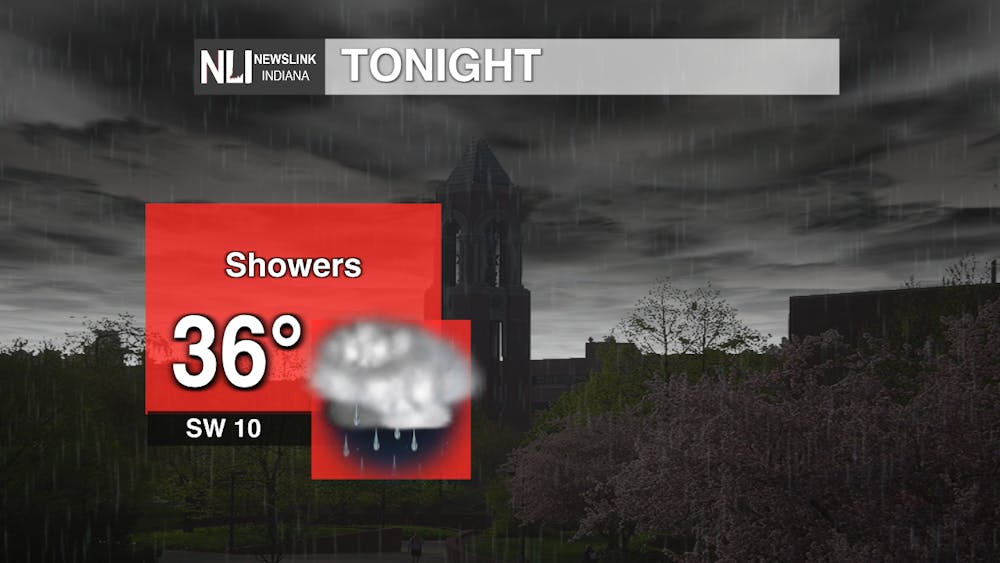
Tonight: Fall conditions move out and winter weather returns tonight when a cold front passes through in the early morning hours. Temperatures will plummet into the mid-30s with winds coming from the southwest at 10mph and gusts up to 30 mph. Rain showers will be scattered throughout the area, making for a gloomy night.
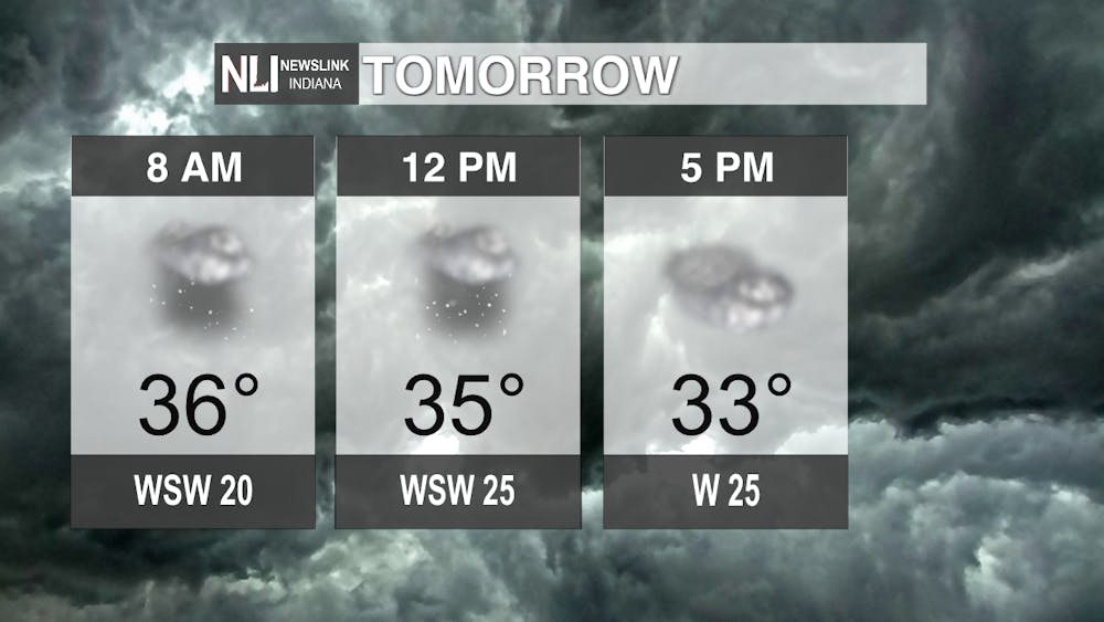
Tomorrow: Winter returns with a vengeance tomorrow as those rain chances become snow chances throughout the day. Temperatures will continue to fall with tomorrow's high being 36 degrees in the morning. Winds will be extra breezy coming from the west southwest at 25 mph and gusts up to 45 mph. This is why we will be under a wind advisory from 7 a.m. to 7 p.m. tomorrow. With it being a big travel day, take precaution on the road as winds can knock your car around and conditions will deteriorate the farther north you go.
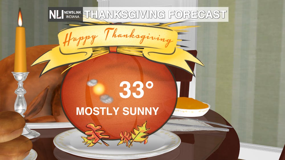
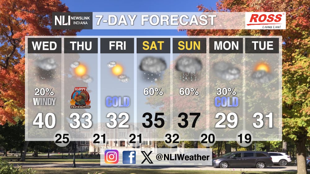
Seven-Day Forecast: Thanksgiving is set to be a cold one. Highs will not break the mid-30s as any remaining heat will escape once the clouds clear out and make for a cold day. Conditions will be mostly sunny and winds will still be on the breezy side. We will move throughout the week with continued cold temperatures before snow chances return Saturday and Sunday. Keep those winter coats handy as lows will be in the 20s as well. Overall, we will be well below our average temperature of 48 degrees as winter arrives early. Have a great Thanksgiving weekend!
-Chief Weather Forecaster Joseph Sawicki
Follow us on Twitter @NLIWeather for breaking weather updates.
NewsLink Indiana is a proud Ambassador for the NOAA Weather-Ready Nation program.
For more information about the Weather-Ready Nation program please click HERE
