


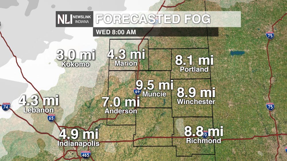
Tonight: A warm front is set to move through the area through the overnight hours, which will allow temperatures to rise tonight. Expect low temperatures to reach the upper 30s late this evening before temperatures rise into the low-to-mid 40s by daybreak. As a result of this warm airmass moving over the cold, snow-covered ground, some patchy fog is possible tomorrow morning.
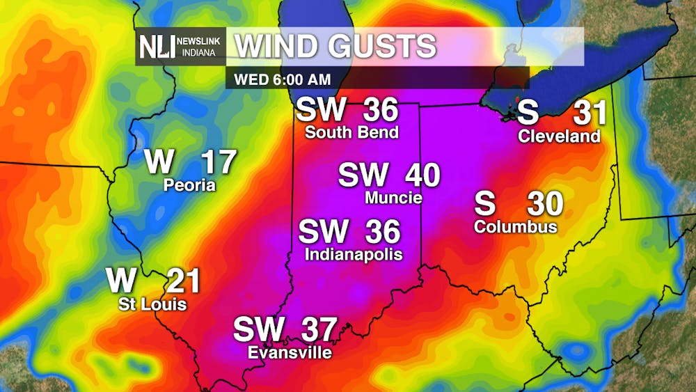

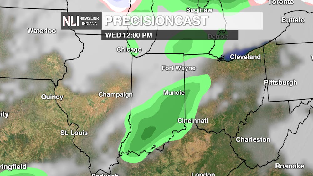
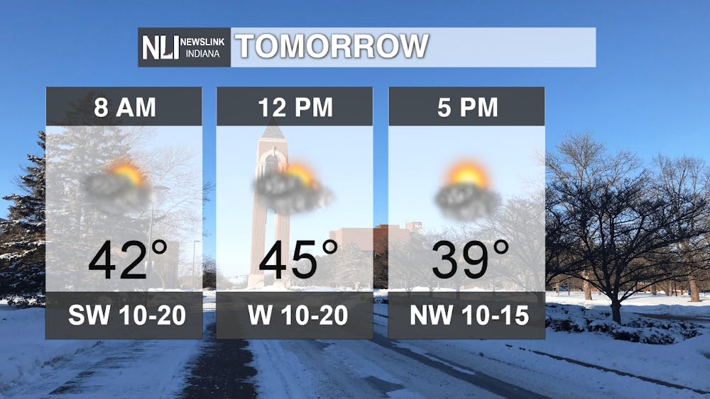
Tomorrow: After the patchy fog clears in the morning, expect another warm day, with high temperatures reaching the mid-to-upper 40s. Temperatures will fall by later in the afternoon into the evening, as a result of a cold front passing through. There is a chance of a stray shower as the front moves through, but expect mainly dry conditions.
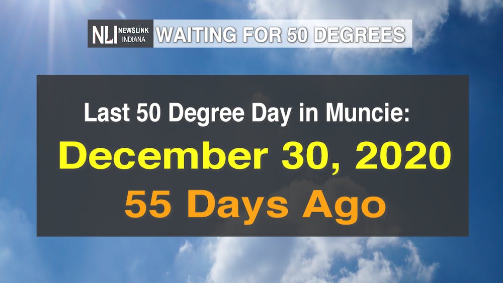
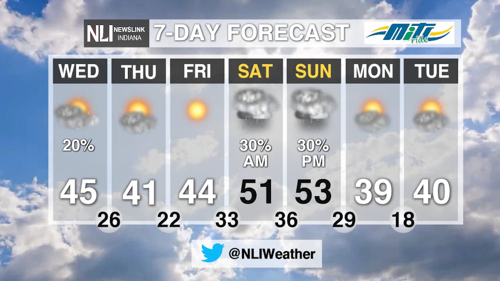
7-Day Forecast: High pressure settles in by Friday, bringing with it plenty of sunshine to end the workweek. By this weekend, temperatures will rise all the way up into the 50s, with the possibility for scattered showers, primarily early Saturday and late Sunday. Another cold front will move through by Monday, dropping the temperatures back into the 30s and 40s to start next week.
---Chief Weather Forecaster Nathan Gidley
Follow us on Twitter @NLIWeather for breaking weather updates.
NewsLink Indiana is a proud Ambassador for the NOAA Weather-Ready Nation program.
For more information about the Weather-Ready Nation program please click HERE


