


Today: Peaks of sunshine will allow the frigid temperatures from overnight to rise into the twenties. With the help of this sunshine, some of the snow may be able to melt off the roadways. Clouds will increase throughout the afternoon as another system begins to approach from the west. Some moisture in the atmosphere could allow a few flakes to fall before dark; however, anything that falls during the day today will be just a dusting.

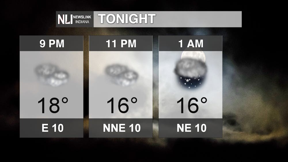
Tonight: Clouds will dominate the night sky which means temperatures won't fall too much, though the low tonight will still be chilly being around 15. Easterly winds from 5-10 mph will allow wind chills in the single digits. Snow will begin to fall around 2-3 am. This will be more scattered in nature and not as severe as was seen at the beginning of the week. Still, roads could be slick around the time of the morning commute, so take it slow; especially on those rural roads that have yet to be treated from Monday's storm.
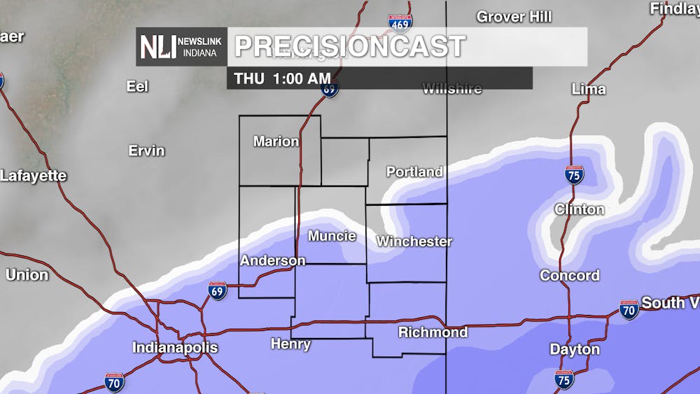
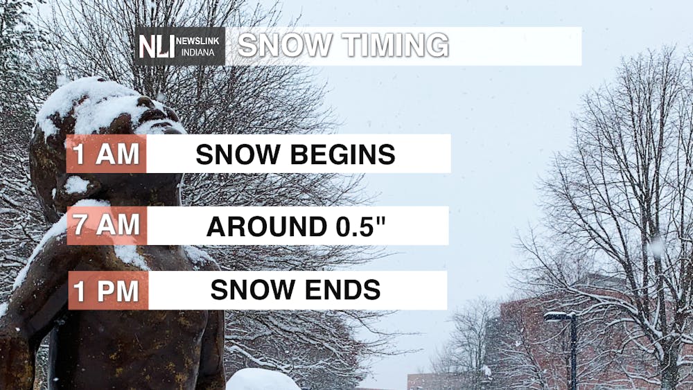
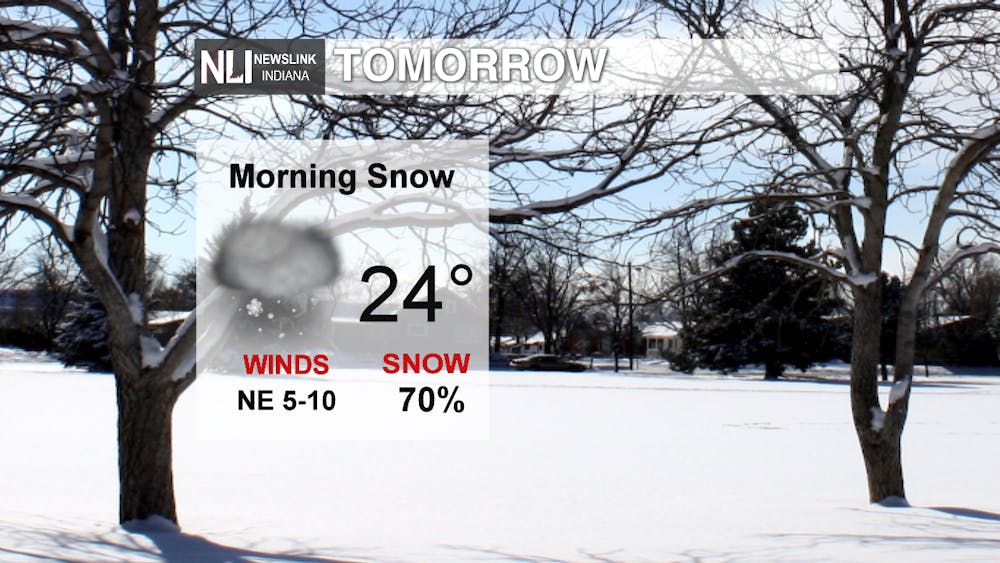
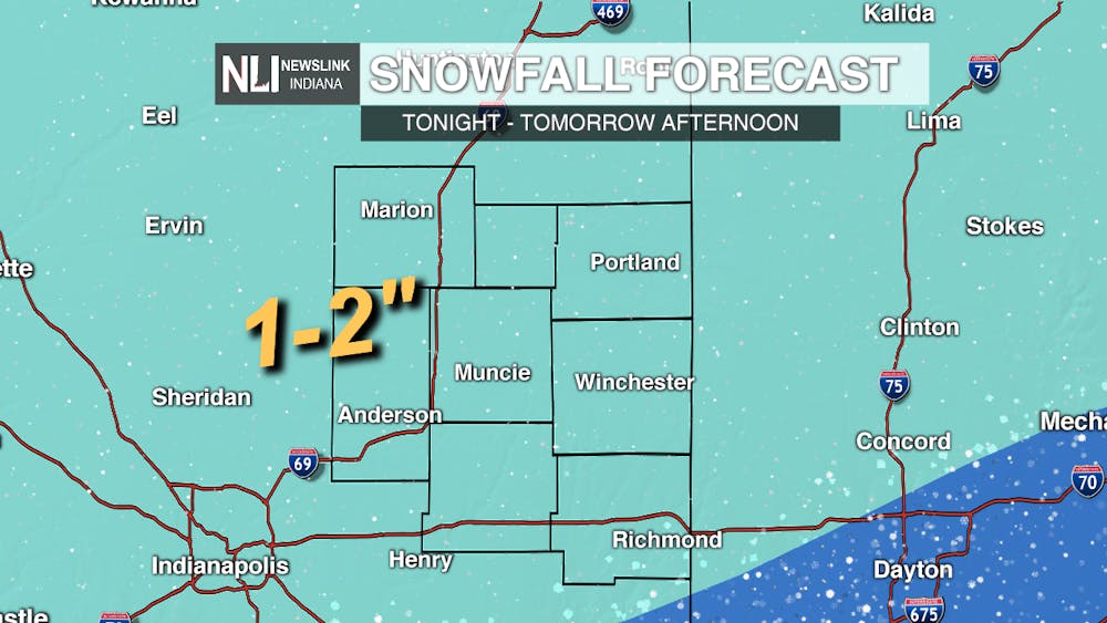
Tomorrow: Snow is the biggest story for Thursday. It will begin in the middle of the night and continue into the early afternoon. This system is not like the storm we saw earlier in the week with much lighter accumulations around 1-2 inches. Roads could still become snow covered, especially those left untreated, so be sure to exercise caution while driving. By the evening, drier air will move into the area putting an end to snow showers. Temperatures will be warmer reaching a high in the mid-20s.
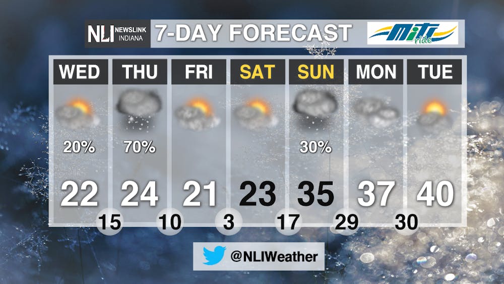
7-Day: After the cold and snow this week, we will be seeing a "heat wave" nearing the end of the forecast period. A few more chilly nights are ahead, but snow is out of the picture for Friday and Saturday when we could see some more sunshine. Sunday temperatures warm into the 30s, and we could even see highs in the 40s by the beginning of next week. However, the quick warming of temperatures on Sunday could pose a threat as the next weather system approaches. Right now, it looks to be mostly snow for our area. The warming temperatures could allow some rain to fall, but cold ground temperatures mean it could freeze on impact. We'll keep an eye on this in the coming days.
-Weather Forecaster Natasha Leland
Follow us on Twitter @NLIWeather for breaking weather updates.
NewsLink Indiana is a proud Ambassador for the NOAA Weather-Ready Nation program.
For more information about the Weather-Ready Nation program please click HERE


