
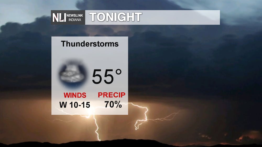
Today was the first time in a while it felt like summer as temperatures soared into the 70's. Those warm conditions and sunny skies will serve as fuel for thunderstorms this evening.
Tuesday Night: The evening starts out calm and mild before thunderstorms move in around midnight. Behind the storms, temperatures fall into the mid-50's.
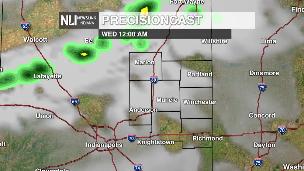
Storm Timing: A line of thunderstorms will develop near the Indiana-Michigan state line and move southeast. This will approach the northern counties of the NewsLink Indiana viewing area around midnight. As these storms move southeast, some of them could contain damaging winds or large hail. As our threat index indicates, large hail seems to be the greatest threat. Storms should exit the region by 3-4AM.


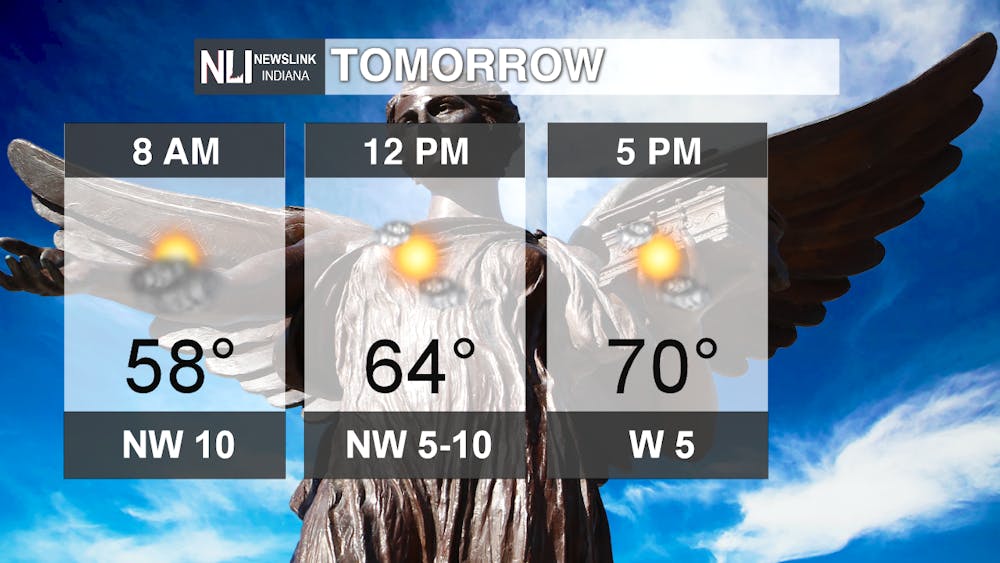
Wednesday: Some clouds may still linger across the region Wednesday morning, but we begin to clear our later in the day. Temperatures rise near the 70 degree mark, making for a fantastic day! Clouds return Wednesday evening as another round of showers and thunderstorms move in.
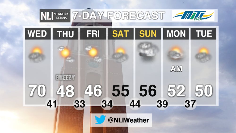
7-Day Forecast: Showers and thunderstorms Wednesday night will usher in MUCH cooler temperatures to end the week! Expect highs only in the 40's Thursday and Friday, with temperatures returning closer to average for the weekend.
Stay with NewsLink Indiana on Twitter and Facebook for the latest severe weather updates.
--Chief Weather Forecaster Gabe Prough
Follow us on Twitter @NLIWeather for breaking weather updates.
NewsLink Indiana is a proud Ambassador for the NOAA Weather-Ready Nation program.
For more information about the Weather-Ready Nation program please click HERE
Read More

Ball State celebrates 2025 summer graduates at commencement ceremony
By Trinity Rea / 3 hours agoBall State's summer commencement honored graduates with speakers delivering messages of creativity, courage, and the power of vulnerability.

ICC: Defense letter confirms Indiana’s Camp Atterbury to be used for immigrant detention
By Indiana Capital Chronicle / 9 hours agoIndiana’s Camp Atterbury will be used to detain immigrant detainees under a new federal plan revealed this week by Defense Secretary Pete Hegseth.

ICC: ‘Good trouble’: Hoosiers rally against Trump, honor late US Rep. John Lewis
By Indiana Capital Chronicle / YesterdayHundreds of people rallied outside the Indiana Statehouse on Thursday to protest President Donald Trump and pay tribute to U.S. Rep. John Lewis of Georgia.
