
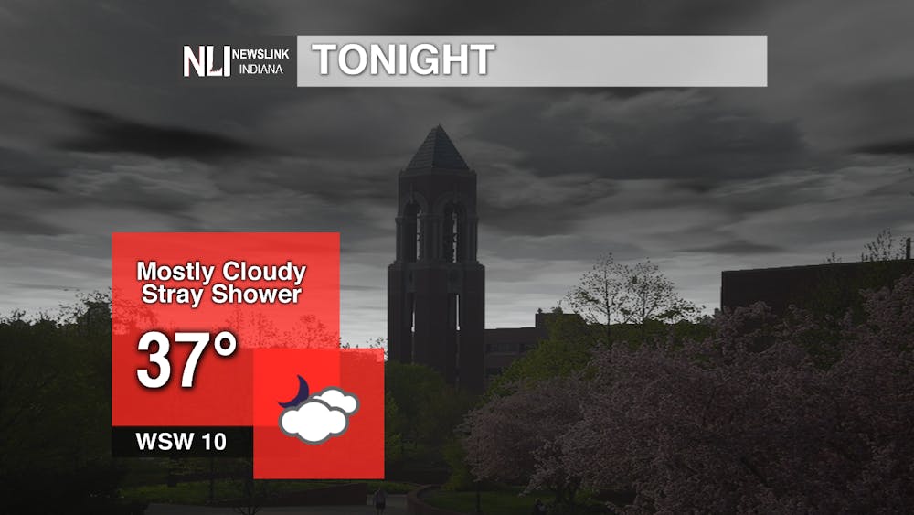
Tonight: After a relatively mild day today, temperatures begin to fall thanks to a passing cold front. The front will keep skies mostly cloudy and a few showers are possible until around 2-3AM. Lows will bottom out in the mid-to-upper 30's.
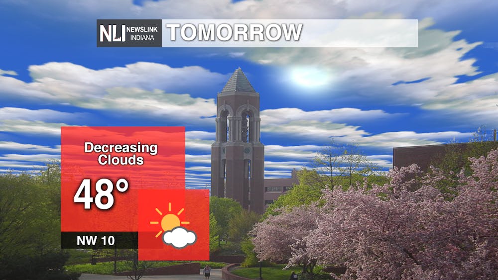
Tomorrow: Highs around east-central Indiana will be roughly 10 degrees cooler tomorrow. Expect highs in the upper 40's and winds shifting to the northwest at around 10 mph.
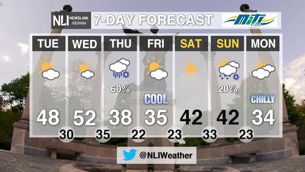
7-Day Forecast: Temperatures remain mild through about midweek. A much stronger front pushes through on Thursday, bringing a rain/snow mix and MUCH cooler temperatures. In the front's wake, highs will be in the 30's along with overnight lows in the 20's! We briefly see a slight rise in temperatures over the weekend before temperatures return to the 20's and 30's next week.
--Assistant Chief Weather Forecaster Gabe Prough
Follow us on Twitter @NLIWeather for breaking weather updates.
NewsLink Indiana is a proud Ambassador for the NOAA Weather-Ready Nation program.
For more information about the Weather-Ready Nation program please click HERE
Read More

IPR: Prairie Creek trails to permanently close to ATVs and horses August 1
By Indiana Public Radio / 4 hours agoThe Muncie parks board will permanently close trails on Prairie Creek Reservoir’s west side to ATV and horse riders on August 1 after the closure was requested by the property’s owner, Indiana American Water.

9-1-1 What's Your Hot Take E13: The Buddie Episode
By Willow Emig and Sam Jasionowski / 9 hours agoIn this episode of 9-1-1 What’s Your Hot Take, Sam and Willow discuss all things Buck & Eddie.

IPR: Indiana will no longer move forward with its plan to reduce greenhouse gas emissions
By Indiana Public Radio / 11 hours agoIndiana is no longer moving forward with its climate action plan.
