
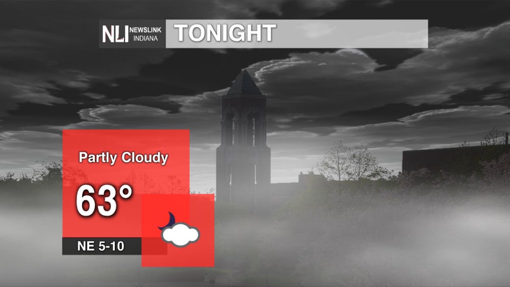
Tonight: After another day of summer-like temperatures despite the approaching first day of fall, temperatures cool off a bit into the lower 60's. Expect partly cloudy skies, with clouds building in through the evening. Those clouds will build in along with patchy fog, which brings us to tomorrow...
Tomorrow: With humid conditions still in place and falling temperatures, patchy fog will be possible in low-lying areas tomorrow morning. Visibility may drop below a mile to even below a half mile in spots. This could cause school delays and even travel issues in spots. Most of the fog will be concentrated in the northern half of the viewing area.

Skies will clear along with the fog. Temperatures start out in the mid-60's before warming to the mid-70's by midday. Our high will near the 80° mark by the late afternoon to early evening along with partly cloudy skies. Northeast winds will begin to lower the humidity.

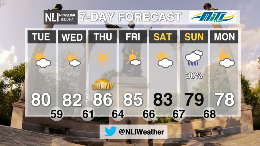
7-Day Forecast: Summer-like temperatures remain all week long with dry conditions. Temperatures remain in the 80's before a front approaches over the weekend. This will bring rain to the forecast on Sunday and drop temperatures into the upper 70's. Don't let that fool you though--warm temperatures appear to be sticking around even through next week.
--Assistant Chief Weather Forecaster Gabe Prough
Follow us on Twitter @NLIWeather for breaking weather updates.
NewsLink Indiana is a proud Ambassador for the NOAA Weather-Ready Nation program.
For more information about the Weather-Ready Nation program please click HERE
Read More

IPR: Prairie Creek trails to permanently close to ATVs and horses August 1
By Indiana Public Radio / 10 hours agoThe Muncie parks board will permanently close trails on Prairie Creek Reservoir’s west side to ATV and horse riders on August 1 after the closure was requested by the property’s owner, Indiana American Water.

9-1-1 What's Your Hot Take E13: The Buddie Episode
By Willow Emig and Sam Jasionowski / 15 hours agoIn this episode of 9-1-1 What’s Your Hot Take, Sam and Willow discuss all things Buck & Eddie.

IPR: Indiana will no longer move forward with its plan to reduce greenhouse gas emissions
By Indiana Public Radio / 17 hours agoIndiana is no longer moving forward with its climate action plan.
