
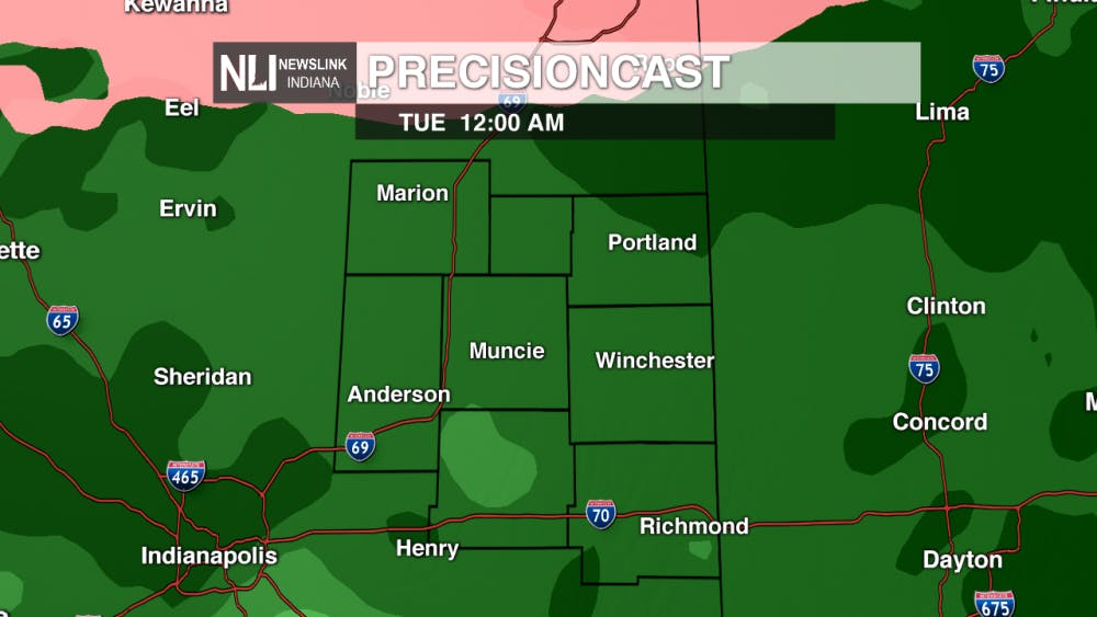
Tonight: Rain will continue to overspread the area as this evening along with warming temperatures. Patchy areas of fog will also somewhat limit visibility as times, especially during tomorrow morning's commute, so be sure to give yourself some extra time to travel.

Due to all the rain this evening, Henry and Wayne counties are under a Flood Watch until 7:00am tomorrow. Remember to never drive through a flooded roadway and stay weather aware!

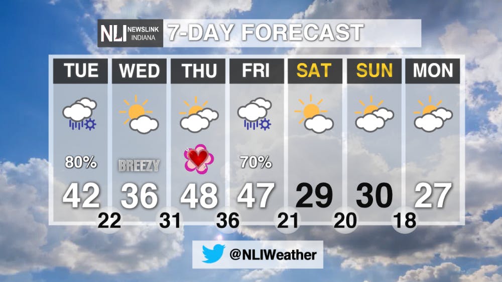
Tomorrow: A few rain showers may be around early tomorrow morning, but most of the rain should be gone in the morning. Dry conditions continue up to the afternoon and early evening, and temperatures will climb to the lower 40's. Precipitation will start as rain before transitioning to snow later on in the evening. Light accumulations under 2" are possible Tuesday night, but there shouldn't be any major travel impacts.

7-Day Forecast: The temperature roller coaster ramps up this week! After the rain and snow tomorrow night, temperatures drop down into the mid-30's Wednesday. Temperatures rise again on Thursday and Friday into the upper-40's before another system moves in Friday night. That system will also begin as rain before transitioning over to snow, and it will drop temperatures down below the freezing mark into the weekend.
--Weather Forecaster Gabe Prough
Follow us on Twitter @NLIWeather for breaking weather updates.
NewsLink Indiana is a proud Ambassador for the NOAA Weather-Ready Nation program.
For more information about the Weather-Ready Nation program please click HERE
Read More

PHOTOS: Fourth of July 2025
By Staff Reports / 15 hours agoIndependence day in Muncie featured celebratory events at Minnetrista Museum and Gardens and Muncie Central Highschool.

Ball State adjusts 51 degree programs amid statewide enrollment mandate
By Trinity Rea / YesterdayIn a statement to The Ball State Daily News, the university says its academic changes reflect long-standing internal planning, not just compliance with new state requirements.
IPR: Trump administration withholds over $100 million in education funding from Indiana schools
By Indiana Public Radio / YesterdayThe Trump administration told states this week that it won’t be dispersing over $6 billion in federal education grants, according to reporting from NPR.
