
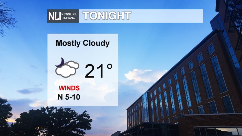
Tonight: We will stay dry overnight while dropping into the low 20's for the low with mostly cloudy skies. Winds will be light out of the north at 5 to 10 mph.
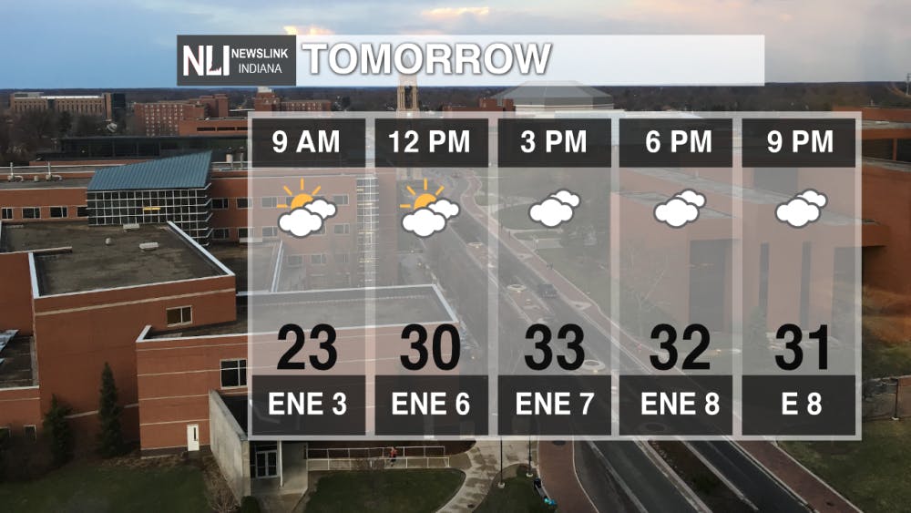
Tomorrow: We will begin with partly cloudy skies in the morning before cloudy skies move in for the rest of the day. We will reach a high temperature of 34 degrees with light winds out of the east-northeast. Since it looks to be cloudy for tomorrow night across the viewing area, the Super Snow Moon (February's full moon and has the snow term in it because of the heavy snow that occurs in this month) will not be visible unfortunately. This is a super moon because the moon will be at its closest distance to Earth.
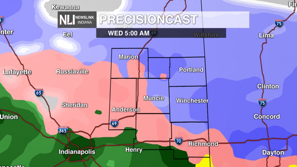
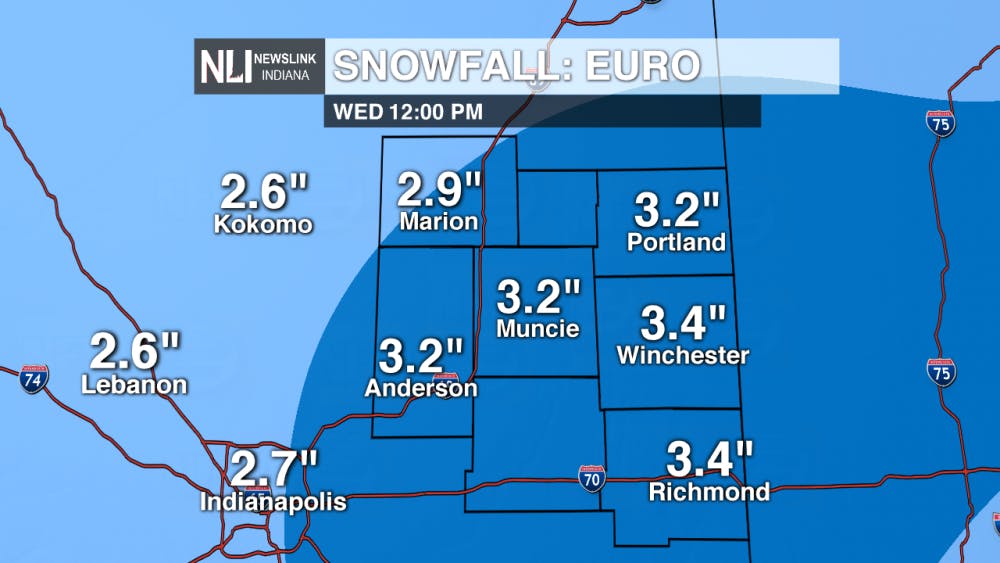
Wednesday's Winter System: We have our next system looking to move into our viewing area in the very early morning hours of Wednesday. A strong warm front will rush in from the south late Tuesday night. We look to start off with snow, which will quickly be followed up with a snow and freezing rain mix, then this will all change over to rain for most of the rest of Wednesday afternoon. At the moment, snow accumulations look to be around 2 to 4 inches. With this snow and wintry mix coming in, it will create a sloppy Wednesday morning commute, but everything will quickly melt once we get past Wednesday.
7-Day: After we get passed Wednesday's system, we will finish the work week dry with highs in the low to mid 40's. We will warm up into the mid 50's for Saturday, and this will give way for rain to likely occur throughout most of the afternoon hours. Even though we are still a bit far out from Saturday, a rumble of thunder or an isolated thunderstorm cannot be ruled out. Rain looks to continue into Sunday morning giving way to partly cloudy skies with windy conditions. We will kick off the new work week next Monday with highs in the lower 40's and dry.

Follow us on Twitter @NLIWeather for breaking weather updates.
NewsLink Indiana is a proud Ambassador for the NOAA Weather-Ready Nation program.
For more information about the Weather-Ready Nation program please click HERE
Read More

New owners of Mark III Taproom announce purchase of new location
By Trinity Rea / 12 hours agoThe new owners of Mark III Taproom have announced they’ve purchased a new location for the oldest gay bar in the state.

Ball State celebrates 2025 summer graduates at commencement ceremony
By Trinity Rea / YesterdayBall State's summer commencement honored graduates with speakers delivering messages of creativity, courage, and the power of vulnerability.

ICC: Defense letter confirms Indiana’s Camp Atterbury to be used for immigrant detention
By Indiana Capital Chronicle / YesterdayIndiana’s Camp Atterbury will be used to detain immigrant detainees under a new federal plan revealed this week by Defense Secretary Pete Hegseth.
