
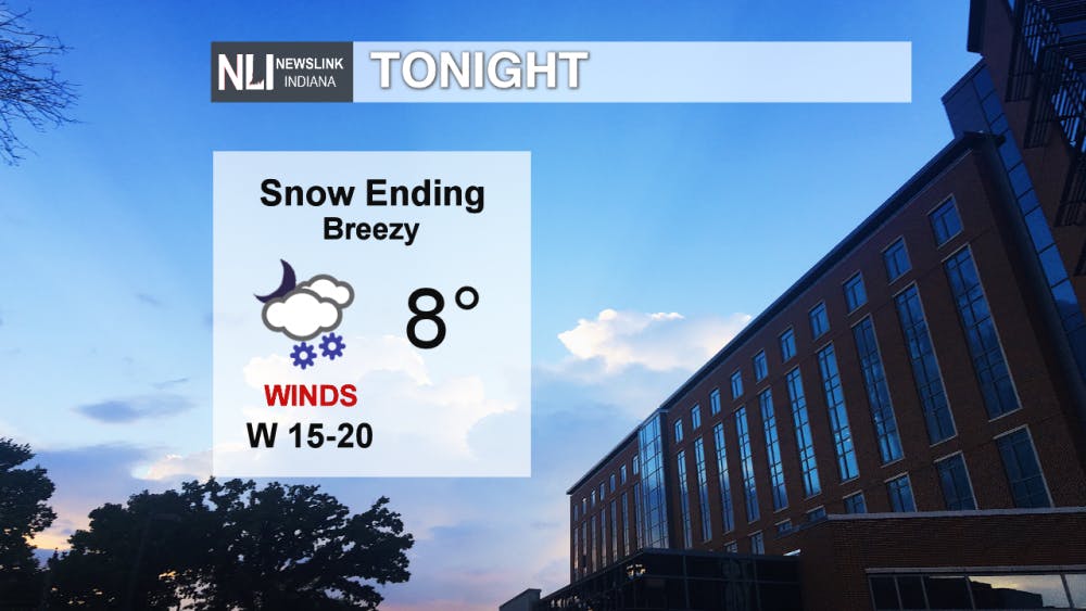
Tonight: A snow and wintry mix of precipitation should end early this evening. Cool air from the northwest will cause temperatures to continue to drop into the single digits this evening. Winds will also be quite breezy, with gusts around 25 mph possible.
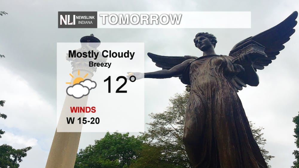
Tomorrow: After a chilly evening, temperatures won't warm up much tomorrow. Clouds will stick around, and winds continue to be breezy through the day. Windy conditions will cause it to feel below zero through much of the day tomorrow, so be sure to bundle up!
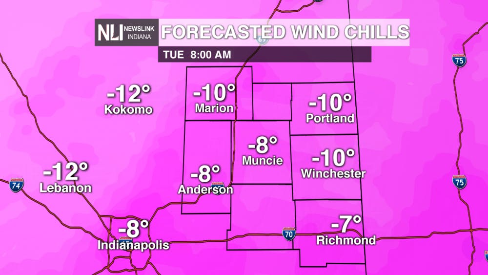
In addition, a Wind Chill Warning will go into effect tomorrow evening. Over the next few days, temperatures could feel as cold as -30 to -40 degrees below zero! In conditions like this, frostbite can occur in as little as 10-15 minutes. Be sure to bundle up and avoid time outside if possible.
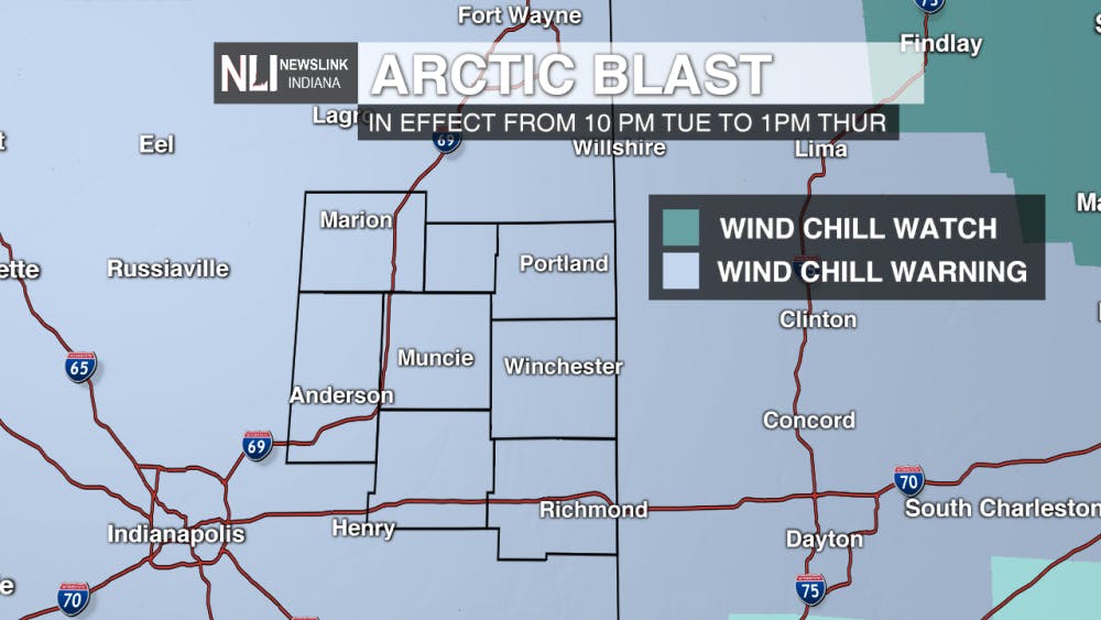
7-Day Forecast: Get ready for weather whiplash! Temperatures continue to drop over the next few days, with the high temperature on Wednesday not even getting above zero. Friday, the chance for snow returns to the area. Temperatures continue to warm over the weekend, with highs in the 50's possible Sunday and into Monday.

--Weather Forecaster Gabe Prough
Follow us on Twitter @NLIWeather for breaking weather updates.
NewsLink Indiana is a proud Ambassador for the NOAA Weather-Ready Nation program.
For more information about the Weather-Ready Nation program please click HERE
Read More

Tagayi to Represent France at U19 Tournament Before Joining Ball State
By Staff Reports / 14 hours agoBefore making her debut in the Mid-American Conference, incoming Ball State women's basketball player Aniss Tagayi will compete for her home country as part of the French national team in the U19 competition.

IPR: Ball State Village hotel project granted tax abatement for 10 years
By Indiana Public Radio / 23 hours agoThe new hotel being built next to Ball State University in the Village has been given a tax abatement for the next decade. But as IPR’s Stephanie Wiechmann reports, an agreement with the developer means Muncie coffers will see some money from the project in that time.
Missed the Buzz? Here's Your CommCenter Catch-Up
By Ball State Daily / YesterdayWith the hustle and bustle of summer – from work and classes to chilling by the pool - it’s easy to miss important updates from Ball State’s Communication Center! This week includes a Gatsby – themed dinner program at the E.B. and Bertha C. Ball Center, asphalt paving projects for 2025, and an upcoming change to campus printing software.
