
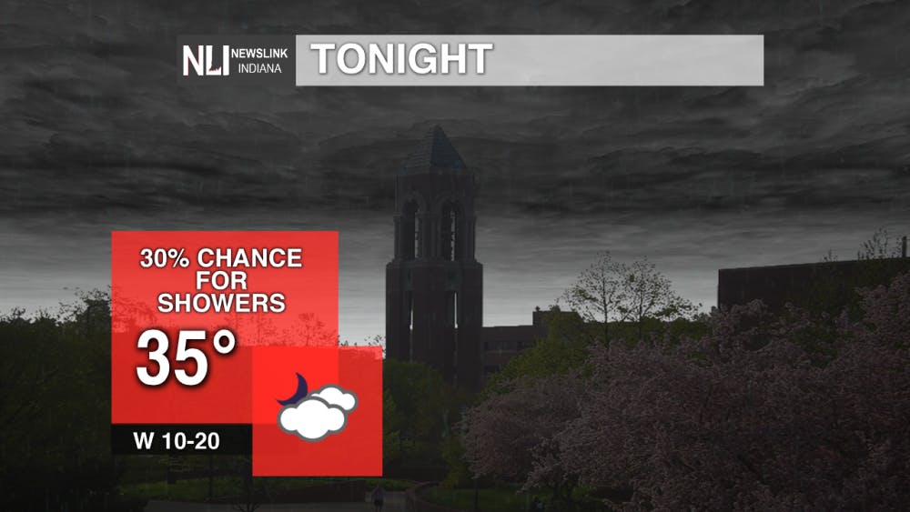
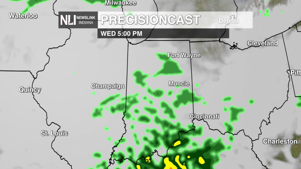
Tonight:
Temperatures overnight will drop down to the mid 30's across the state. There is a 30% chance for late overnight showers, and even a possible flurry. Early morning hours bring rain into central Indiana, with some areas having potential for flurries. These flurries shouldn't stick, as the ground temperatures are still above the freezing point.
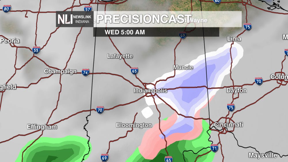
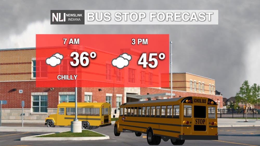
Wednesday:
Wednesday will bring cool morning temperatures with overcast skies. The rain will subside, but will return in the afternoon. Temperatures will continue to climb throughout the day, just teasing the 50 degree mark for much of the state.
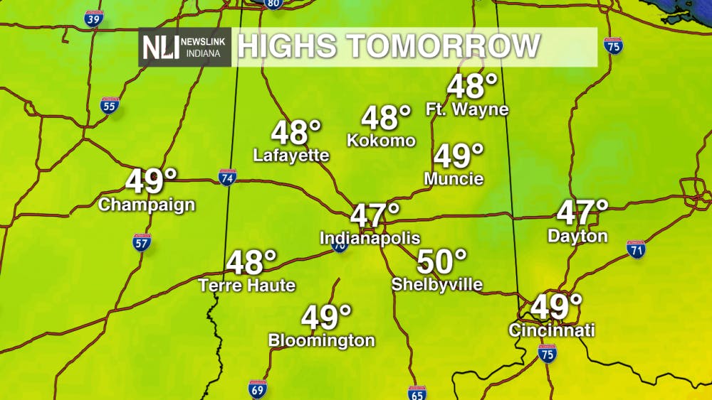
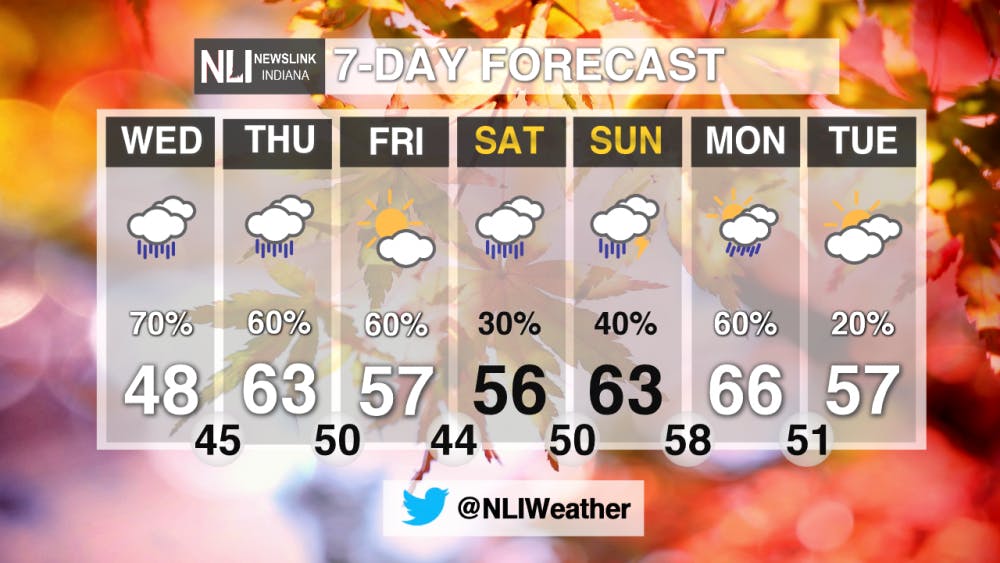
7-Day Forecast:
A wet week is ahead, with showers expected to stick around until the weekend. Temperatures will rebound back into the 50's and 60's as the week progresses. Sunday holds a chance for thunderstorms throughout the day, with clearing conditions finally setting into late Monday into Tuesday.
Read More

Missed It? We’ve Got You Covered - CommCenter Catch-Up
By Ball State Daily / 5 hours agoWith summer internships ramping up, hanging out with friends and family, and making sure you have enough time for yourself – it’s easy to miss Ball State’s Communication Center announcements! This week’s catch-up highlights free Premium Google AI for students, free planetarium shows for June and July, and 2025 U.S. News “Best Online Programs” announced.

9-1-1 What's Your Hot Take E11: Season Ranking
By Willow Emig and Sam Jasionowski / 5 hours agoIn this episode of 9-1-1 What’s Your Hot Take, Sam and Willow rank the seasons of 9-1-1 from their favorite to least favorite.
Nurse practitioner offers three easy ways to save more money in healthcare
By Nick Roark / 10 hours agoSeven out of ten Americans believe the healthcare system is in crisis or has major problems, according to a November 2024 Gallup poll on American healthcare.
