
Tonight: Tonight will be a low of 42. As cloud coverage starts to form overnight there is a potential for showers overnight into tomorrow morning. Winds coming in from the east at 10 mph.

Saturday:Potential for showers in the AM hours continued over from tonight. Cloudy conditions throughout the day and warmer than today due to warming southeastern air masses moving in. Highs in the low 60s and only dropping down to the upper 50s at night.

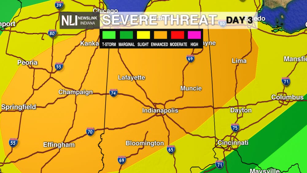
7-Day Forecast: A warmer weekend brings about a severe threat of weather. Sunday's main risk includes, but is not limited to: hail, strong wind gusts, and isolated tornadoes. As this severe weather passes, we bring about a cooler, but sunnier, week.

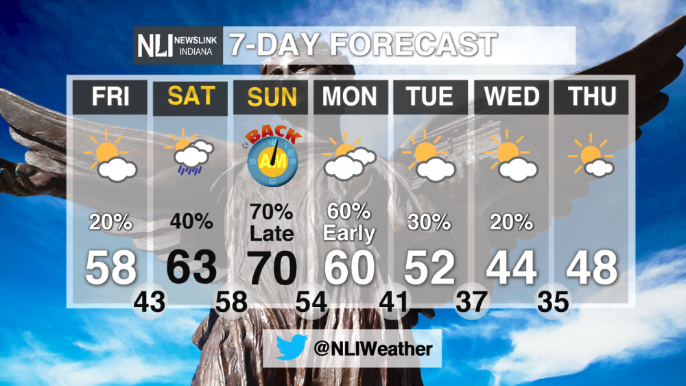
Make sure to follow us on Twitter, @NLIWeather.--- Weather Forecaster Liz Szewczyk
NewsLink Indiana is a proud Ambassador for the NOAA Weather-Ready Nation program. For more information about the Weather-Ready Nation program please click HERE
Read More

Missed It? We’ve Got You Covered - CommCenter Catch-Up
By Ball State Daily / 2 hours agoWith summer internships ramping up, hanging out with friends and family, and making sure you have enough time for yourself – it’s easy to miss Ball State’s Communication Center announcements! This week’s catch-up highlights free Premium Google AI for students, free planetarium shows for June and July, and 2025 U.S. News “Best Online Programs” announced.

9-1-1 What's Your Hot Take E11: Season Ranking
By Willow Emig and Sam Jasionowski / 2 hours agoIn this episode of 9-1-1 What’s Your Hot Take, Sam and Willow rank the seasons of 9-1-1 from their favorite to least favorite.
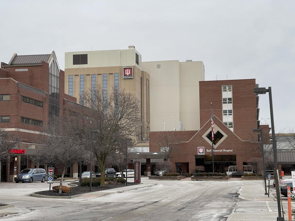
Nurse practitioner offers three easy ways to save more money in healthcare
By Nick Roark / 8 hours agoSeven out of ten Americans believe the healthcare system is in crisis or has major problems, according to a November 2024 Gallup poll on American healthcare.
