


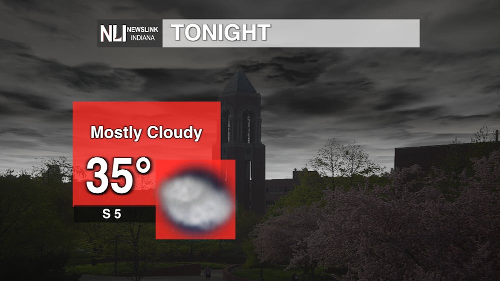
Tonight: The low for tonight won't get much cooler, getting down to 35 degrees. After a breezy past few days, the winds will calm down only coming out of the south at 5 mph. Fortunately, the clouds will still be sticking around throughout the night which will help warm up our temperatures tomorrow.
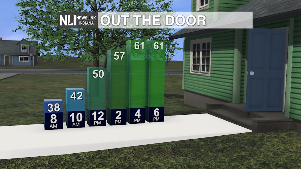
Tomorrow: We will be getting away from those chilly temperatures we have been feeling the past few days and the high will get in the low 60s. There will be clouds present throughout the morning, along with a few midday showers, but they will start to clear out getting into the early afternoon.
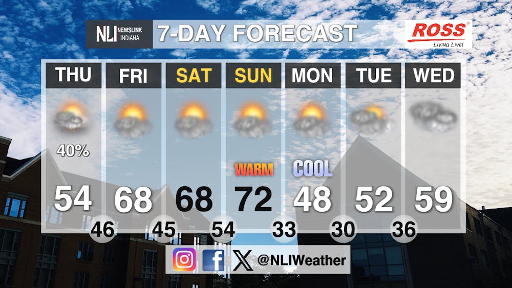
Seven-Day Forecast: After the last few days where the temperatures got below freezing, we will finally be seeing a warmup as the rest of the week concludes. Thursday will have a few light midday showers with temperatures starting to rise to 54 degrees as the high. Friday and Saturday will both get up to 68 degrees with the sun peeking in and out of the clouds throughout both days. Sunday will be our warmest high of the week getting up to 72 degrees, well above the temperatures we have experienced the past few days. Unfortunately, the temperature will drop almost 20 degrees overnight and the high on Monday will only get up to 48 degrees. Now it will start to warm throughout the middle of the week getting into the high-50s on Wednesday.
- Weather Forecaster Orion Aric
Follow us on Facebook, Instagram, and X @NLIWeather for breaking weather updates.
NewsLink Indiana is a proud Ambassador for the NOAA Weather-Ready Nation program.
For more information about the Weather-Ready Nation program please click HERE


