


Tonight: Temperatures will drop down to the high-50s, with winds coming out of the southwest at around 15 mph. Chances of rain increase as we make our way later this evening to tomorrow morning.

Tomorrow: As you leave tomorrow morning, you can go without your jackets, but be sure to grab an umbrella. Early morning temperatures will be in the high-50s and will increase throughout the day to the high-70s. Still, with those rising temperatures, we do see chances of rain returning to our forecast, bringing with it the possibility of severe weather. This severe weather can bring thunderstorms, large hail, high winds, and even isolated tornadoes to our area, so be sure to remain weather aware during this time.

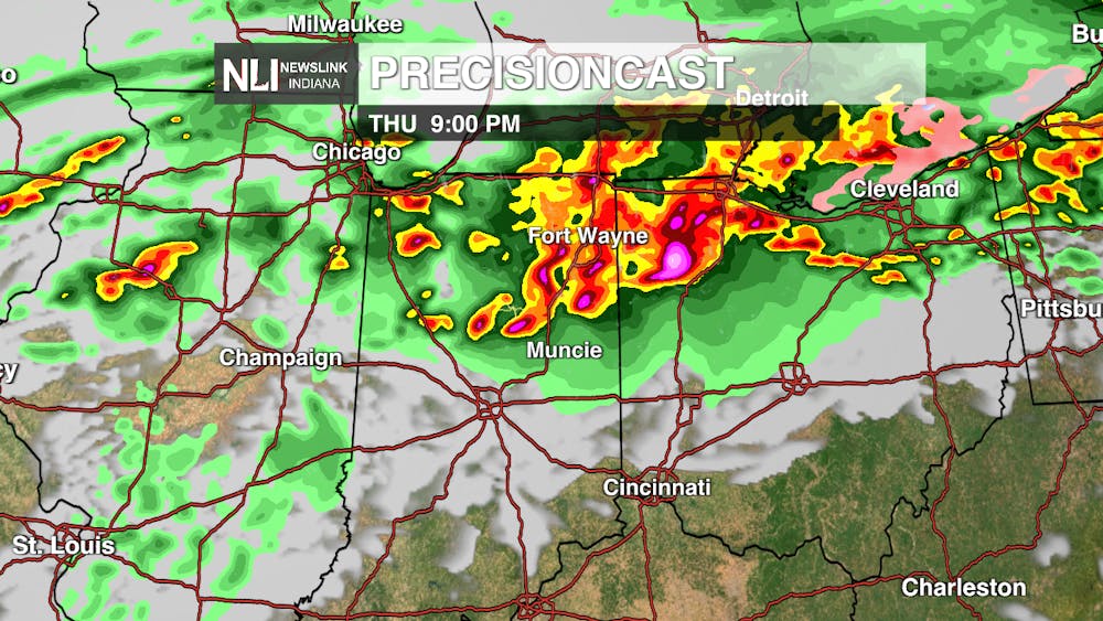
Seven-Day Forecast: Over the next few days, we see our temperature increase to record high temperatures on Thursday and then drop significantly on Friday as a cold front moves into our area. This cold front is pushing in some precipitation and severe weather late Thursday and early Friday morning, which could impact your Friday commute. The temperature will pick back up as we make our way into the weekend and into the beginning of next week. With these increasing temperatures, we again see those rain chances return to our forecast on Monday and Tuesday.

- Weather Forecaster Halle Dziekan
Follow us on Facebook, Instagram, and X @NLIWeather for breaking weather updates.
NewsLink Indiana is a proud Ambassador for the NOAA Weather-Ready Nation program.
For more information about the Weather-Ready Nation program please click HERE


