


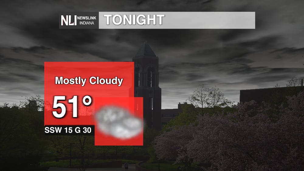
Tonight: This evening, temperatures will be rather mild with a low of 51 degrees. The conditions will remain cloudy throughout the night with some possible showers lingering in the later hours. Winds coming from the south-southwest at 15 mph with winds gusting up to 30 mph. Enjoy this mild evening before we start to see those below freezing temperatures roll back into our region.
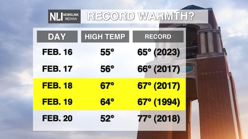
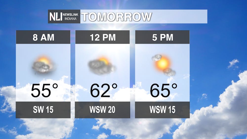
Tomorrow: Showers will continue through the early morning hours tomorrow but end up clearing out by the afternoon. Temperatures will be reaching up to 67 degrees which would set us at the record high that was set back in 2017. Conditions will clear up leaving us with some sunshine by midday. Winds gusting up to 35 mph.
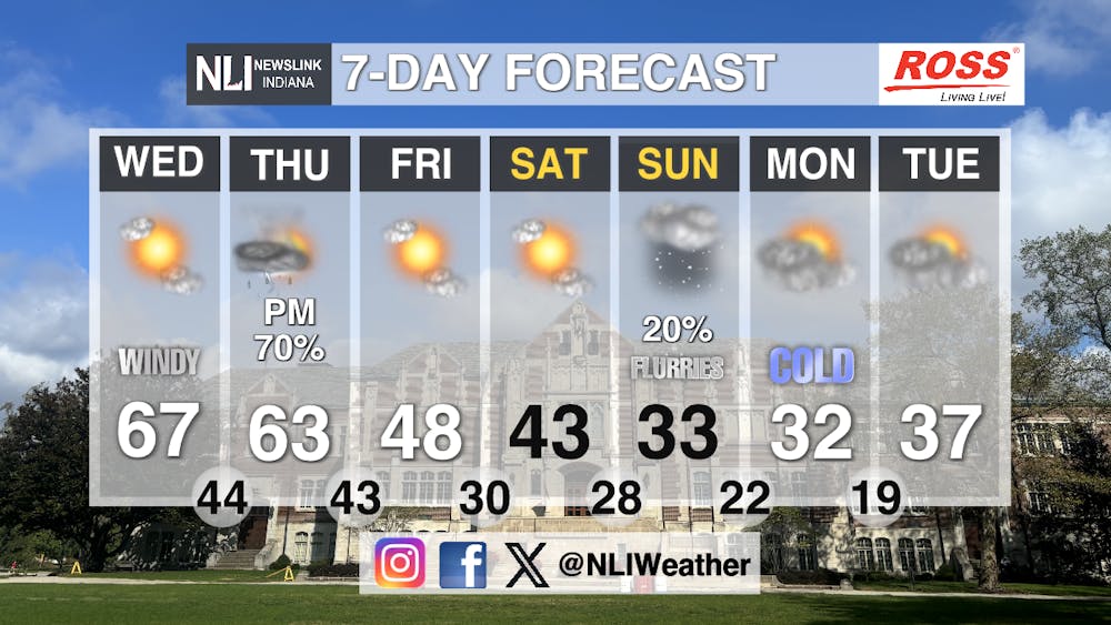
Seven-Day Forecast: Those mild temperatures wont be sticking around for long. Thursday we have a chance of thunderstorms in the evening leaving us with cooler temperatures for the next coming days. Highs being in the 60s and lows in the 30s throughout the week. Conditions remaining mostly cloudy with some pops of sunshine Friday and Saturday. Possible snow flurries this Sunday as temperatures dip down below freezing.
- Assistant Chief weather Forecaster Elizabeth Myers
Follow us on Facebook, Instagram, and X @NLIWeather for breaking weather updates.
NewsLink Indiana is a proud Ambassador for the NOAA Weather-Ready Nation program.
For more information about the Weather-Ready Nation program please click HERE
