


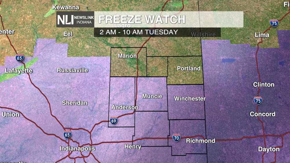
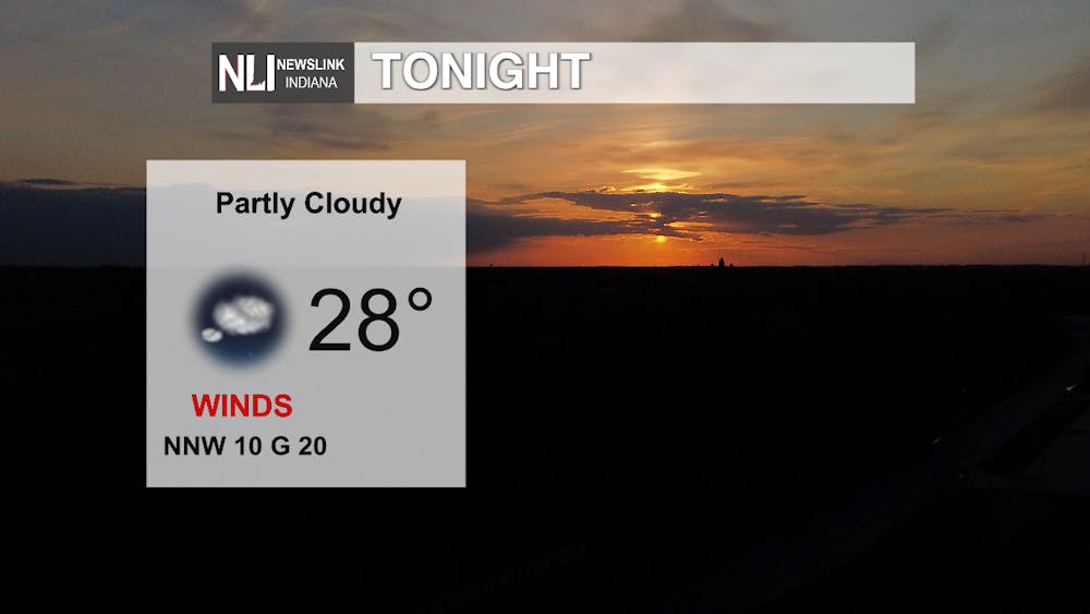
Tonight: Another cold night is ahead for us with temperatures expected to reach 28 degrees for our low. There is a freeze warning in effect so make sure to bundle up if you are going outside tonight. Conditions will remain partly cloudy with winds blowing from the north north west at 10 mph and gusts up to 20 mph.
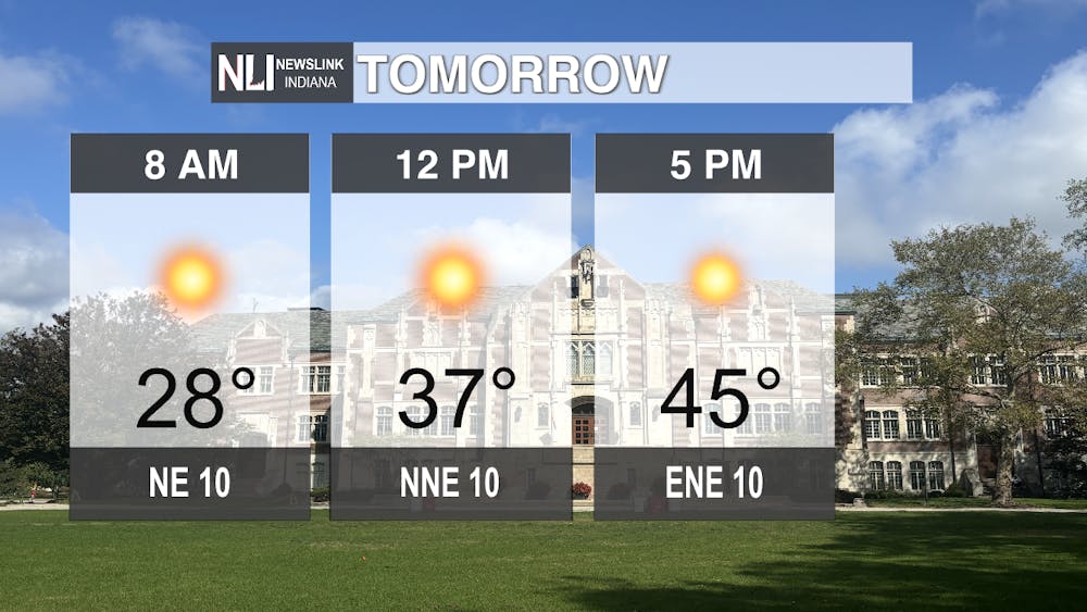
Tomorrow: A chill will carry over through the night into the morning with temperatures remaining at 28 degrees as you start your morning commute. Temperatures will slowly increase throughout the day being in the mid-to-high 30s at noon and 45 degrees for our high at 5 p.m. Conditions will be sunny and clear with winds blowing a consistent 10 mph throughout the day.
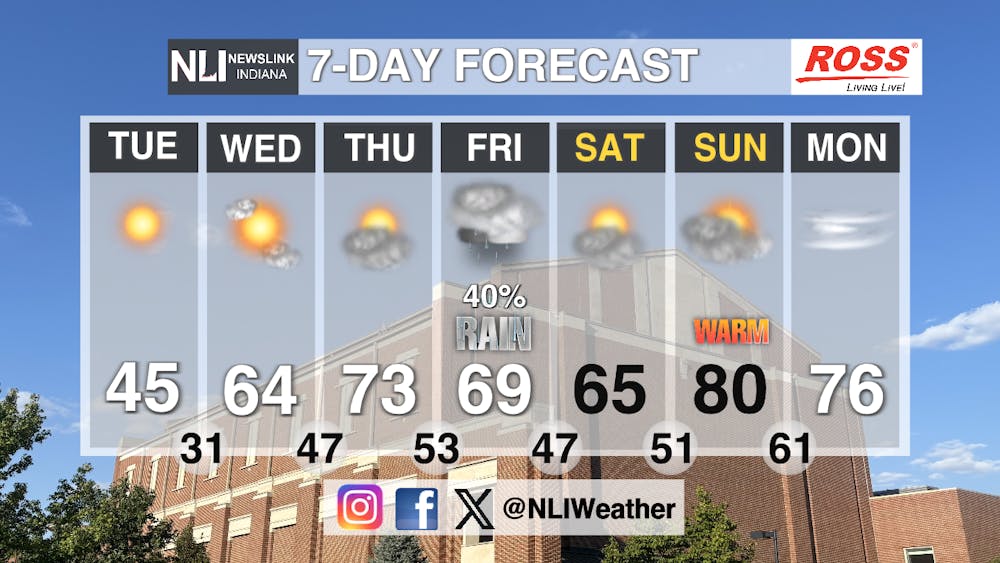
Seven-Day Forecast: Even with a cool start to the week, temperatures will increase dramatically by Wednesday afternoon. Temperatures will jump almost 20 degrees back up to the mid-60s. Temperatures will continue to increase up until Thursday with a high of 73 with more cloud cover moving in Thursday afternoon. Friday will bring a 40 percent chance of rain in the afternoon with temperatures cooling off to 69 degrees. That rain will continue into Saturday morning. The temperatures will remain warm despite the rain on Saturday with the high being 65 degrees. The heat will return on Sunday though with a warm highs in the low-80s. Winds and cloud cover will stay in our area even into next work week with the temperatures remaining in the mid-70s.
-Weather Forecaster Evan Reed
NewsLink Indiana is a proud Ambassador for the NOAA Weather-Ready Nation program.
Follow us on Facebook, Instagram, and X @NLIWeather for breaking weather updates.
For more information about the Weather-Ready Nation program please click HERE
