


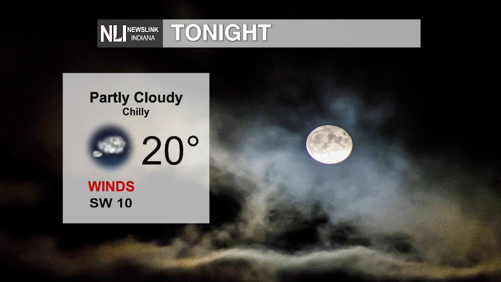
Tonight: A bit warmer tonight as winds switch from out of the SW, with these winds expected to increase into tomorrow. Some high clouds as well, but the weather appears to be on the calm and chilly side - albeit ten degrees warmer than last night!
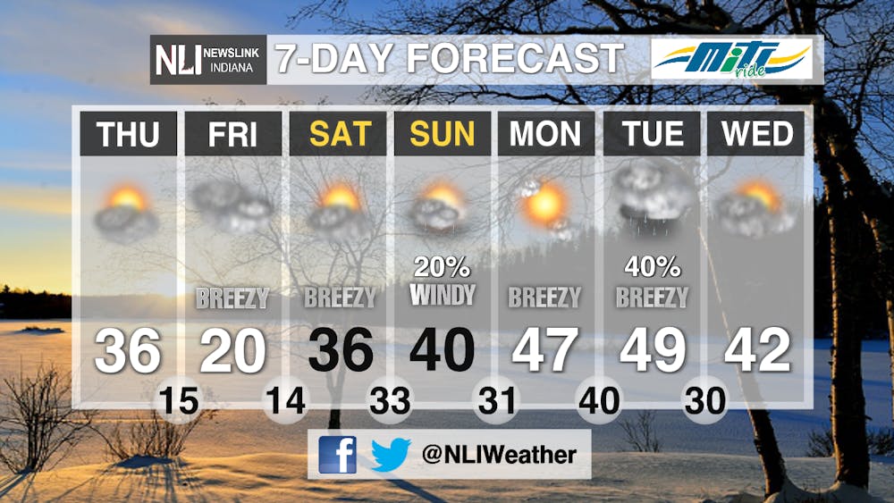
Tomorrow: Looking at some breezy southwest winds and some sunshine to help warm things up a bit, bumping our temperatures up 7 degrees from what we had today. Some clouds will filter in later in the day, however, as we watch for our next system drawing near Friday.

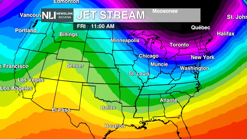
7-day Forecast: Bundle up! Friday and Saturday should be frigid when you factor in those "feels-like" temperatures! Winds stay breezy and shift to out of the northwest & remain gusty with temperatures feeling like between -5 and 5. However, rejoice, because a ridge of high pressure looks to bump those temperatures up to about 10 degrees above normal on Tuesday! (Yay!) There'll be some clouds and rain around with a system that works through the area, though (Boo!), but at least it looks like plain rain for now instead of that dreaded ice folks to our south and west down towards Texas have been dealing with!
--Weather Forecaster Ryan Hill
Follow us on Twitter @NLIWeather for breaking weather updates.
NewsLink Indiana is a proud Ambassador for the NOAA Weather-Ready Nation program.
For more information about the Weather-Ready Nation program please click HERE


