


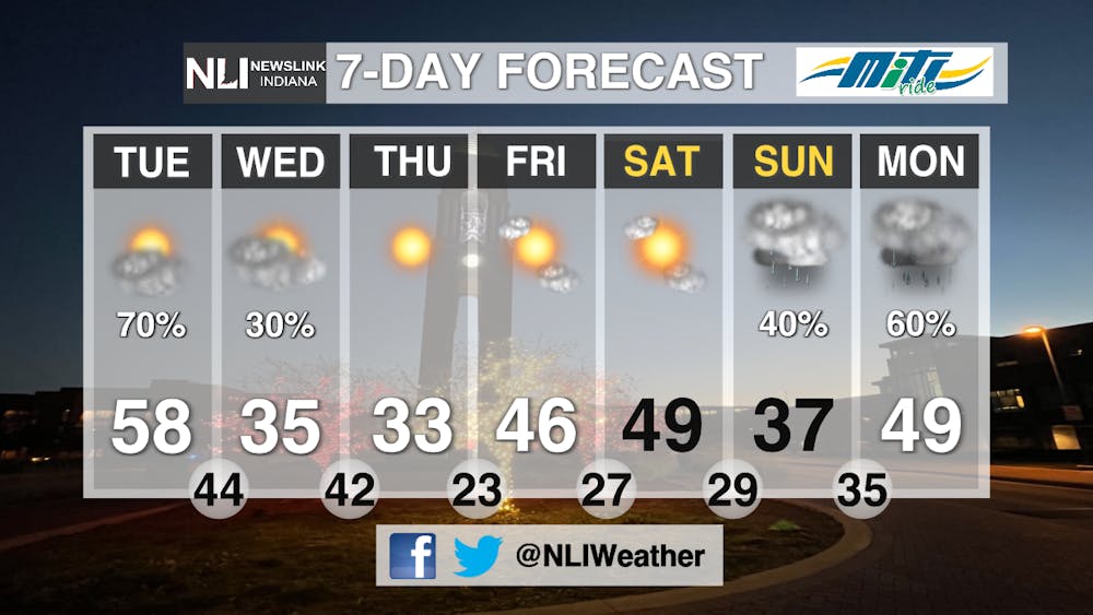
Today: A warm day is ahead, with highs in the upper 50s and even 60 in some places, with winds out of the south at 10-15mph.

Tonight: Rain and Thunderstorms are possible after 8pm and throughout the night. A Wind Advisory is in place from 7pm to 4am, with winds expected to be out of the west at 15-20mph, gusting up to 40mph.

Tomorrow: Sharply colder tomorrow, with highs only in the mid-30s. Rain chances will diminish soon after the morning hours, becoming mostly sunny in the afternoon.

7-Day Forecast: Dryer and cooler weather persists throughout the rest of the work week, before rain chances return Sunday night into Monday morning as a cold front moves through the area.
--Weather Forecaster Noah Gordon
Follow us on Twitter @NLIWeather for breaking weather updates.
NewsLink Indiana is a proud Ambassador for the NOAA Weather-Ready Nation program. For more information about the Weather-Ready Nation program please click HERE


