


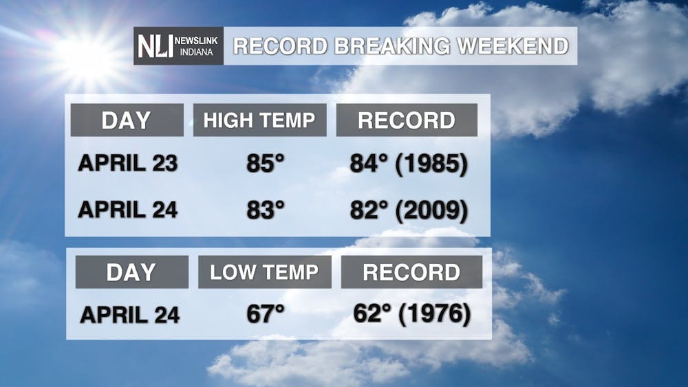
We set 3 new temperature records in Muncie this past weekend!!! Both Saturday and Sunday set new records for high temperatures! Saturday's high of 85 beat the record of 84 set back in 1985. Sunday's high of 83 beat the record of 82 set back in 2009. Also on Sunday, we set a record for the warmest low temperature for April 24th! Sunday's low of 67 beat out the record maximum low of 62 set back in 1976. Records date back to 1962 in Muncie.
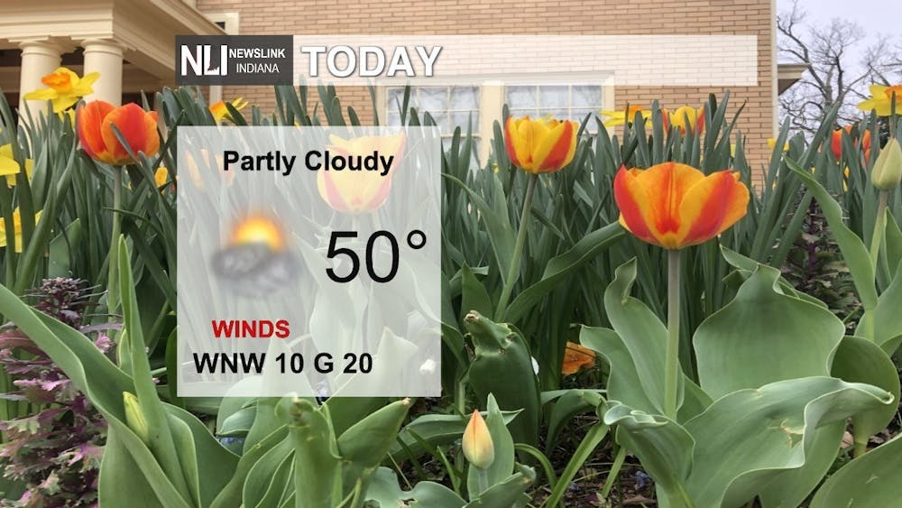
Today: Temperatures will be 10-15 degrees below average today, with highs only topping out near 50 degrees under partly cloudy skies. Winds from the west northwest will help keep temperatures cool, with gusts up to 20 MPH.
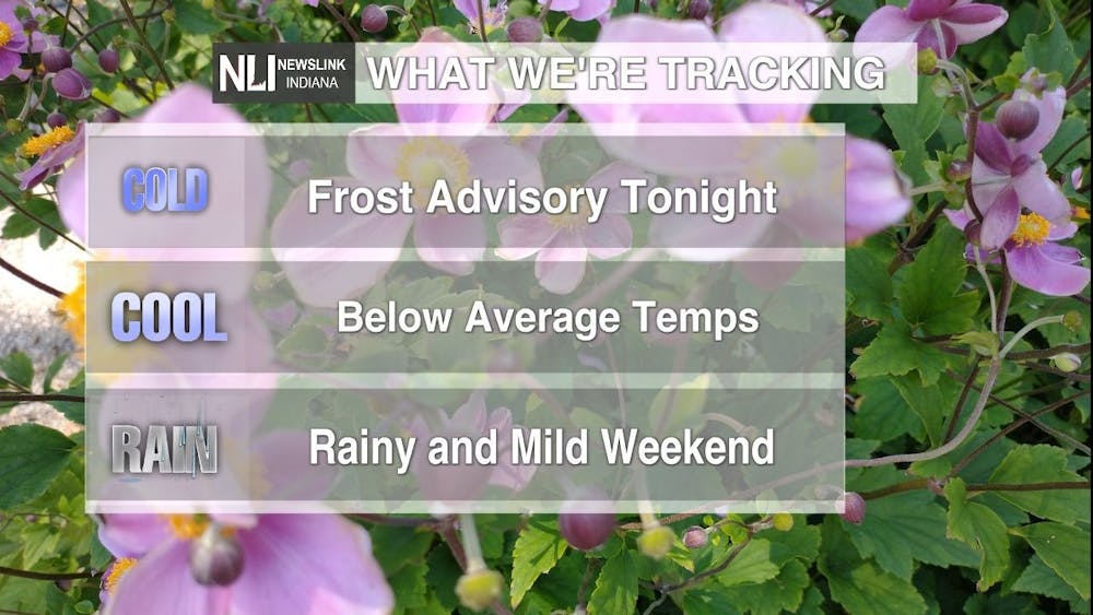
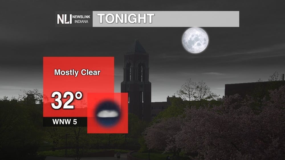
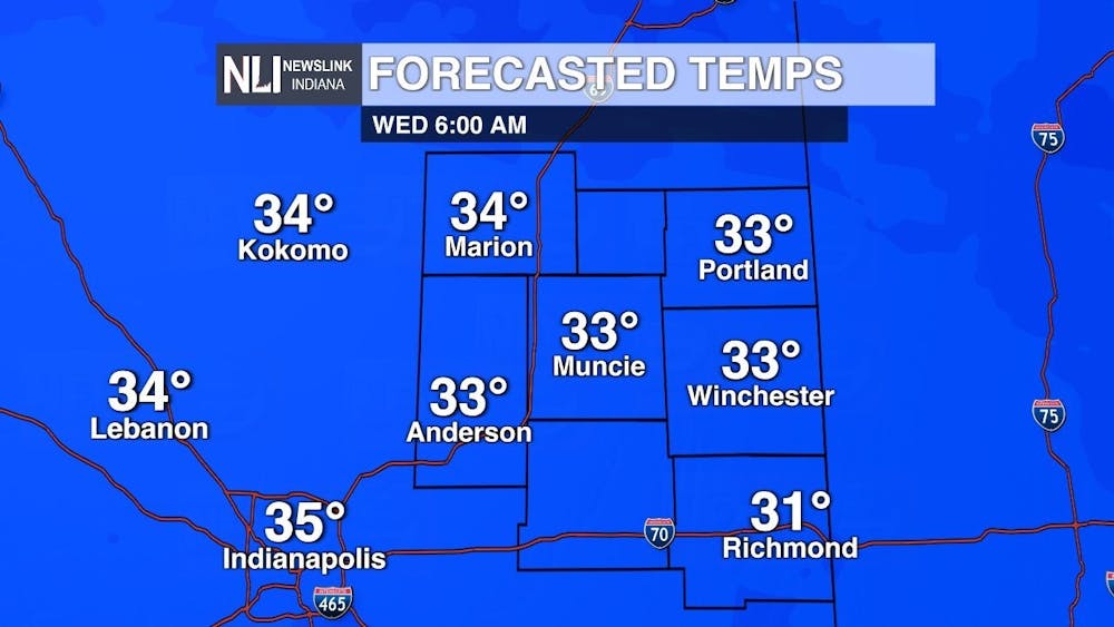
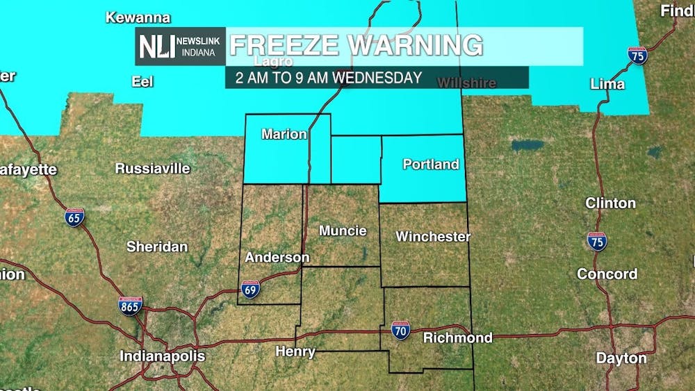
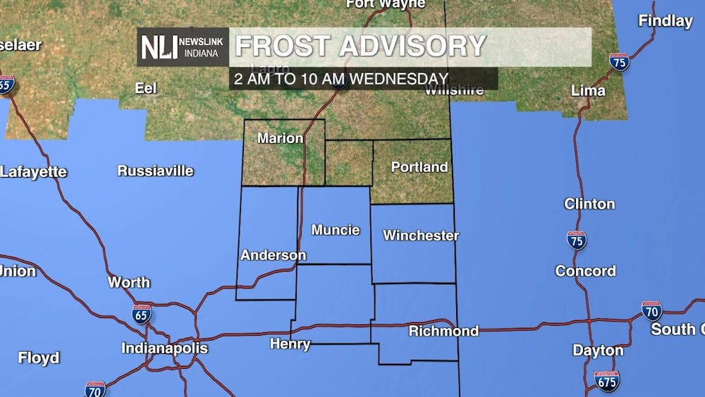
Tonight: A Frost Advisory will be in effect from 2-10 AM on Wednesday for Madison, Delaware, Randolph, Henry, and Wayne counties. Low temperatures will be in the low to mid 30s in these locations. In Muncie, the forecasted low is 32 degrees. In Grant, Blackford, and Jay counties, a Freeze Warning will be in effect from 2-9 AM on Wednesday, where temperatures are expected to be at or below freezing by daybreak. If you have started to plant, be sure to cover any outdoor plants or bring them inside! Winds will be light out of the west northwest at 5 MPH.
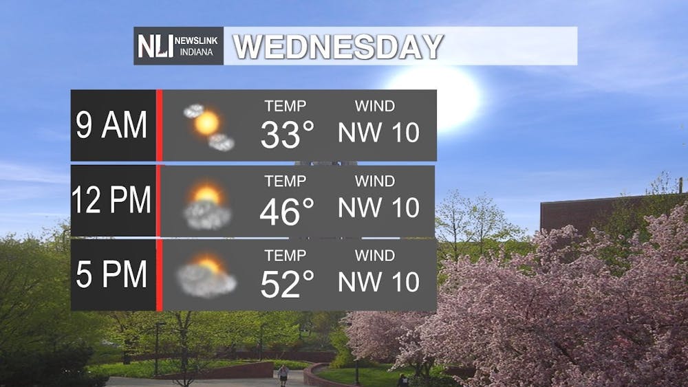
Tomorrow: You'll want to grab a coat on your way to school or work tomorrow, as temperatures will be right around freezing! Temperatures will once again be below average on Wednesday, topping out at a high of 52 dgerees. We will see an increase in clouds during the afternoon. Winds will be out of the northwest at 10 MPH throughout the day.
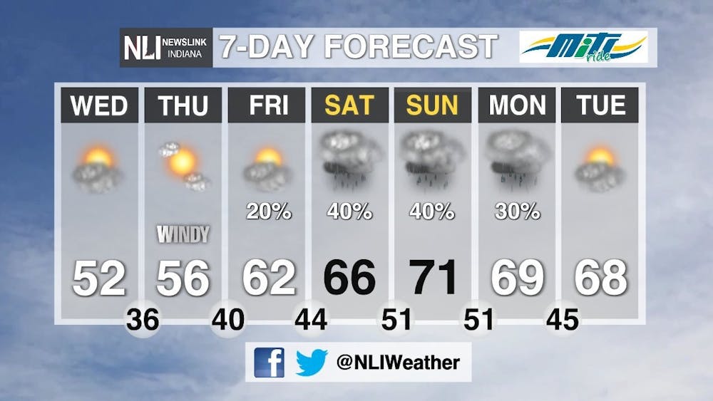
7-Day Forecast: We will gradually see temperatures increase throughout the rest of the week, with a rainy and mild weekend expected. We will see rain throughout the weekend, and lingering into Monday as well. Temperatures will be in the upper 60s to low 70s, which is slightly above average, but it will definitely be cooler than this past weekend when we experienced record breaking temperatures in the 80s.
---Chief Weather Forecaster Maddi Johnson
Follow us on Twitter and Facebook @NLIWeather for breaking weather updates.
NewsLink Indiana is a proud Ambassador for the NOAA Weather-Ready Nation program.
For more information about the Weather-Ready Nation program please click HERE


