


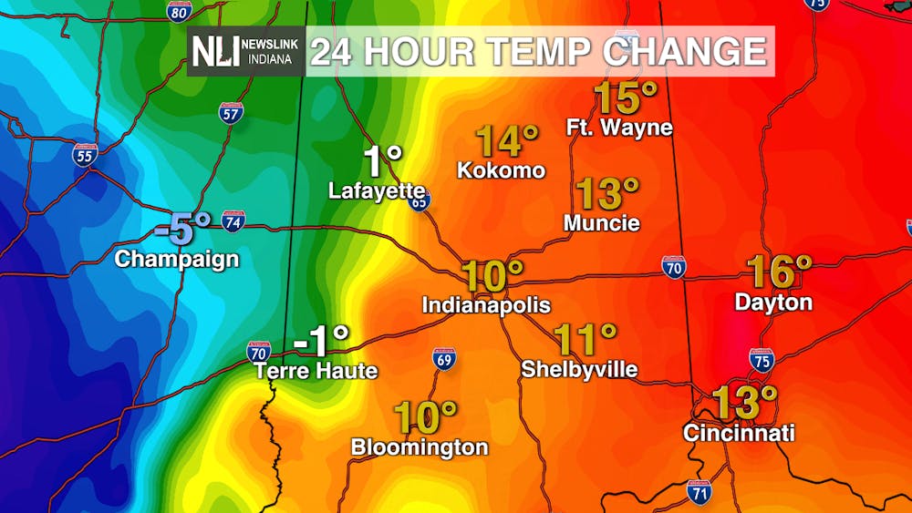
Gloomy weather across the area today, following a warm front this morning. We saw some light precipitation early this morning, as well as some gusty winds and warmer temperatures move into the area.
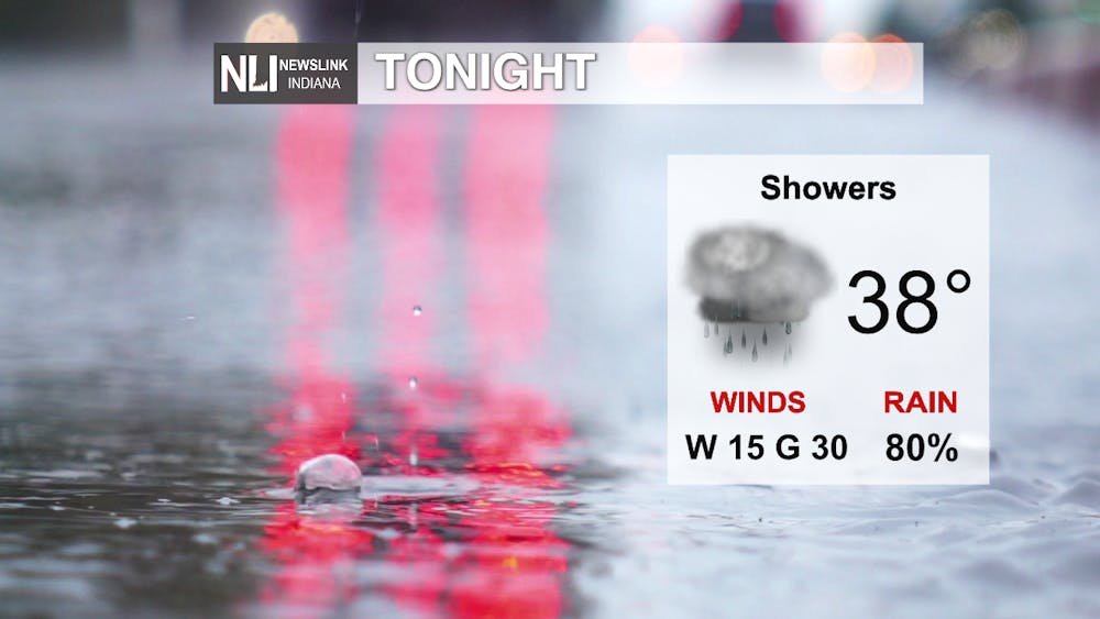
Tonight: Rain out ahead of a cold front will move through tonight. Expect the heaviest rain between 10 and 11pm before moving out of the area after midnight early tomorrow morning. There are still some wind gusts of up to 30 mph, so it might not be a bad idea to bring in or stay any lawn furniture as well as bring up any trash bins or recycling bins from the road.
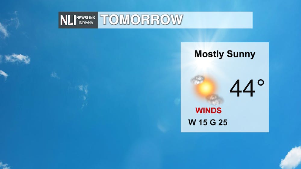
Tomorrow: Colder temperatures move into the area tomorrow thanks to another cold front. High of 44 with winds still a little bit on the gusty side, but plenty of sunshine.

Temperature Trend: This wild weather rollercoaster looks to continue over the next couple of days. Dropping down below average to end the week, but right back up normal for the weekend. To start next week temperatures right back to being below average.
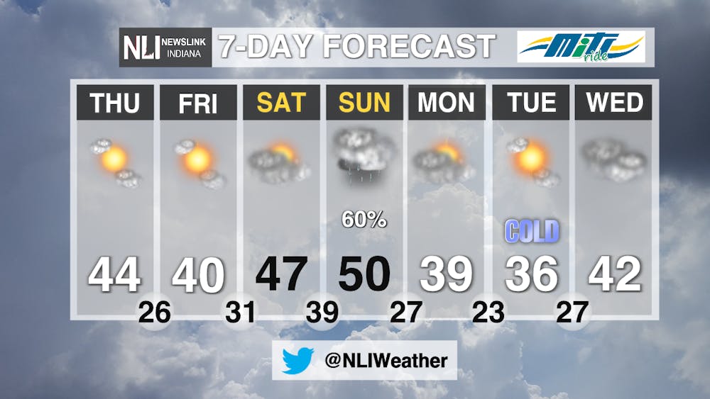
7-Day Forecast: Sunshine but colder temperatures to end the week. Then right back up hill for temperatures in the 50's on Sunday. Precipitation will return to the area on Sunday. rain for most day, however some wintry precipitation as well as snowflakes could mix in during the evening hours. Temperatures right back down into the 30's to beginning the week on Monday and Tuesday. Cloudy skies and temperatures up into the 40's for your mid week.
-Weather Forecaster Adam Feick


