


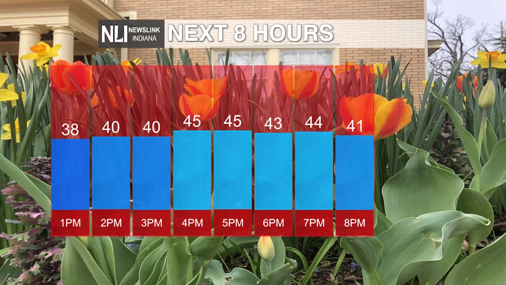
Today: Clearing skies throughout the afternoon with winds on the lighter side, coming out of the northwest at 5-10 mph. A high of 45 degrees for your day.
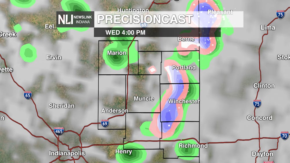
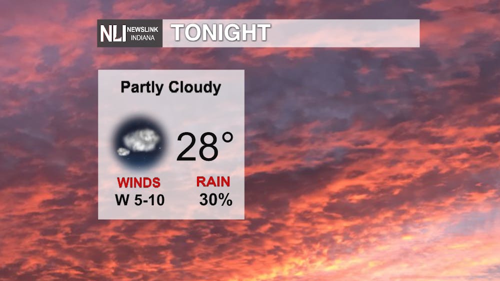
Tonight: Showers mixed with snow will move into the area around the evening rush hour. They will linger until about 9pm, leaving behind partly cloudy skies. Temperatures will drop off quickly to a low of 28 degrees. We could break another record low tonight of 27 degrees that was set back in 1950. Another freeze warning is in effect from 1am tonight until 10am tomorrow morning. Be sure to cover your outdoor plants or bring them inside. In addition, drip water from faucets to prevent pipes from freezing.

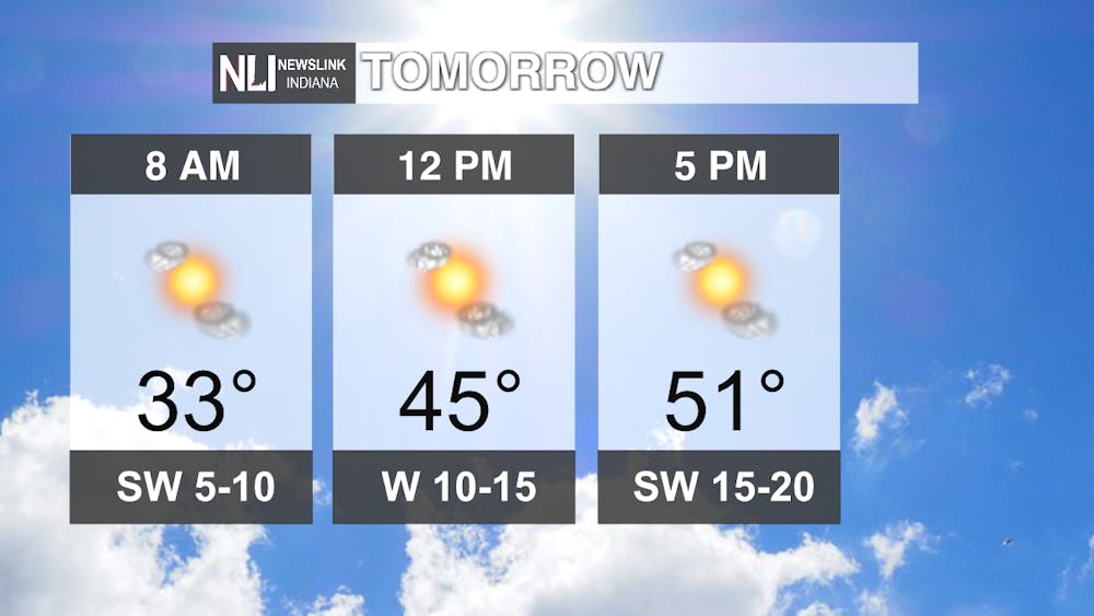
Tomorrow: Plenty of sunshine for your Thursday afternoon. Temperatures warming up to the lower 50s, yet this is still well below average for this time of year. Winds will increase throughout the day along with the temperatures, topping out at 15-20mph, gusts up to 25.
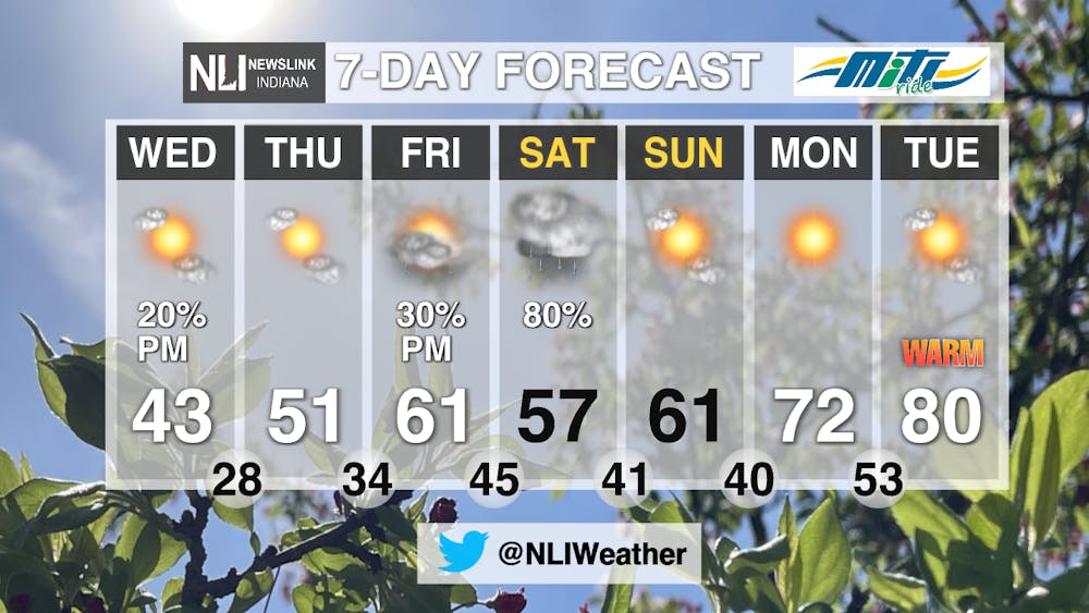
7-Day Forecast: A well needed warm up is on the way! The start of the weekend brings a chance of rain, but clearing out by Sunday. Plenty of sunshine for the start of next week, along with warmer temperatures. By Monday we are back above average, sitting at 72 degrees and on Tuesday hitting 80 degrees!
--Weather Forecaster Hope Kleitsch
Follow us on Twitter @NLIWeather for breaking weather updates.
NewsLink Indiana is a proud Ambassador for the NOAA Weather-Ready Nation program.
For more information about the Weather-Ready Nation
program please click HERE


