


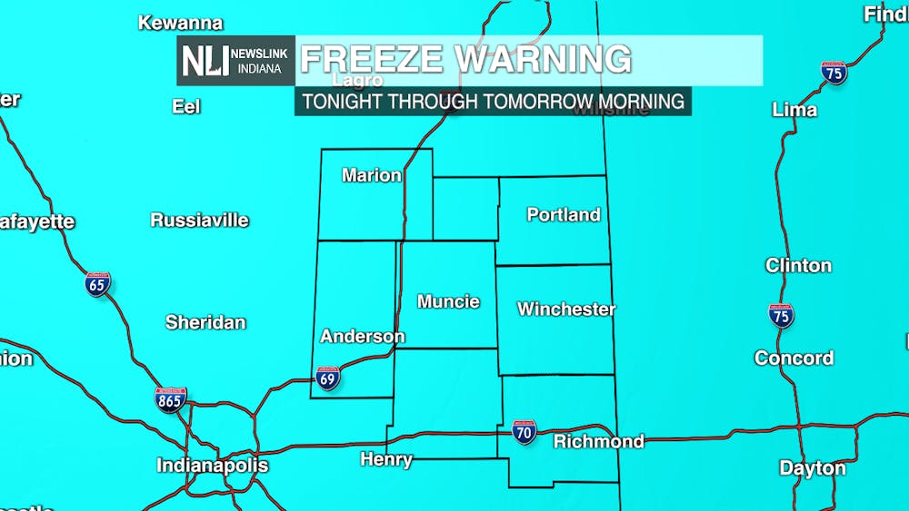
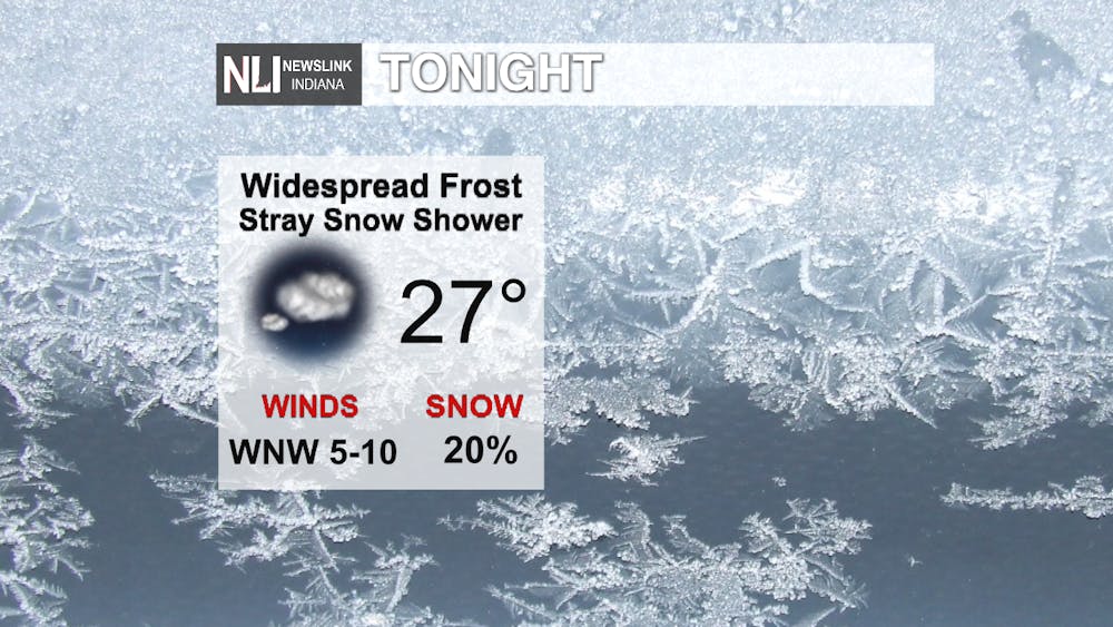
Tonight: Expect scattered rain and snow showers to come to an end this evening. We hold on to the chance for a stray snow shower through the overnight hours. Clouds will decrease by daybreak, allowing temperatures to drop off into the upper-to-mid 20s across the area. Widespread frost is likely. A Freeze Warning is in effect across the entire viewing area through tomorrow morning.
Tomorrow: After a frosty start to the day, temperatures will return to the 50s with mostly sunny skies. Enjoy the nice day after all of the cold and snow we experienced over the past few days. Frost is once again possible tomorrow night, but expect frost to not be as widespread as the previous two nights.

Extended Outlook: Temperatures return to seasonable levels on Friday with more clouds and the chance for a stray shower late. Rain chances return to start the weekend as a weather system passes through the area. This will drop temperatures back into the 50s on Saturday. We look to dry out then on Sunday and to start the week, with high temperatures going well above average. Highs could be close to 80 degrees by Tuesday, a remarkable difference compared to the cold temperatures we have experienced this week. Highs will stay in the 70s on Wednesday, with another chance for rain showers.


---Chief Weather Forecaster Nathan Gidley
Follow us on Twitter @NLIWeather for breaking weather updates.
NewsLink Indiana is a proud Ambassador for the NOAA Weather-Ready Nation program.
For more information about the Weather-Ready Nation program please click HERE


