


Weekend Recap: This past weekend saw a severe weather system cover much of the Eastern United States and bring several dozen possible tornadoes, long with many wind damage and hail reports. In fact, Saturday had the most storm reports of any day this year so far, and the 5th most tornado reports. Indiana escaped the tornado outbreak but much of Central Indiana, including Muncie, saw severe wind and hail.


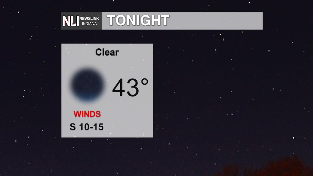
Tonight: Clear skies and a low of 43 tonight, with winds remaining light but steady out of the South - a calm contrast to Saturday night.
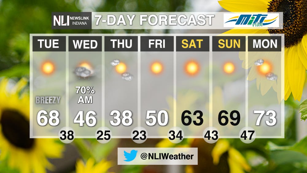
Tomorrow: A sunny and cool morning tomorrow morning, warming up to 67 by 5pm. However, clouds also move in throughout the day ahead of a line of showers visiting the area overnight into Wednesday morning. Starting around noon the winds will start to drastically pick up to 20-25mph with gusts up to the 30-40mph range.

7-Day: Overnight Tuesday night will see rain chances move through the area which will last until about 6am Wednesday. This rain also ushers in a several-day cooldown dropping the high Thursday to 38. Fortunately, the temps rebound again going into the weekend and by Sunday we reach a nice and sunny 69. Next week will see the return of 70's with 73 on Monday.
-Weather Forecaster Rudy Ahlersmeyer
Follow us on Twitter @NLIWeather for breaking weather updates.
NewsLink Indiana is a proud Ambassador for the NOAA Weather-Ready Nation program.
For more information about the Weather-Ready Nation program please click HERE .


