


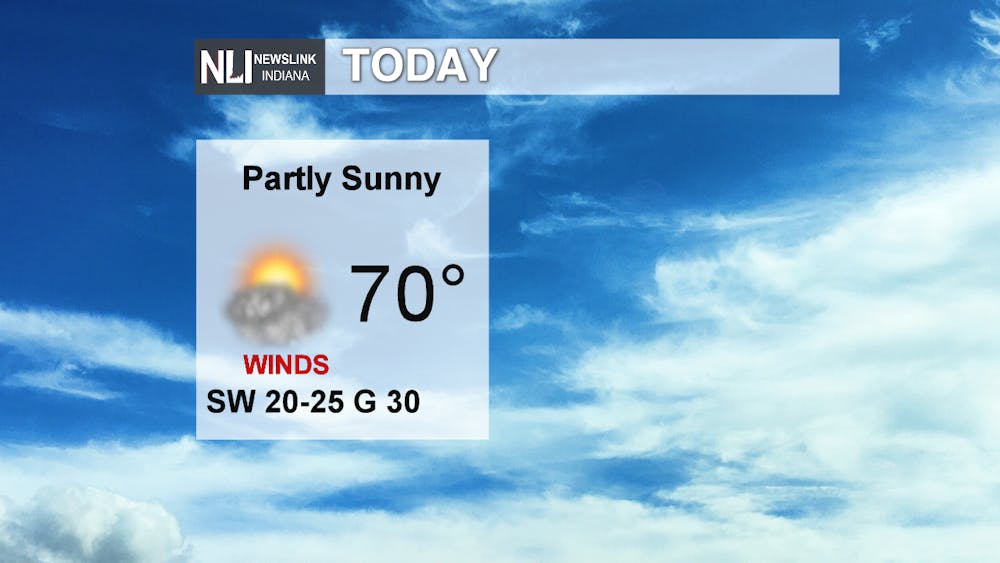
Today: Skies will decrease throughout the day, leading to partly sunny skies, with a high near 70 degrees. Breezy, with winds coming out of the southwest at 20-25mph, gusts up to 30.
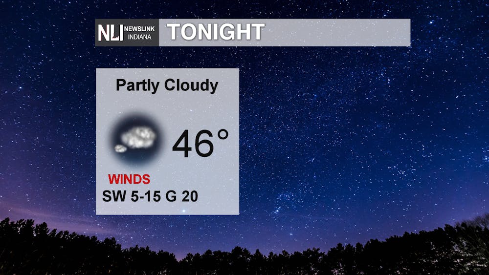
Tonight: Clouds will increase going into the early morning hours as the next system moves into the area. A low of 46 degrees for tonight. Winds will die down, remaining out of the southwest at 5 to 15mph.
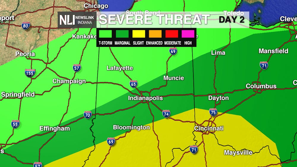
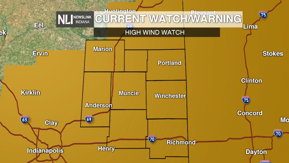
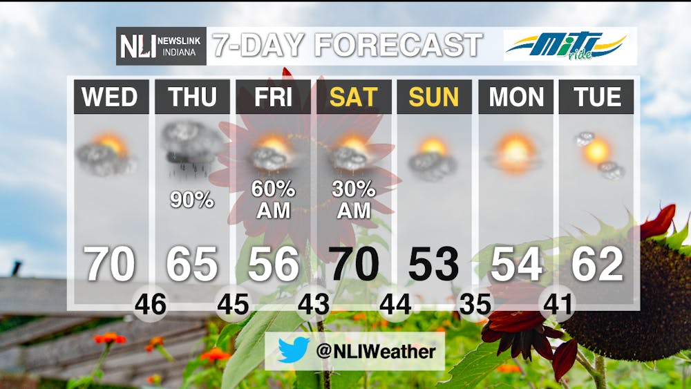
Tomorrow: Rain showers will move into the area around 7am. Light showers through the morning hours, but heavier pockets and some thunder move in after the lunchtime hour. The southern counties of our viewing area have a “marginal” risk of severe weather. Be sure to follow our updates on Twitter if severe weather moves into our area. A high of 65 by 5pm. Winds will pick up throughout the day, coming out of the southeast. A high wind watch goes into effect at 8pm for the entire viewing area. This entails sustained winds of 25 to 35 mph, gusts up to 60. The watch ends at 6am Friday morning. If you have outdoor furniture, be sure to bring it inside.

7-Day Forecast: A rainy rest of the week as the next rain system will stick around for Thursday, Friday, and Saturday. The system will push out of the area Saturday afternoon, leaving mostly sunny skies for the remainder of the weekend and early next week. A big drop in temperature for Sunday and Monday, with highs only in the mid 50s.
--Weather Forecaster Hope Kleitsch
Follow us on Twitter @NLIWeather for breaking weather updates.
NewsLink Indiana is a proud Ambassador for the NOAA Weather-Ready Nation program.
For more information about the Weather-Ready Nation program please click HERE


