


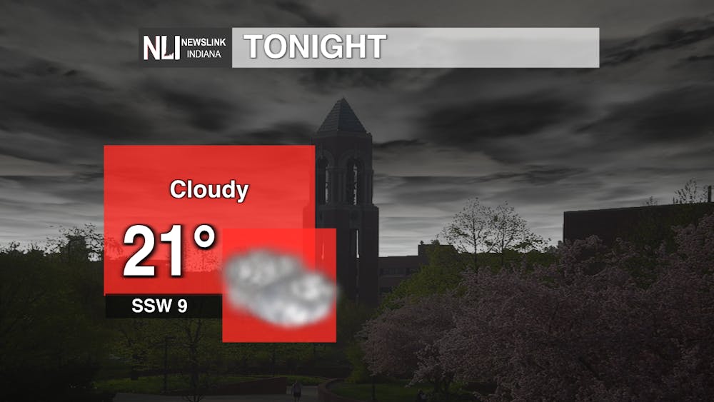
Tonight: We are looking at a mostly cloudy night with temperatures dropping into the low-20s and staying around that range for the rest of the night. Winds will be variable around 10 mph coming out of the SSW.
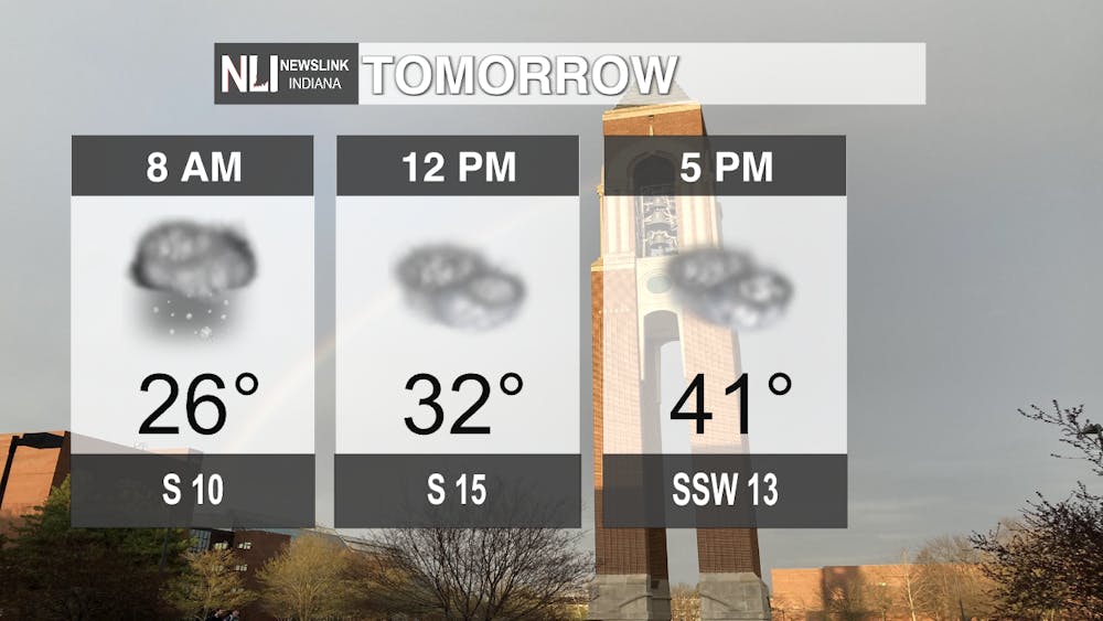
Tomorrow: Temperatures will start to warm up a bit with a high of 41 degrees and winds still staying variable but gusting up to 25 mph. However, there will be a chance of snow flurries early tomorrow giving way to pretty widespread cloud cover for the rest of the day.
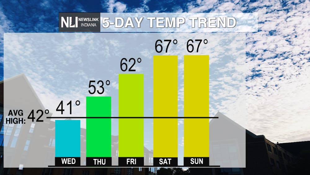
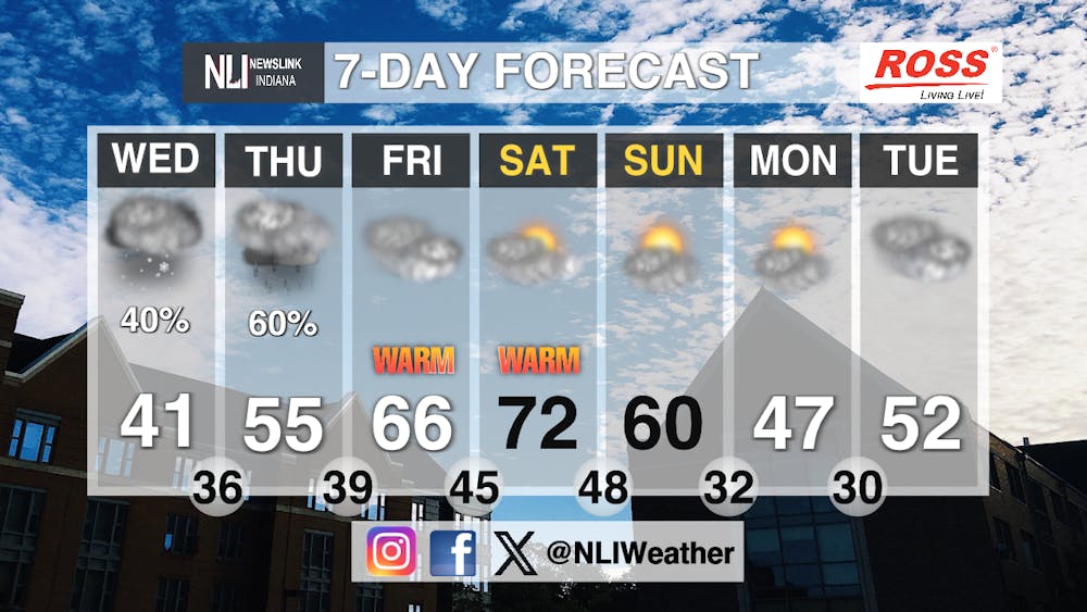
Seven-day Forecast: Over the next seven we will start to see a very noticeable increase in temperatures. Temperatures will still stay pretty chilly for Wednesday and Thursday with snow flurries turning into rain on Wednesday, but we will really see warmth on Friday as we break the 60 degree mark and start to see some sun break through the clouds. Saturday and Sunday are looking both at 67 degree days and even a possibility of hitting 70. Higher wind gusts could be a possibility on Sunday with gusts up to 25 mph.
- Weather Forecaster Jonas Hinderer
Follow us on Facebook, Instagram, and X @NLIWeather for breaking weather updates.
NewsLink Indiana is a proud Ambassador for the NOAA Weather-Ready Nation program.
For more information about the Weather-Ready Nation program please click HERE


