


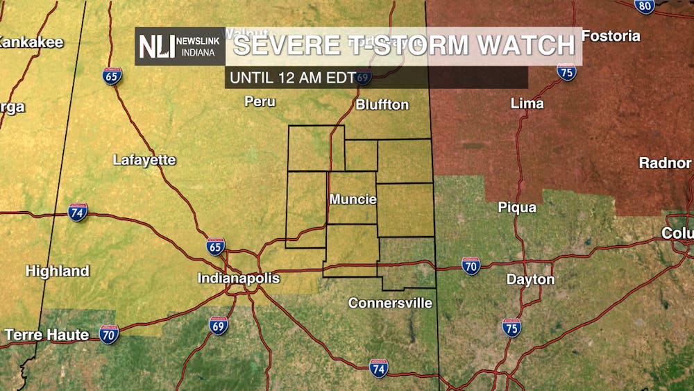
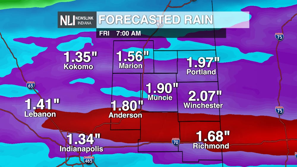
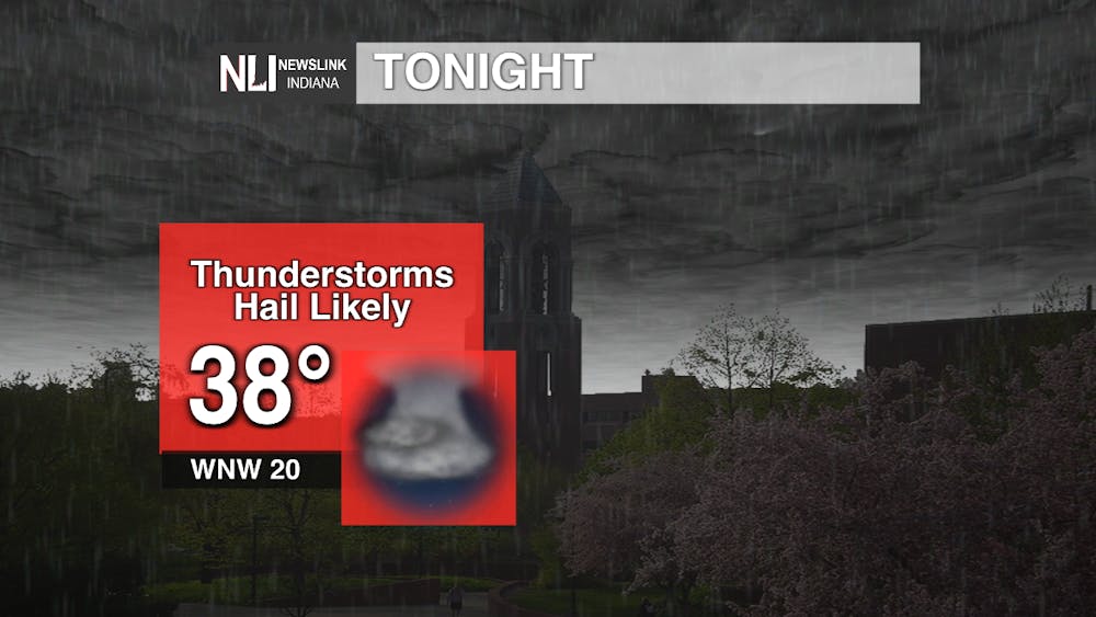
Tonight: The latest cold front will move through our area this evening. Conditions will begin deteriorating around 8 p.m. before storms pick up heading into the 9 p.m. hour and lasting through midnight. A severe thunderstorm watch is in place for Muncie and the surrounding counties until midnight. Once the worst storms move through, moderate and sometimes heavy rain will persist into the early morning hours. Select areas may receive up to and exceeding two inches of rain. That's equivalent to two feet of snow! Once the front moves through, temperatures plummet into the high-30s for the low this evening.
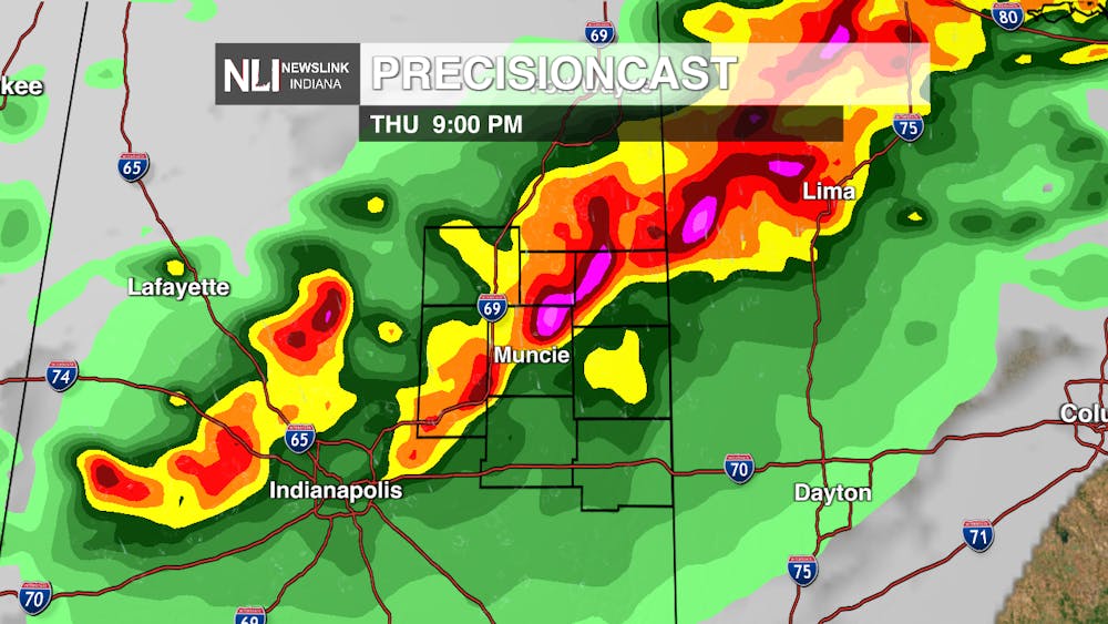
The main threats this evening include damaging winds up to 80mph and hail up to 2.5 inches in select areas. That's the equivalent of a tennis ball. An isolated and brief tornado or two is also possible this evening. Make sure you have a way to receive warnings and follow the NLI Weather Facebook page for more information.
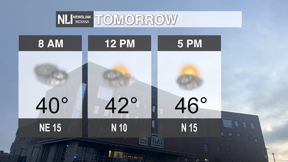
Tomorrow: Temperatures begin well below where they were today in the low-40s. There will not be much heating during the day as highs will rise into the mid-40s. Clouds will slowly move out during the day with partly cloudy conditions by the evening commute. Winds will come from the north at 10-15 mph.
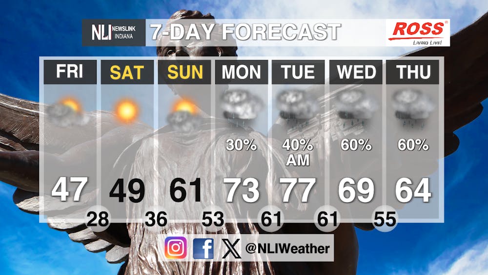
Seven-Day Forecast: After a couple days in the 40s, temperatures will rise back into the 70s by next week. Sunshine stays around through the weekend before a long stretch of rain chances enters the picture next week. It will make for that spring-feel with rainy conditions and highs in a mild range. On the bright side, no chance of severe weather is possible for next week at this time for Muncie.
- Chief Weather Forecaster Joseph Sawicki
Follow us on Facebook, Instagram, and X @NLIWeather for breaking weather updates.
NewsLink Indiana is a proud Ambassador for the NOAA Weather-Ready Nation program.
For more information about the Weather-Ready Nation program please click HERE


