


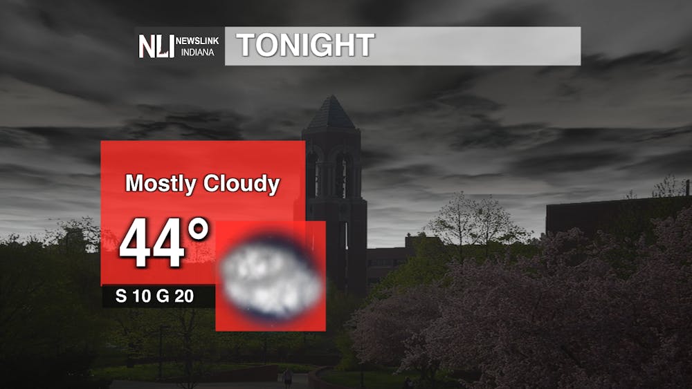
Tonight: Clear start to our night before clouds start to make their way in. We will still be experiencing around the same gusty winds that we have been experiencing in our region recently with the winds staying to the south around 10 mph, however gusts will be up to 20 mph. We will reach a low of 44 degrees so a heavy coat will still be needed if you do need to head out tonight.
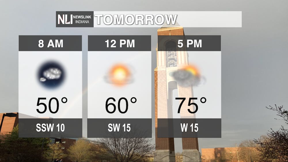
Tomorrow: Warmer and above average temperatures can be expected for the next week including Friday. At the bus stop expect the temperature to be around 50 degrees, so a light jacket is suggested as temperatures will be very mild. Afternoon hours temperatures will be very comfortable, reaching 60 degrees. Eventually by your evening commute, you can lose the jacket as temperatures will reach 75 degrees. Time to pull your shorts and t-shirts back out!
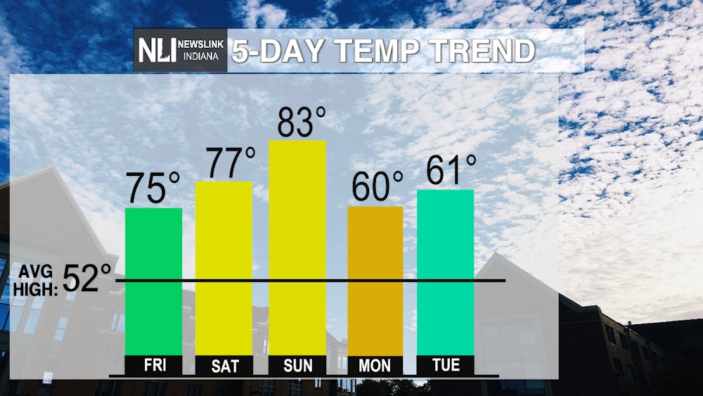
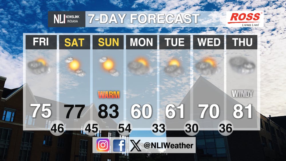
Seven-Day Forecast: Expect warmer temperatures for the next week as spring weather is coming. Gusty winds will still continue to linger around, however on the bright side, we do not have a severe threat or storms for the next week ahead. Ice and snow from the system that moved out this past week will begin to melt, so expect spots on roads and sidewalks to be slick and wet. As for the next week temperatures will be on a increasing trend eventually by Sunday reaching our high of the week of 83 degrees. Monday we cool off slightly to 60 degrees but later warm back up to the 70's again by Wednesday, and 81 by Thursday.
- Weather Forecaster Kendra Heath
Follow us on Facebook, Instagram, and X @NLIWeather for breaking weather updates.
NewsLink Indiana is a proud Ambassador for the NOAA Weather-Ready Nation program.
For more information about the Weather-Ready Nation program please click HERE


