


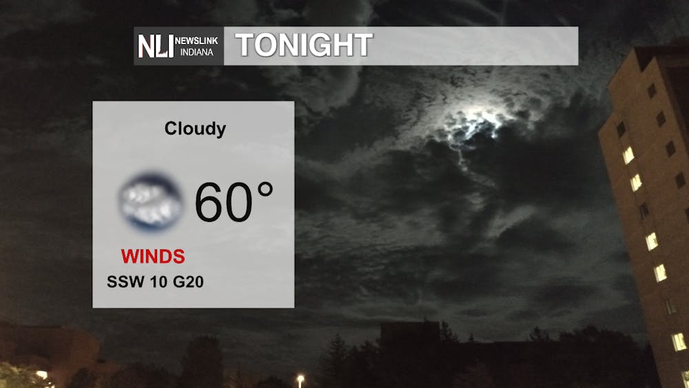
Tonight: A warm night ahead this evening with temperatures remaining in the low-60s. Cloud cover will begin to move in around 9 p.m. and increase into the morning. The wind will calm to 10 mph with gusts of 20 mph.
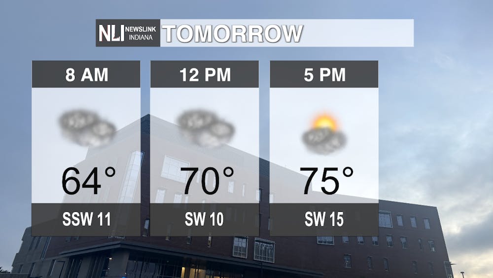
Tomorrow: Cloud cover from the evening will persist through the morning and afternoon, with the sun poking out around 5 p.m. The temperatures will stay warm despite the cloud cover. Temperatures will be 64 degrees as you start your commute to work or school, then increasing slowly to the high of 75 degrees as the day comes to a close.
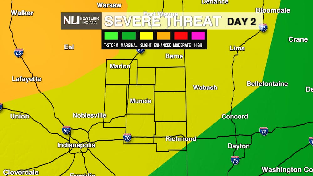
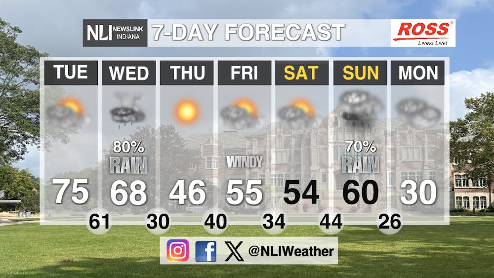
Seven-Day Forecast: Tuesday evening our viewing area will have a chance of severe weather, with high winds, hail chances, and the slight possibility of a tornado. The rain and storms will continue from Tuesday night with an 80 percent chance of showers and scattered thunderstorms. The sun will return on Thursday, however, the temperature will drop down to the mid-to-high 40s. As temperatures increase into the 50s again on Friday, winds will increase and cloud cover will return to our area. Temperatures will remain the same over the weekend with chances of rain to end the weekend on Sunday with a 70 percent chance of precipitation. Temperatures will drop dramatically at the beginning of next work week back below freezing with the high on Monday being 30 degrees so don't put the winter jacket away just yet.
- Weather Forecaster Evan Reed
Follow us on Facebook, Instagram, and X @NLIWeather for breaking weather updates.
NewsLink Indiana is a proud Ambassador for the NOAA Weather-Ready Nation program.
For more information about the Weather-Ready Nation program please click HERE


