


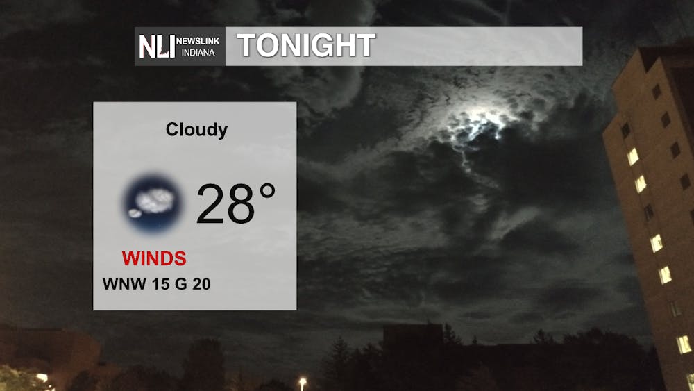
Tonight: Make sure to bring a jacket or coat outside tonight since temperatures will drop below freezing with the low being 28 degrees. The wind will also be a factor tonight with a consistent 15 mph wind and gusts up to 20 mph. Conditions will remain partly cloudy into the early morning.
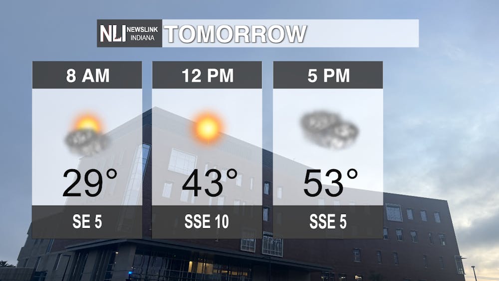
Tomorrow: As you start the commute to work or school, temperatures will remain below freezing at 29 degrees. However, the wind will calm down to 5 mph in the early morning. Temperatures will quickly rise and the cloud cover will move away giving sunny conditions at noon with temperatures in the mid-to-low 40s. Clouds will move back in through the afternoon as the temperature increases to the high of 53 for the day.
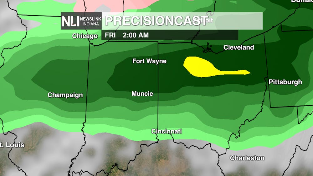
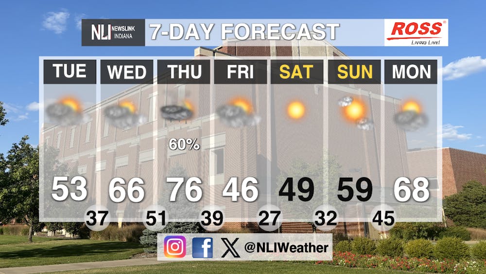
Seven-Day Forecast: After a cool start to the week, temperatures will begin to rise again on Wednesday with mostly cloudy conditions and a high of 66 degrees. Thursday has the potential to have some record breaking temperatures with the high being 76 degrees. However, there is a chance for showers and thunderstorms after 5 p.m. These showers will continue into early Friday morning causing the temperatures to dip drastically. The high for Friday will be in the mid-40s, for an almost 30 degree difference in temperature between Thursday and Friday. The weekend will see the slow climb back up in temperatures with the sun finally emerging on Saturday with a high of 49 degrees. Sunday the high will climb back up to the high-50s with slight cloud cover expected throughout the day. As next work week begins, cloud cover is expected to return with temperatures rising back into the mid-to-high 60s.
- Weather Forecaster Evan Reed
Follow us on Facebook, Instagram, and X @NLIWeather for breaking weather updates.
NewsLink Indiana is a proud Ambassador for the NOAA Weather-Ready Nation program.
For more information about the Weather-Ready Nation program please click HERE


