


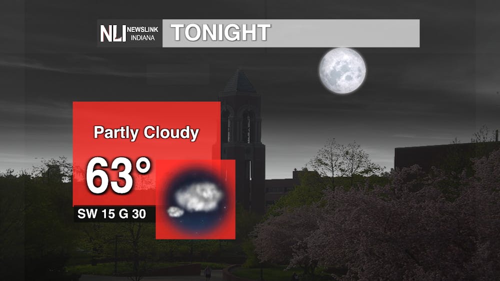
Tonight: Strong winds blowing from the South Southwest help ensure temperatures tonight stay warm and consistent. To add to this, moisture will also help support these temperatures as it’ll start to feel a little more humid. Surface winds assisted with strong wind gusts will blow you away tonight as these gusts only continue to strengthen into tomorrow - gusts as high as 40 mph. With all these warmer elements moving in, along with cooler upper levels from the past couple of days, cloud formation is more favorable.
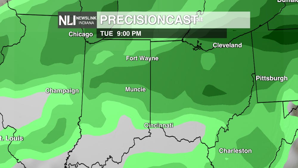
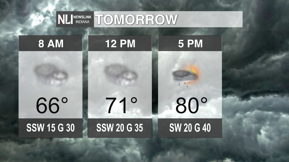
Tomorrow: Temperatures on Tuesday are really going to make some big leaps throughout the day as ridging remains stable. The main concern for midday tomorrow would have to be the wind gusts. Surface winds assisted with improved gusting shows a trend of increasing wind speeds throughout the afternoon into early evening hours, especially as a developing low-pressure system advances closer to our area. For our later hours, a temperature uprise assisted with increased moisture levels, all combined with a plowing cold front creates instability for our area. As of right now, Muncie is just barely out of a Level 2 (Marginal Risk) for severe weather. The further Northeast the low-pressure system moves, the higher chances that more severe storms will follow, giving high confidence that the Muncie area will not receive any severe weather. Note on General thunderstorms: All thunderstorms can produce deadly lightning, gusty winds and even small hail. Always stay weather aware.
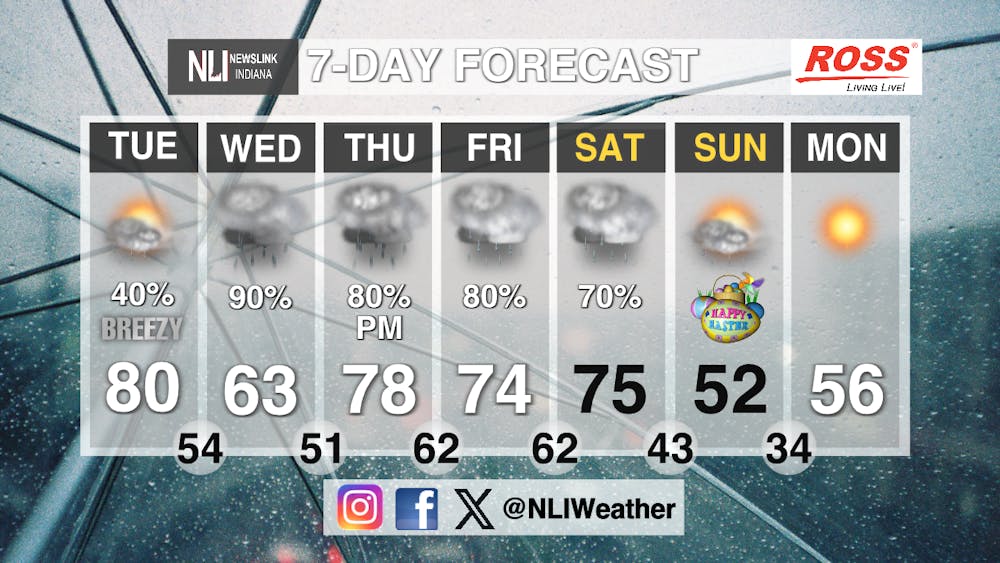
Seven-Day Forecast: From Tuesday, conditions throughout this week look to be very wet and humid. As we take a glance at Wednesday, isolated rain showers will continue in from Tuesday evening. Wednesday’s system looks a bit messier than Tuesday. Any energy supporting storm production has lowered, whereas the likelihood of more downpouring has increased. Winds continuing to blow from the Southwest continue to support warm air keeping temperatures & moisture levels pretty high. Flooding could possibly be an issue though, but with probability of isolated showers or continuous rainfall, is still being monitored. For Thursday, another low-pressure system moving from the Southwest will make its way towards our area supporting a more rainy environment throughout afternoon into early evening. With this, confidence is more high of precipitation occurring. Moving into Friday humid air continues to remain in the area, but with a lack of ridging or frontal assistance, there aren’t enough elements to support storm development. Isolated rain showers are the likely trend for Friday. Saturday night looks to be the grand finale of everything as a cold front pushes through. With continuous humidity and warming winds throughout midday, the evening cold front will create more widespread rainfall than some of the previous days creating cooler temperatures. On Sunday everything will calm down, bringing our environment back into a high-pressured state. Skies will hopefully be clearing out making way for a sunny Easter.
- Weather Forecaster Rachel Fulton
Follow us on Facebook, Instagram, and X @NLIWeather for breaking weather updates.
NewsLink Indiana is a proud Ambassador for the NOAA Weather-Ready Nation program.
For more information about the Weather-Ready Nation program please click HERE


