


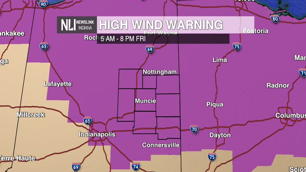
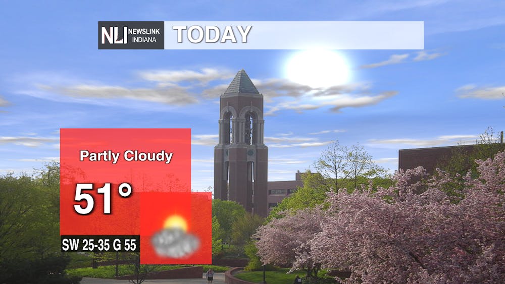
Today: For today, a high wind warning remains in effect until 8:00 tonight. Continue to watch for possible downed trees or power outages. Use caution when driving especially on open roads. Pleasant temperatures and clear skies will be present throughout the afternoon into evening however.
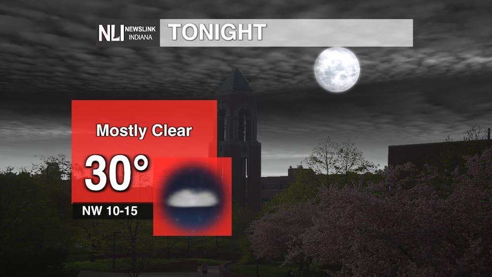
Tonight: Expect a few passing clouds earlier this evening to become more widespread into morning hours. The vicious winds will slacken off towards midnight. Temps will decline below the freezing mark.
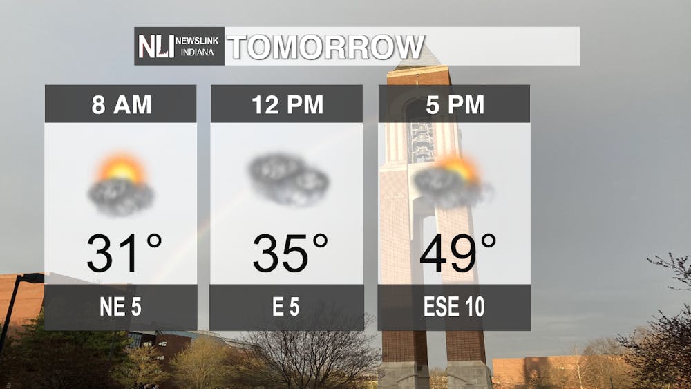
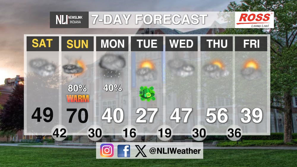
Tomorrow: Saturday will hold rather cloudy skies and chilly temperatures albeit climbing later into the late afternoon. A random stray sprinkle is possible. Winds will remain calmer. Make sure to stay weather aware as this lull will be followed by severe weather into Sunday.
Seven-Day Forecast: This coming weekend and following week will contain rather mischievous weather. Sunday will be warm but dangerous severe thunderstorms are expected late going into Monday. Damaging winds are the main threat and ever changing conditions could enhance the risk. Watch for snow to follow this and very cold temperatures. St. Patrick's Day will be rather cold this year with morning wind chills nearing zero degrees. Only late in the week will more balanced weather return.
- Weather Forecaster Edward Hill
Follow us on Facebook, Instagram, and X @NLIWeather for breaking weather updates.
NewsLink Indiana is a proud Ambassador for the NOAA Weather-Ready Nation program.
For more information about the Weather-Ready Nation program please click HERE


