


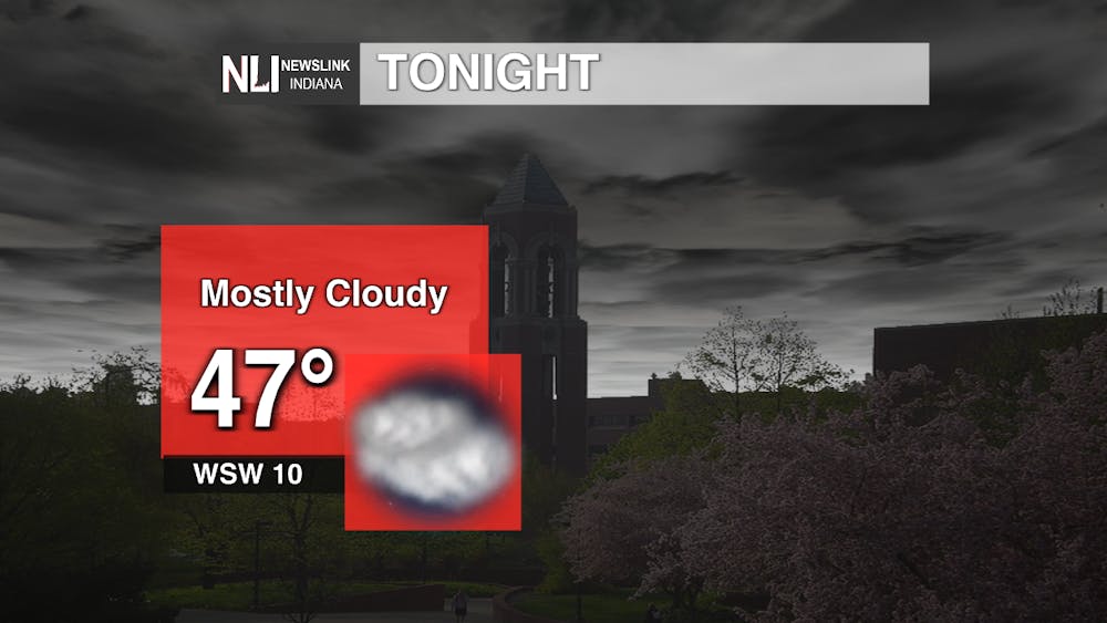
Tonight: Cloud cover will start to increase over night coming with a 20% chance of rain after 4 a.m. Temperatures will get down to around 47 degrees with winds coming out of the west southwest at 10 mph.
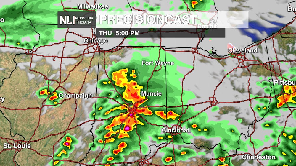
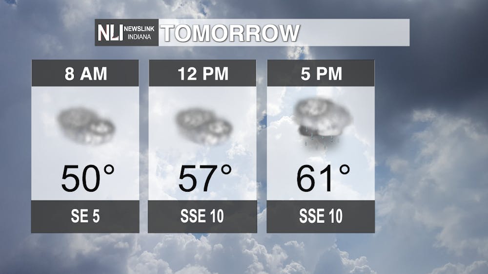
Tomorrow: The morning will start off decently warm at 8 a.m. increasing into the low-60s by 5 p.m. Clouds and winds will increase throughout the day coming out of the southeast. The Storm Prediction Center has placed under a slight risk for severe weather tomorrow afternoon. This means after 5 p.m. there are chances of severe thunderstorms and even a possibility of tornados forming until 11 p.m. Make sure you stay weather aware throughout the day and have a way to receive warnings.
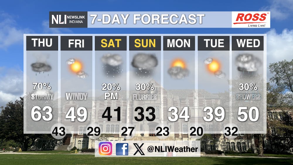
Seven-Day Forecast: Tomorrow there is a 70% chance of thunderstorms with a high of 63 degrees. After that storm moves through, the temperatures keep dropping through the weekend and start of the work week. Saturday night there is a slight chance of late night flurries and the flurry chances increase to 30% during the day on Sunday. Sunday is the coldest temperature we get throughout the next seven days at 33 degrees. Luckily, those temperatures increase to 50 degrees on Wednesday and there is a 30% chance of rain showers as well.
- Weather Forecaster Orion Lucas
Follow us on Facebook, Instagram, and X @NLIWeather for breaking weather updates.
NewsLink Indiana is a proud Ambassador for the NOAA Weather-Ready Nation program.
For more information about the Weather-Ready Nation program please click HERE
