


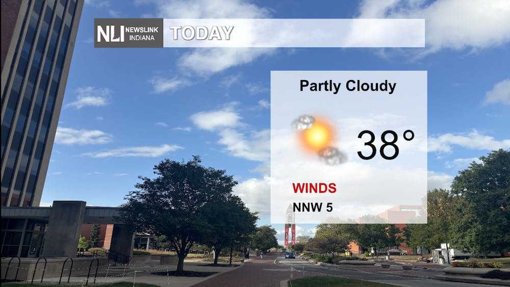
Today: Expect a high of 38 degrees with the winds staying steady throughout the day, not reaching above the 5 mph threshold until later in the evening. Melting snow should be our main concern throughout the day as temperatures will be above freezing and may cause some slick spots. Conditions will be rather cloudy and chilly throughout the day.
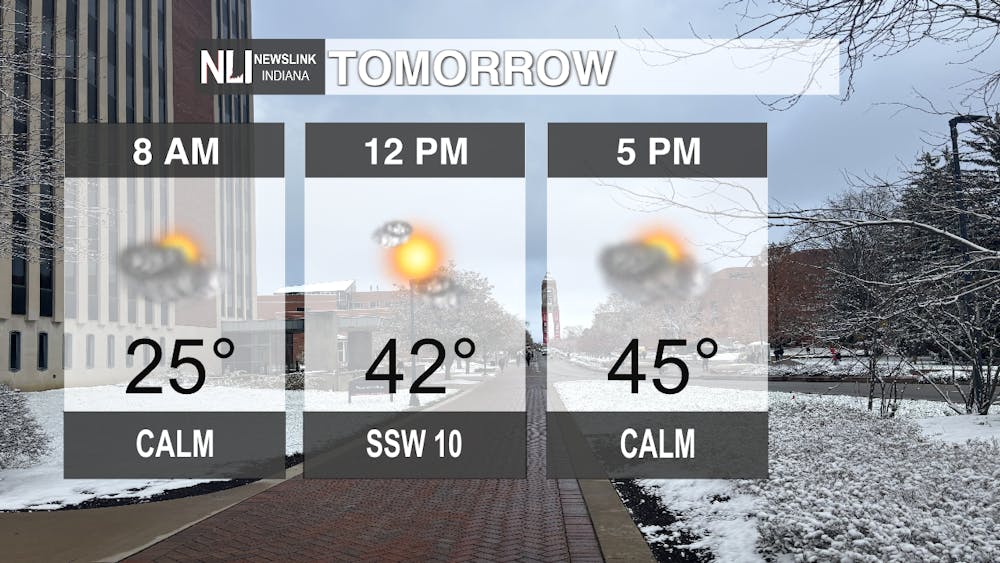
Tomorrow: A coat will definitely still be needed at the bus stop in the morning, even though we are starting to warm up slightly; it is still going to be below freezing in the early hours. Heading into noon, expect winds to pick up, reaching 10 mph coming in from the south southwest, along with rapidly increasing temperatures reaching 42 degrees by noon. Conditions throughout the day will stay persistent with partly cloudy skies. Approaching rush hour, temperatures will be at their peak, 45 degrees, and will soon start to steadily decrease to our low of 31 degrees for the night.
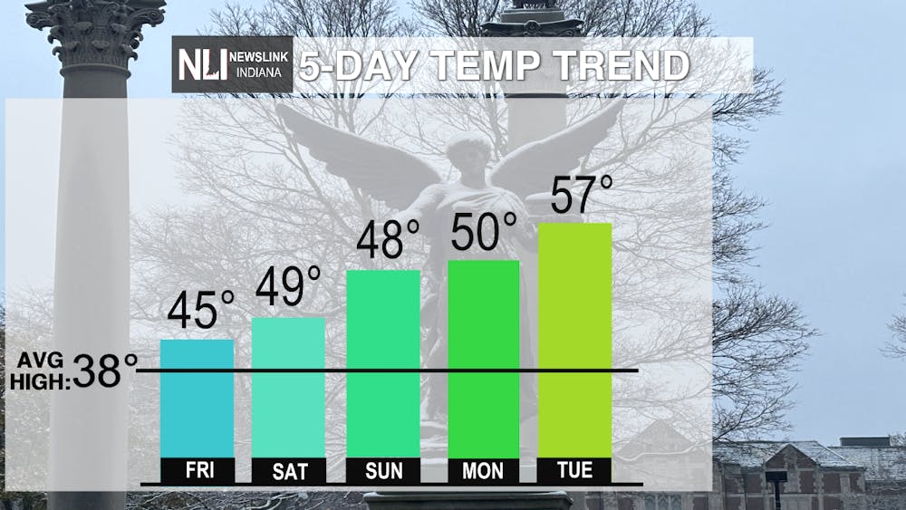
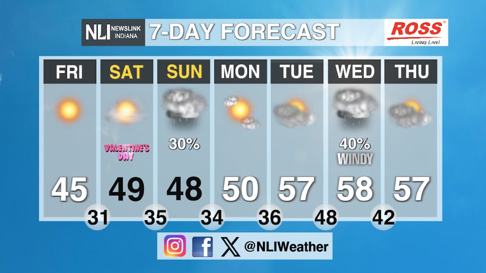
Seven-Day Forecast: Overall, we are seeing some hope and relief of the very chilly temperatures that we have been experiencing the past few weeks for our region. Today, temperatures will stay chilly, but as we head into the weekend, we are seeing above average temperatures reaching the upper 50’s next week. Although Sunday and Wednesday both bring chances of rain, fair conditions remain throughout the rest of the week with consistent increasing temperatures in the forecast. Looking forward to seeing some warmer weather and the grass peeking out again!
- Weather Forecaster Kendra Heath
Follow us on Facebook, Instagram, and X @NLIWeather for breaking weather updates.
NewsLink Indiana is a proud Ambassador for the NOAA Weather-Ready Nation program.
For more information about the Weather-Ready Nation program please click HERE


