


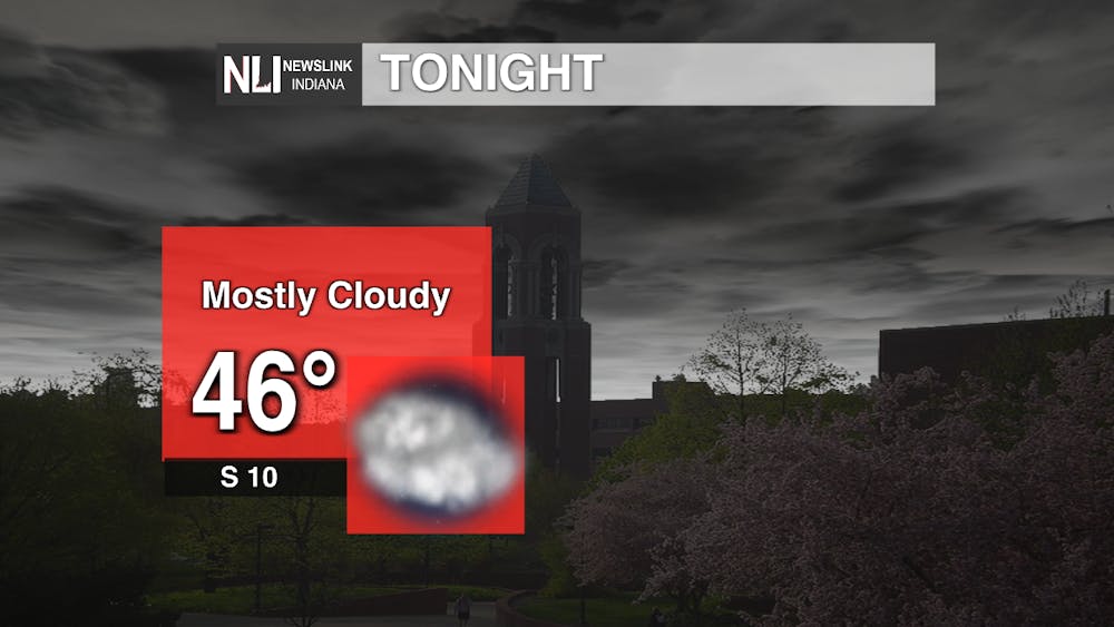
Tonight: Temperatures will drop to the high-40s overnight, and our winds will shift from the west-southwest to the south at around 10 mph. Our cloud coverage will increase as we make our way later into the evening, leaving us with overcast skies. .
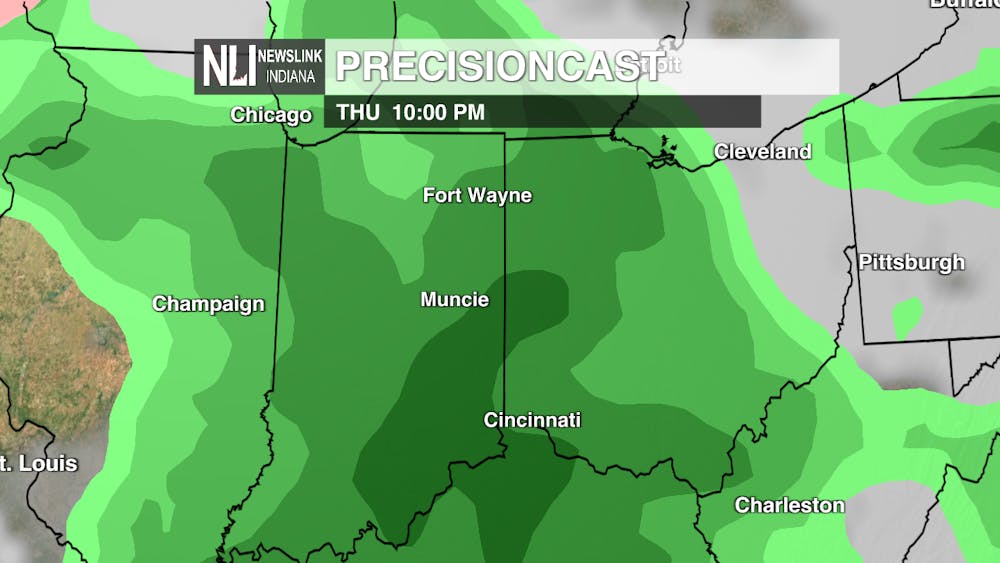
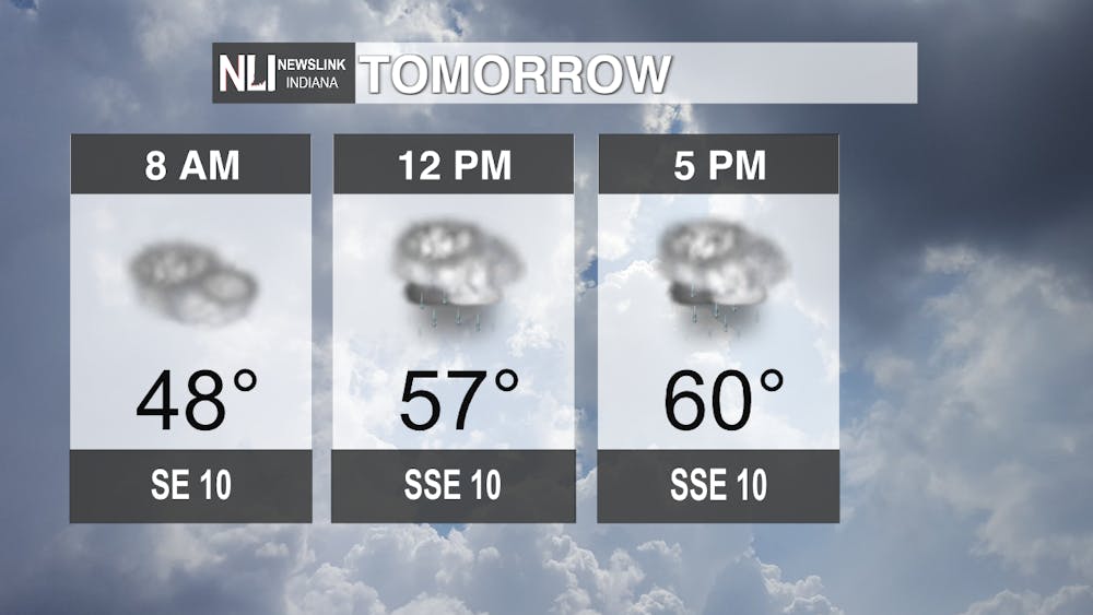
Tomorrow: In the morning, temperatures are expected to be in the high-40s and will increase throughout the day, reaching the low-60s by the late afternoon. Skies will be mostly cloudy tomorrow with winds coming up from the south-southeast at around 10 mph. Rain is expected to start in the early afternoon, with possible thunderstorms.
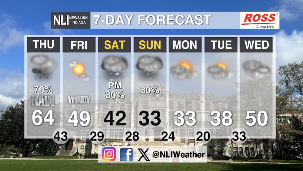
Seven-Day Forecast: These spring-like temperatures are not sticking around for much longer, as we move later into the weekend and early next week, daytime highs fall to the mid-to-low 30s. Chances of precipitation return to our forecast; rain is expected tomorrow afternoon into the early hours of Friday morning and snow is possible on Saturday and Sunday due to the cooling temperatures. It is also going to be quite windy during the next few days, with wind gust getting over 30 mph on Friday.
- Weather Forecaster Halle Dziekan
Follow us on Facebook, Instagram, and X @NLIWeather for breaking weather updates.
NewsLink Indiana is a proud Ambassador for the NOAA Weather-Ready Nation program.
For more information about the Weather-Ready Nation program please click HERE
