


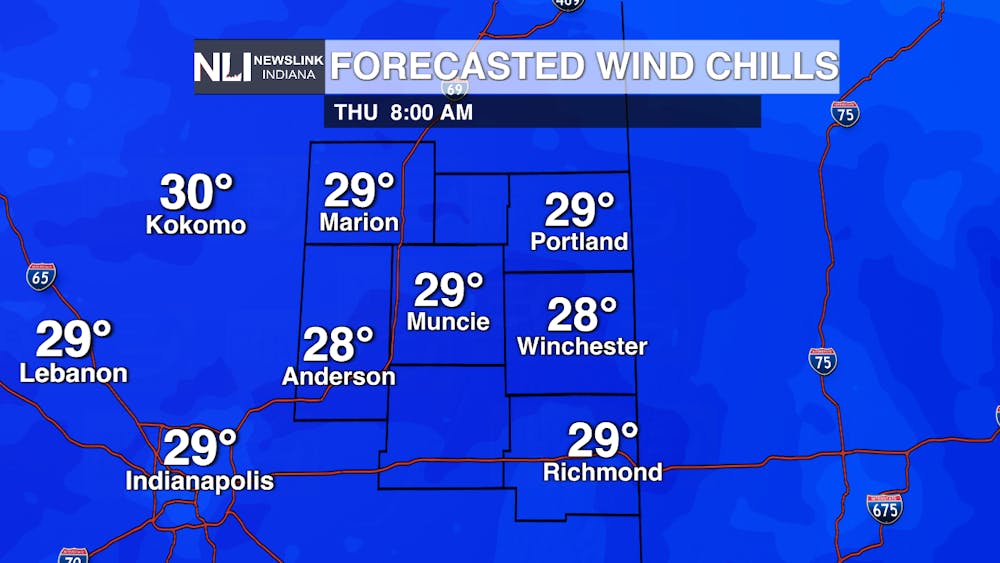
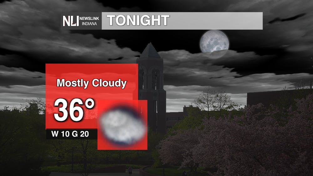
Tonight: Temperatures are going to continue dropping off into the night with lows falling into the mid-30s. Wind chills are going to make conditions feel even colder with values in the low-30s and even some in the high-20s. Frost is possible tonight with these low temperatures as there is a frost advisory in effect from 2-9 a.m., so make sure to bring those plants inside out of the cold.
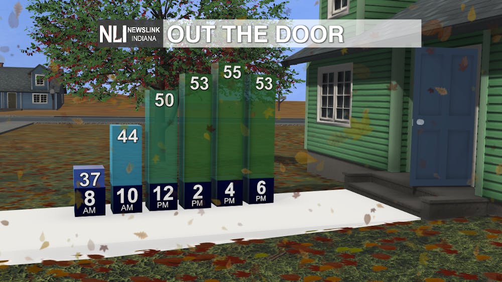
Tomorrow: Keep those coats handy as tomorrow morning is going to be a cold start with temperatures in the mid-30s. Sunshine will heat things up to a more comfortable high of 55 degrees by the afternoon with little cloud cover throughout the day. Winds will also be not as breezy staying around 10-20 mph from the west.
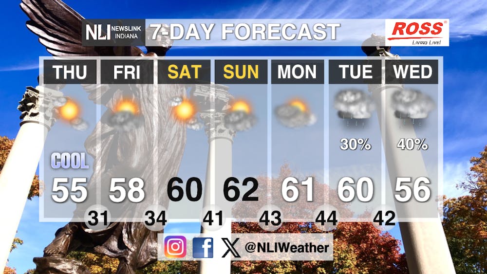
Seven-Day Forecast: After a few cloudy days, sunshine returns over the next few days with a healthy mix of sun and clouds in the forecast. Temperatures will warm up into the 60s by the weekend, making for great pumpkin patch weather on the final weekend before Halloween next Friday. Clouds start to build back in Monday before rain chances return mid-week. Lows are going to be chilly in the 30s and 40s so bundle up if you head outside in the evening.
Chief Weather Forecaster Joe Sawicki
Follow us on Twitter @NLIWeather for breaking weather updates.
NewsLink Indiana is a proud Ambassador for the NOAA Weather-Ready Nation program.
For more information about the Weather-Ready Nation program please click HERE


