


Tonight:
A warm night is ahead, with lows in the lower 60s under mostly cloudy skies. Winds may be breezy at times, with sustained winds at around 15 mph out of the SSW, with gusts up to 25mph.

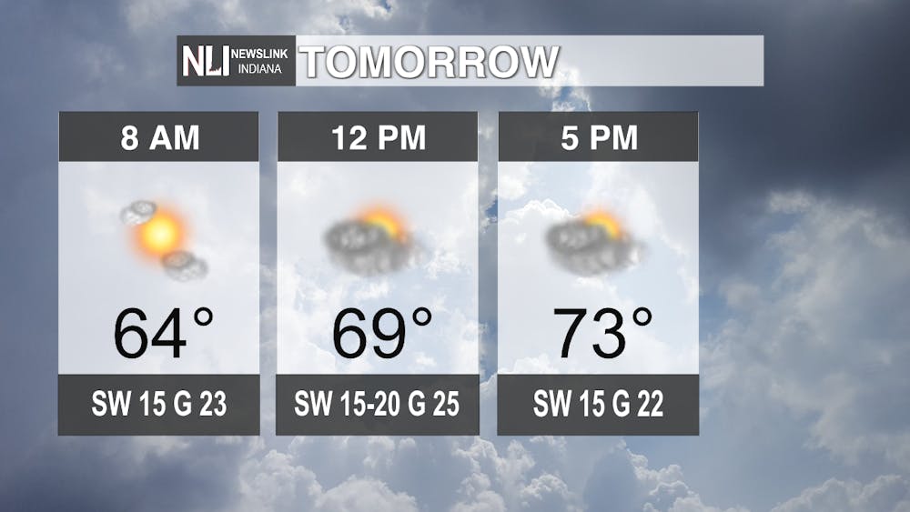
Tomorrow:
Another beautiful and unseasonably warm day is ahead Friday, with temperatures well into the mid-70s once again. However, tomorrow will be the end of our warm stretch of days, as clouds and scattered rain move in by the evening hours.
7-Day Forecast:
As we head into the weekend, a strong cold front is expected to move through Central Indiana, with rain chances increasing as the day progresses Saturday before rain is expected the majority of Sunday. Highs are forecasted to be in the low 60s and mid 50s throughout the weekend, marking a return to around normal temperatures for the end of October. However, some of the coldest air we've seen since mid-march moves into the region early next week, with high temperatures through Wednesday struggling to get out of the mid 40s, with overnight lows in the 20s. As for the Halloween forecast, temperatures look to be bitterly cold, with feels like temperatures in the 30s all day long, followed by what is likely to be our first hard frost of the season into Wednesday morning.

- Weather Forecaster Noah Gordon
Follow us on Twitter @NLIWeather for breaking weather updates.
NewsLink Indiana is a proud Ambassador for the NOAA Weather-Ready Nation program.
For more information about the Weather-Ready Nation program please click HERE
