


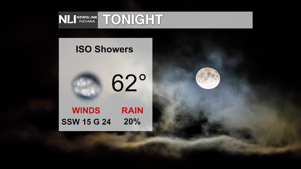
Tonight: These warmer temperatures continue to persist with a low of 62 overnight Friday. A 20% chance of isolated showers are likely to pop up throughout late Thursday and into early Friday morning. It will be windy so if you are going out tonight or commuting early Friday morning, make sure to bring a light jacket.
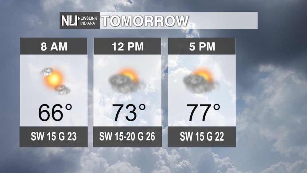
Tomorrow: Similar to today, Friday's high will reach up to 77. The warm temperatures will last throughout the day accompanied by increasing cloud cover as we move into the afternoon and evening hours. Winds are expected to continue with gusts up to 26 mph at noon. There is a good chance of rain that will begin Friday night and last throughout the weekend.
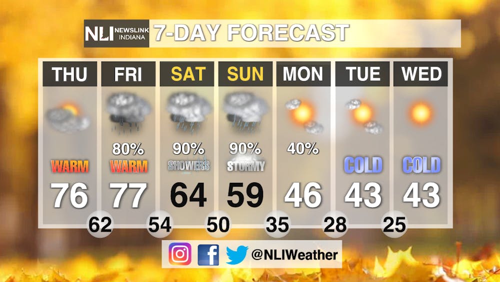
7-Day Forecast: The 7-day forecast holds a lot in store for us. The end of this week will have high 70 temperatures. As we move into the weekend, it will be nothing but rainy. Temperatures are also expected to drop over the weekend. Those colder temperatures will linger into the beginning of next week. Fall will finally roll around in time for Halloween on Tuesday.
- Weather Forecaster Izzy Collins
Follow us on Twitter @NLIWeather for breaking weather updates.
NewsLink Indiana is a proud Ambassador for the NOAA Weather-Ready Nation program.
For more information about the Weather-Ready Nation program please click HERE


