
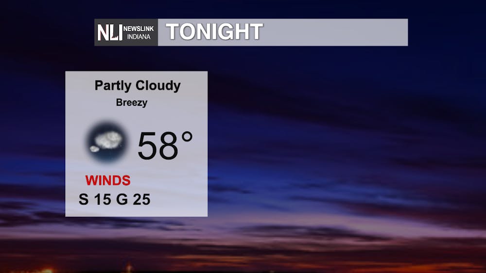
Tonight: The mostly clear skies will continue overnight, and our low temperature should just be 8 degrees cooler than what our normal high is for this time of year! Southerly winds are expected to continue making things breezy throughout the evening and into tomorrow morning as well.
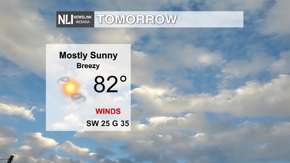
Tomorrow: Get ready for some potentially record warmth tomorrow! We should end up around 82° tomorrow, tying our record back in 1985, but there's a possibility we could even break that record - Freshening SW winds (gusting to 35 mph at times) along with plenty of sunshine could serve to get us above that record temp. We could see increasing clouds in the evening and we will have to watch for some overnight showers after our newscast tomorrow. The other thing we will have to watch for is the trash cans if it is pick-up day in your neighborhood; they might get pushed a little due to that feisty breeze!
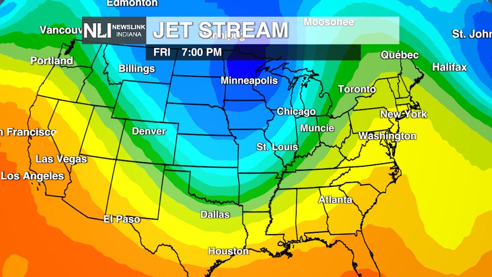
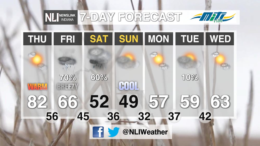
7-day Forecast: A strong frontal system powered by a strong upper-level trough in the jet stream - the river of air separating the warm and cold airmasses & the point/path where storm systems move along - is the source of some shower & possible thunderstorm chances Friday, which we are closely watching for our Late-Nite Carnival at Ball State. Current trends are looking potentially promising as we might actually get some dry time per our latest data, but new showers could filter in as we close things out extending into Saturday morning. A cloudy and cool weekend is expected before high-pressure ridging pushes in to help moderate/warm those temperatures to the lower & mod 60s by the middle of next week.
-- Weather Forecaster Ryan Hill
Follow us on Twitter @NLIWeather for breaking weather updates.
NewsLink Indiana is a proud Ambassador for the NOAA Weather-Ready Nation program. For more information about the Weather-Ready Nation program please click HERE
Read More

9-1-1 What's Your Hot Take E12: Season 6 Recap
By Willow Emig and Sam Jasionowski / 11 hours agoIn this episode of 9-1-1 What’s Your Hot Take, Sam and Willow discuss the events of season 5 of 9-1-1.

Prairie Creek Reservoir beach cleared for reopening
By Staff Reports / 12 hours agoThe City of Muncie announced the reopening of Prairie Creek Reservoir's beach via a press release July 3, successfully passing its water quality tests.

Record Parlor of Muncie aims to create good music and good vibes
By Kylee White / 14 hours agoRecord Parlor of Muncie hopes to provide good music while highlighting local artists.
