


Today: Thunderstorms are going to move in to day at 5 pm and continue into the evening. Expect the temperature to move into the low 60s as we head into the evening.
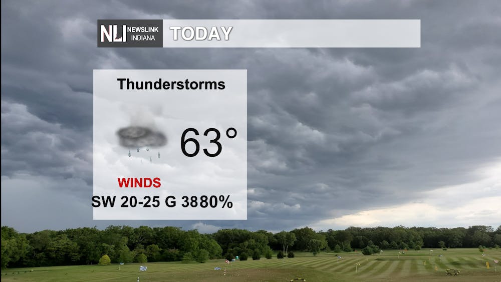
Tonight: Thunderstorms will continue through midnight, corresponding with warming temperatures. Expect strong wind gusts to continue, with gusts getting up to 50 mph! It may be a good day to stay inside this evening.

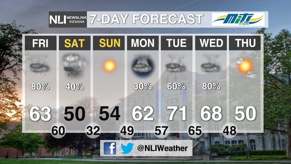
Tomorrow: We have a 40% chance of rain showers in the early afternoon tomorrow. It will also cool down to a high of only 52 F.

7-Day Forecast: This weekend will not be the only time we have a chance for extreme weather this week. It will begin to rain on Monday, and transition to thunderstorms on Tuesday and Wednesday. We may reach 70 F on Tuesday! YOu will want to keep an eye on the forecast in the coming days to see how these systems develop. Expect warm temperatures and high winds consistently on days with storms.
--Weather Forecaster Ian Kowalski
Follow us on Twitter @NLIWeather for breaking weather updates.
NewsLink Indiana is a proud Ambassador for the NOAA Weather-Ready Nation program. For more information about the Weather-Ready Nation program please click HERE


