


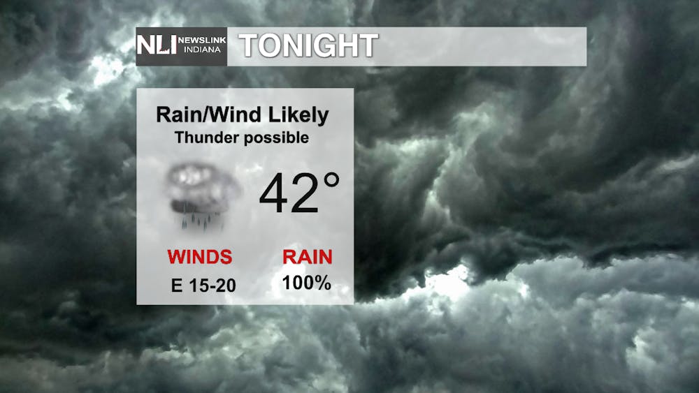
Tonight: Rain is expected to be likely tonight with temperatures quickly rising back into the low 50s by late tonight. A few rumbles of thunder may be possible with the heavier pockets of rain later tonight. Winds will be a little breezy at times too.
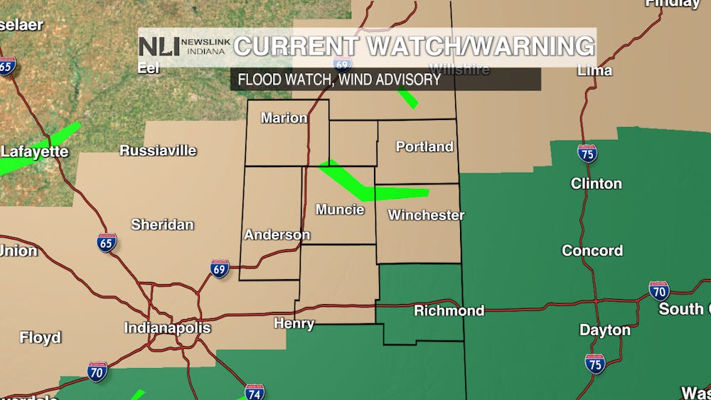
Watches/Warnings: A Flood Watch is in place for our area until Saturday 8am which means that we have the potential to see flooding in our area with any heavy rain that we do get. A Wind Advisory will be in place as well from 4am Saturday through 5pm Saturday meaning that we could see strong winds behind the cold front.
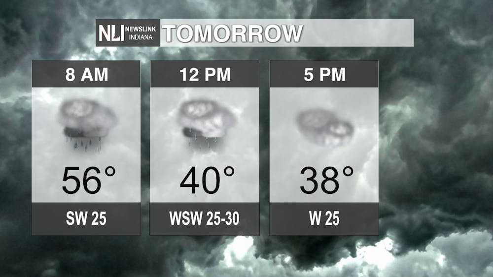
Tomorrow: The day is expected to begin with additional showers through the early afternoon before the system clears. Along with that, temperatures will quickly fall from the mid-50s to the upper-30s by the end of the day.
7-Day Forecast: Mild temperatures are expected through this weekend before cooler air returns for next week with a chance for additional showers on Monday too. Cooler weather will be in place through Thursday before more milder weather returns by next Friday with our next best chance of rain too to finish of the month of March.

--Weather Forecaster Eric Segbor
Follow us on Twitter @NLIWeather for breaking weather updates.
NewsLink Indiana is a proud Ambassador for the NOAA Weather-Ready Nation program. For more information about the Weather-Ready Nation program please click HERE


