


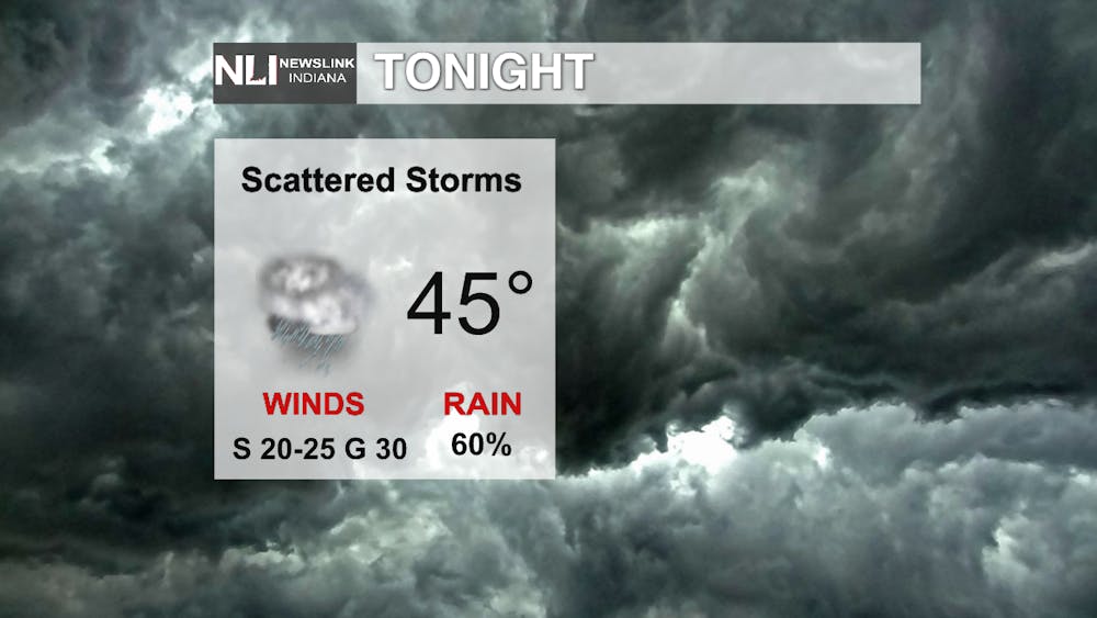
Tonight - It was a beautiful day out there today with lots of sunshine and a high temperature of 60 degrees. Going into tonight temperatures will start to cool off to a low of 45 degrees. Scattered storms are likely at 60% throughout tonight with winds coming out of the south at 20-25 mph sustained with gusts of up to 30 mph.
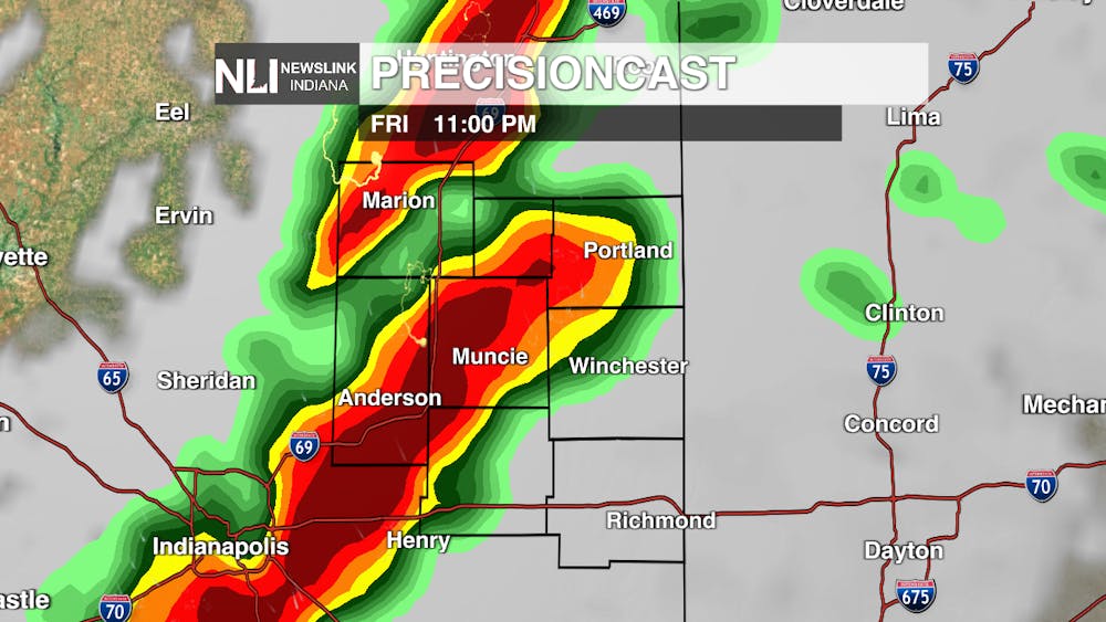
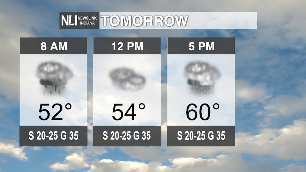
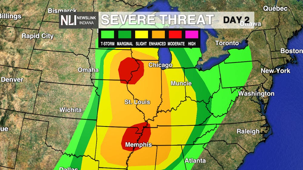
Tomorrow - Throughout the day tomorrow we will have patches of scattered rain leading up to a line of storms at 5PM that will bring the heaviest rainfall up to that point. After this line of storms moves out of our area is when we are concerned about the severe weather that will be following around 11PM Friday night. As you can see in the graphic below Muncie is in the slight risk which means that scattered severe thunderstorms are possible in the area. For Muncie our biggest threats tomorrow night are going to be the rainfall and damaging winds. We will possibly see winds of up to 55 mph in and around the area so do keep that in mind for tomorrow night. These storms will be moving quickly so it should pass over Muncie in a matter of an hour or so and we will be clear in the early hours of Saturday.

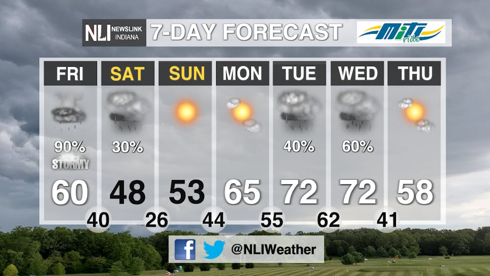
7-Day - After the severe weather tomorrow we will experience a bit of a cool down over the weekend. This cool down will not last long as by Monday we are back into the mid 60s and into the 70s for Tuesday and Wednesday. Along with this warm-up we are expected to see chances of rain for much of the beginning of next week as well.
--Weather Forecaster Dimitri Gegas
Follow us on Twitter @NLIWeather for breaking weather updates.
NewsLink Indiana is a proud Ambassador for the NOAA Weather-Ready Nation program. For more information about the Weather-Ready Nation program please click HERE


