


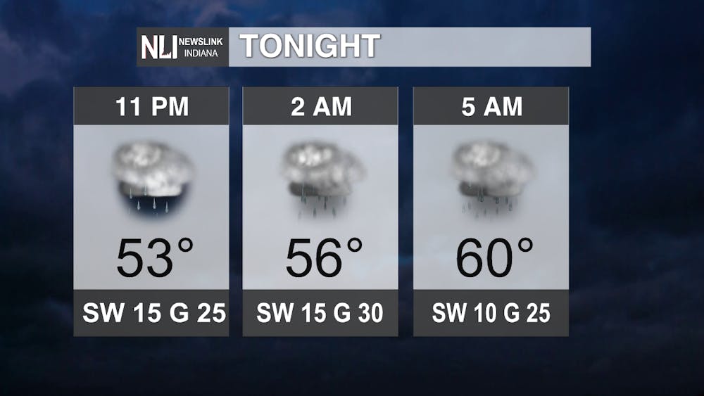
Tonight: Tonight looks to be one of those weird ones where the temperatures will rise as a frontal boundary we will be dealing with for the remainder of this week slides northwards and SW winds increase. Along with that, rainfall chances are expected to rise as well, and along with some heavy rain, some isolated strong thunderstorms appear possible overnight into tomorrow. Our low is actually right5 now, and we warm to 60 degrees by 5 AM!
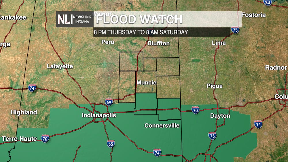
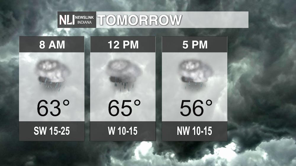
Tomorrow: We're looking at mostly a washout with some shots at heavier rain with amounts 1-2" and locally higher especially through Muncie and points east. Turn around, don't drown is the phrase of the forecast period as this heavy rain is not alone though as we head deeper into the week and weekend! Other than that, not too bad, with a high more than 10 degrees above average at 65, so although we'll be taking out those umbreallas, maybe we can dress for warmer weather!
7-day Forecast: Another storm system (this time a much more potent one) bears the threat of more heavy rains with an additional couple of inches or more Muncie and south with the addition of some wind gusts of 40-45 mph possible. We finally calm and clear things out the second half of the weekend into next week, though, and although we cool 5-10 degrees below average initially by Monday and Tuesday, we warm to just above average by Wednesday with a high of 54.

--Weather Forecaster Ryan Hill
Follow us on Twitter @NLIWeather for breaking weather updates.
NewsLink Indiana is a proud Ambassador for the NOAA Weather-Ready Nation program. For more information about the Weather-Ready Nation program please click HERE


