Overview:
The start of the month was a warm one after a bitter cold stretch towards the end of December. A warm front passed through the area at the end of December which brought much warmer than average temperatures. Even after a cold front came through, temperatures never dipped below average until the very end of January. These warm temperatures deterred any possible snowfall. Dreary conditions were the story for the month, yet this is typical for winter months in Muncie.
Temperatures:
Temperatures sat well above average throughout most of the month, coming to an average monthly temperature of 37.1℉ which is 8.5℉ above average. The start to the month was well above normal. On the 3rd a new record of 64℉ was set. This temperature was nearly 30℉ warmer than average. Temperatures dropped back into the mid-30s by the 6th, yet they were still above average. Another warm front would bring temperatures back into the 50s for the 11th and 12th. On the 19th a high of 57℉ was recorded which would be the last 50℉ day for the month.
The lowest high and low would be recorded on the 31st. A high of 24℉ was recorded with a low of 13℉. This day would be the only day to not get out of the 20s and the only night to drop into the teens.

Precipitation:
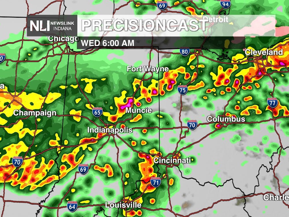
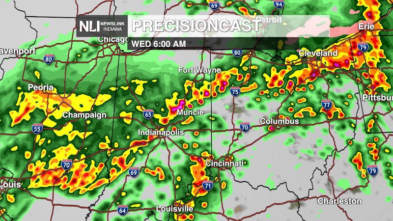
With the warm temperatures, snowfall was very minimal, however precipitation was slightly above average for the month. On the 3rd, 0.66” of rain was recorded. With this system, thunder was reported in the vicinity which is uncommon for January. Conditions were dry until a cold front moved through the area on the 12th which dropped 0.57” of precipitation. The greatest 24-hour rainfall was reported on the 18th and 19th when 1.28” of rain fell. Also on the 19th, a rare severe thunderstorm warning was issued just southwest of Muncie where strong winds and quarter sized hail were imminent. The storm ultimately weakened by the time it reached Muncie, however, gusts of 51 mph were still recorded along with the abundance of rainfall.
At the end of the month is when winter precipitation was finally anticipated. A winter storm warning was issued on the 24th. 6-9” was anticipated, however the snow to liquid ratios were much lower than anticipated as warm air pushed ahead of the low, creating the heavy wet snow. In Muncie, only about 3.3” of snow fell. A few more dustings to less than an inch of snowfall were recorded through the remainder of the month as clipper systems rolled through.
Cloud Cover:
Through the entire month of January, only 3 days of clear conditions (30% cloud cover or less) were noted. In January of 2022 there were 10 clear days, so this January posed much more dreary. 10 partly cloudy (40-70% cloud cover) were noted and 18 cloudy (>80% cloud cover) days were distinguished. It is typical for winter months to be overcast for a majority of the time. This is due to a temperature inversion occurring between the much cooler surface and warmer atmosphere. The moisture in the air essentially gets stuck and cloud cover lingers.

--Chief Weather Forecaster Hope Kleitsch
Follow us on Twitter @NLIWeather for breaking weather updates.
NewsLink Indiana is a proud Ambassador for the NOAA Weather-Ready Nation program.
For more information about the Weather-Ready Nation program please click HERE